Map of Huntington
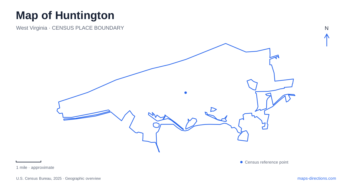
Street tiles load from OpenStreetMap when opened. The blue line shows the 2025 Census boundary.
- State
- West Virginia
- Population · July 2025
- 44,815
- Land area
- 16.5 sq mi
- Water area
- 2.2 sq mi
Huntington, West Virginia, is easiest to understand by keeping the Ohio River, downtown's numbered streets and avenues, and the Marshall University campus in the same view. The riverfront gives the center a northern edge, while parks and institutional destinations draw journeys farther into the city. Its public spaces also reveal several kinds of history: railroad buildings reused for shopping, a river reclaimed for recreation after flood-control construction, and a campus memorial with deep community significance.
Downtown between the avenues and the river
Pullman Square is listed at 220 9th Street and occupies the downtown area along Third Avenue. It is an entertainment, dining, and retail destination within the central grid. Nearby Fourth Avenue carries a different kind of cultural landmark: the Keith-Albee Performing Arts Center at 925 Fourth Avenue. The street numbers are useful here because two destinations can share a downtown identity while facing different avenues.
A map of Huntington makes more sense when those parallel avenues remain visible. Third Avenue's commercial activity, Fourth Avenue's theater, and the waterfront beyond Veterans Memorial Boulevard form distinct layers of the central district. A visit organized around a performance can include nearby downtown places without assuming that every venue belongs to the same square or complex. The numbered system helps relate these stops to one another at the scale of individual blocks.
A station adapted for a different kind of arrival
Heritage Station occupies the former Baltimore and Ohio passenger station at 11th Street and Veterans Memorial Boulevard. The historic railroad complex now accommodates independent shops and other businesses. The visitors bureau operates from the original depot building, alongside an artisan center featuring regional work. Rail history therefore remains part of an active commercial setting rather than being confined to an isolated monument.
This station should also be distinguished from the former Chesapeake and Ohio depot at 10th Street and Seventh Avenue. A statue of city founder Collis P. Huntington stands there, sculpted by Gutzon Borglum, who also created Mount Rushmore. The two station sites preserve different railroad associations and occupy separate parts of the street grid. Identifying the railway name is a useful way to interpret an older photograph or historical reference that simply mentions the depot.
The river beyond the floodwall
Harris Riverfront Park lies along the Ohio River, with a downtown reference point at 10th Street and Veterans Memorial Boulevard. Its setting reflects the consequences of the devastating 1937 flood. A protective floodwall was completed in 1943, separating much of downtown from the water; the park, opened in 1977, later helped restore the river as a place for public recreation.
That sequence explains a feature easily overlooked on a map of Huntington: being close to the river on a street plan is not the same as standing on the riverfront. The flood-control structure is a significant part of the built landscape between them. The park represents an intentional connection back to the water, making the shoreline legible as both infrastructure and public space rather than simply the empty edge of the downtown blocks.
Marshall's historic and memorial landmarks
Old Main faces Hal Greer Boulevard and Fourth Avenue on the university campus. Although it reads as one familiar landmark, the building consists of five connected additions constructed between 1868 and 1908. Its position and accumulated architecture provide a useful introduction to the institution's long development.
The Memorial Fountain stands outside the Memorial Student Center. Designed by Harry Bertoia and dedicated in 1972, it remembers the 75 people killed in the November 14, 1970, plane crash. The fountain's water is traditionally turned off during the annual memorial observance and restored in spring. Understanding that purpose gives the campus landmark a meaning beyond its appearance on a walking route: it is a place of remembrance within everyday university life.
Ritter Park and the greener interior
Ritter Park extends the picture beyond the riverfront and campus. Its shelters are listed at 1340 8th Street, while the pathway and fountain area are identified with 10th Street and 13th Avenue. The rose garden, amphitheater, playground, and courts spread activities across different portions of the grounds. The park's crushed-limestone walking loop is reserved for pedestrians under the district's current posted rule; bicycles can use the inner roadway instead.
These details reveal Huntington as a series of connected but distinct settings. Downtown rail buildings and arts venues occupy the street grid, the floodwall shapes the river edge, Marshall preserves institutional history and collective memory, and Ritter Park supplies a substantial inland green space. Keeping those relationships visible produces a practical map for exploring the city while respecting the different histories that each place represents.
Map and statistics: U.S. Census Bureau, 2025 Gazetteer, January 2025 generalized place boundaries and Vintage 2025 population estimates. Local references: Huntington Area CVB; Keith-Albee Performing Arts Center; City of Huntington; Greater Huntington Park and Recreation District; Marshall University. Article prepared by Maps & Directions.