Map of Huntington Park
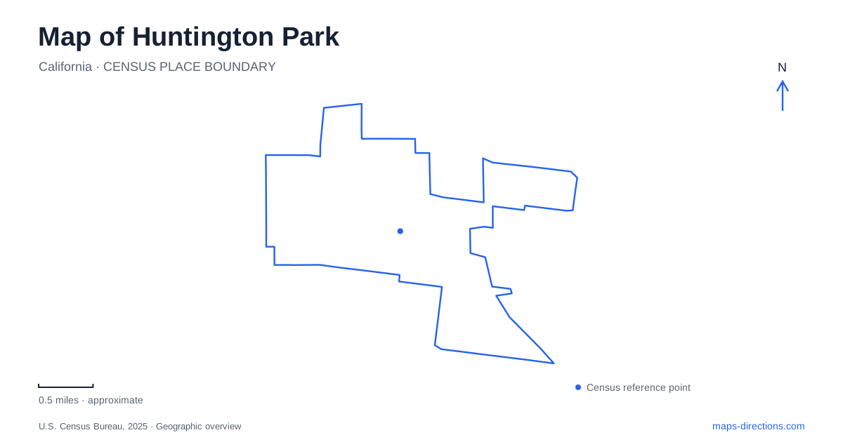
Street tiles load from OpenStreetMap when opened. The blue line shows the 2025 Census boundary.
- State
- California
- Population · July 2025
- 51,544
- Land area
- 3.0 sq mi
- Water area
- 0.0 sq mi
Huntington Park belongs to the closely built urban landscape of southeastern Los Angeles County. Pacific Boulevard provides its main retail corridor, while nearby residential streets, civic buildings, and parks reveal the community at a smaller scale. The city developed with strong transportation and industrial connections, and its map still reflects that history. Understanding the principal streets is a useful way to organize a visit without reducing the whole place to a single shopping destination.
Pacific Boulevard and the commercial spine
The city's environmental assessment identifies Pacific Boulevard as the main retail corridor both during the major growth of the 1920s and today. That continuity gives the boulevard a role extending beyond individual stores. It is a long-established commercial reference within a dense surrounding street network, useful for orienting a walk or understanding how nearby neighborhoods relate to the business district.
The wider urban context matters too. Industrial development in neighboring Vernon helped shape demand for housing and services nearby. The city grew as part of a regional landscape of factories, transport routes, and working communities. A map that shows municipal boundaries alongside the street network therefore explains more than one that isolates the commercial strip: daily movement has long connected this community with places immediately beyond its limits.
Randolph Street and the railway origin
The name Huntington Park is tied to the expansion of Henry Huntington's Pacific Electric Railway. In 1902, developers offered a railway right-of-way along what is now Randolph Street and renamed their development in an effort to attract the line. Before that, the subdivision had been called La Park. The railway connection was part of the developers' vision for a transport and commercial location.
The city incorporated in 1906 after residents pursued local government through several petitions. These dates place the present street network within an early twentieth-century urban development story. Randolph Street is especially useful as a historical reference because the road name marks a corridor associated with the city's founding ambitions. The historical railway role does not, by itself, imply a present-day passenger station or service along every part of that route.
Miles Avenue's civic cluster
City Hall is at 6550 Miles Avenue, while the county library building is at 6518 Miles Avenue. The closely spaced addresses identify a civic grouping separate from Pacific Boulevard's retail emphasis. Robert Keller Park shares the City Hall address in the municipal recreation directory. Together, these places show how public administration, learning, and open space occupy their own part of the central street pattern.
The library began in City Hall in 1913 before moving through larger premises and into its Civic Center building in 1970. That history makes the present proximity especially meaningful. The county has undertaken a refurbishment of the library, and its location page carries a temporary-closure notice, so the historic building should not be treated as a guaranteed indoor stop. It remains an important geographical reference within Huntington Park's civic landscape.
Salt Lake Park at Florence Avenue
Salt Lake Park occupies the corner of East Florence Avenue and Salt Lake Avenue, with the recreation center listed at 3401 East Florence Avenue. Its facilities include a gymnasium, ball diamonds, soccer fields, outdoor basketball courts, tennis courts, playgrounds, and picnic areas. The concentration of activities makes this a substantial recreation destination within the otherwise closely developed urban area.
The corner location helps distinguish it from the community center farther along Salt Lake Avenue, listed at 6925. These facilities serve related public purposes but occupy different addresses. For a sports game, class, or meeting, knowing which building or field complex hosts the activity is more useful than following a general parks-department label. Florence Avenue supplies the clear cross-street reference for the main recreation grounds.
Smaller parks on different streets
Freedom Park sits at Carmelita Street and East 61st Street, with an address of 3801 East 61st. Its recreation center, basketball courts, and playground offer a smaller neighborhood setting than Salt Lake Park. On the western side, Raul R. Perez Memorial Park is at 6208 Alameda Street near Randolph Street. Its outdoor grounds include a walking trail, sports space, and exercise equipment.
These locations broaden the map of Huntington Park beyond its retail corridor. Alameda and Randolph identify the western park setting, Miles Avenue organizes civic destinations, and Florence Avenue locates the larger recreation complex. Pacific Boulevard supplies the commercial spine through this wider pattern. Reading the named roads and public places together gives Huntington Park a clear local structure within the continuous urban fabric of southeast Los Angeles County.
Map and statistics: U.S. Census Bureau, 2025 Gazetteer, January 2025 generalized place boundaries and Vintage 2025 population estimates. Local references: City of Huntington Park; LA County Library; Los Angeles County Supervisor Janice Hahn. Article prepared by Maps & Directions.