Map of Huntington Beach
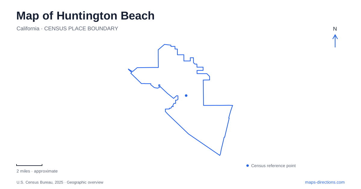
Street tiles load from OpenStreetMap when opened. The blue line shows the 2025 Census boundary.
- State
- California
- Population · July 2025
- 191,451
- Land area
- 27.3 sq mi
- Water area
- 0.5 sq mi
Huntington Beach contains several kinds of coast within one city map. The pier and Main Street form a recognizable downtown focus, but the shoreline continues through city-managed sand, state beaches and a protected estuary. Inland, Central Park introduces lakes and native-plant habitats, while the northwestern harbour follows an engineered pattern of islands and residential waterways. Distinguishing these landscapes makes it easier to choose a route that matches the kind of visit intended.
Main Street meets the Pacific
The Huntington Beach Pier projects 1,850 feet into the ocean at Main Street and Pacific Coast Highway. That intersection is the clearest reference for the downtown waterfront: Main Street approaches from the urban side, the coast highway follows the shore, and the pier extends outward across the surf.
Each direction produces a different experience. Walking inland leads toward shops and dining, following the beachside path stays parallel to the ocean, and walking onto the pier provides an elevated view back toward the shoreline. The pier is not a continuation of the cycling path; bicycles and skateboards are prohibited on it. This small but consequential distinction keeps a coastal ride separate from a pedestrian visit over the water.
The structure also makes the coastline legible. Looking back from it reveals the relationship between the broad beach, waterfront development and the long route beside the sand more clearly than a street-level view alone.
Three connected beaches with different boundaries
The central city beach lies between two state-managed stretches. Huntington State Beach runs south from Beach Boulevard to the Santa Ana River at the Newport Beach boundary. Bolsa Chica State Beach occupies the northern section between Seapoint Avenue and Warner Avenue.
A paved beachside trail links these stretches over approximately eight and a half miles. Its continuity can make the shoreline feel like one uninterrupted park, but management boundaries still matter for entrances, parking arrangements and permitted activities. A pass or reservation associated with one facility should not be assumed to cover every lot along the entire route.
For a map of Huntington Beach, Beach Boulevard, Seapoint Avenue and Warner Avenue are therefore useful coastal reference lines. They divide the long shore into understandable sections without requiring visitors to memorize every individual parking entrance. The Santa Ana River marks a stronger physical boundary at the southern end, where the river mouth interrupts the sandy coastline.
Across the highway, an estuary
Bolsa Chica Ecological Reserve occupies the inland side of Pacific Coast Highway, separate from Bolsa Chica State Beach. Its roughly 1,300 acres include salt marsh, mudflats, open water, dunes and nesting habitat. The reserve's purpose is conservation and nature observation, rather than the recreation associated with the ocean-facing beach.
Two main parking areas connect with a network of about four miles of trails. The northern access is beside the interpretive center on Warner Avenue, while the southern lot is reached from the coast highway. These approaches enter different parts of the same wetland landscape.
The distinction is especially important for cyclists and dog walkers. Neither bicycles nor pet dogs are allowed within the reserve, although the neighboring beachside route accommodates different uses. Some land is also closed because of active oil and gas operations. The visible mixture of habitat restoration and industrial infrastructure reflects a complicated coastal history, not an invitation to follow every track shown in an aerial image.
Inland habitats at Shipley
Shipley Nature Center provides a smaller ecological landscape within Central Park West. Established in 1974, it occupies eighteen acres and presents native California habitats through trails and environmental education. Its location at 17851 Goldenwest Street places it inland from the open beach and estuary.
More than 4,000 feet of paths pass through plant communities that include oak woodland, coastal sage scrub and riparian habitat. Blackbird Pond supplies a focal point, and water levels can change with rainfall and replenishment. The center's trail guide is useful because this is a carefully managed habitat area within a much larger public park.
A Huntington Beach visit that combines Shipley with Bolsa Chica can compare two different approaches to urban conservation. One offers a compact collection of native plant communities; the other preserves a broad coastal estuary shaped by tidal water and adjoining land uses.
The harbour's constructed geography
Huntington Harbour occupies the northwestern part of the city near Sunset Beach and Seal Beach. Developed in the 1960s, it contains five artificial islands and residential waterfronts. Its channels present a different map pattern from both the straight beach promenade and the irregular wetland trails.
Boating, kayaking and paddleboarding are associated with this sheltered-water setting. Streets and bridges serve the island neighborhoods, while water-based routes follow the channels between them. An open-ocean beach outing and a harbour excursion consequently start from different geographic assumptions. Keeping the pier, estuary, inland park and harbour distinct gives Huntington Beach a fuller identity than its surf-facing shoreline alone.
Map and statistics: U.S. Census Bureau, 2025 Gazetteer, January 2025 generalized place boundaries and Vintage 2025 population estimates. Local references: Visit Huntington Beach; California State Parks; California Department of Fish and Wildlife; Friends of Shipley Nature Center. Article prepared by Maps & Directions.