Map of Huber Heights
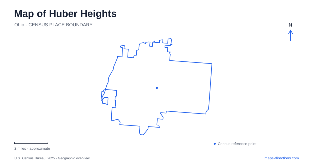
Street tiles load from OpenStreetMap when opened. The blue line shows the 2025 Census boundary.
- State
- Ohio
- Population · July 2025
- 43,905
- Land area
- 22.7 sq mi
- Water area
- 0.2 sq mi
Huber Heights brings together a postwar residential landscape and much older rural and river histories. Interstate 70 is an obvious organizing line on a regional map, but the city becomes more distinctive when the view includes the Great Miami River to the west and Carriage Hill's agricultural landscape to the east. Between those areas are neighborhoods, commercial corridors, and a newer recreation and entertainment district with its own set of destinations.
Brick homes and an older riverside community
The municipal history identifies 1956 as the year the first house in Charles Huber's development was built. Construction continued for decades, producing a large residential community before the city incorporated in 1981. This explains why the local identity is strongly associated with postwar housing rather than a single nineteenth-century courthouse square.
Yet settlement did not begin with those homes. The city's fire-service history describes Miami Villa beside the river, near Chambersburg and Rip Rap Roads, organizing a volunteer department in 1945. Residents raised money and built a station to serve both their neighborhood and the surrounding rural township.
These two histories give Huber Heights a useful internal distinction. The river community represents a settlement pattern predating the major housing development, while the extensive residential neighborhoods reflect a later, much larger transformation. A map that shows only highway exits misses that difference in how the city grew.
Two pikes and the entertainment district
Old Troy Pike and Brandt Pike provide clear north–south reference lines around Interstate 70. They are signed as State Routes 202 and 201 respectively. The Rose Music Center's published directions use either corridor to reach Executive Boulevard, placing the venue between the two approaches north of the interstate.
Its address, 6800 Executive Boulevard, is a useful anchor for The Heights district. The city's comprehensive plan also identifies the aquatic center, YMCA, Eichelberger Amphitheater, and other community destinations with this newer phase of development. These facilities add a civic and recreational cluster to a map otherwise dominated by residential streets and roadside businesses.
The road names clarify how the cluster works. Executive Boulevard serves movement across the district, while the pikes connect it with interstate interchanges and neighborhoods farther south. That relationship is more useful than treating the concert venue as an isolated regional attraction.
Carriage Hill preserves a working farm story
On the eastern side of the Huber Heights landscape, Carriage Hill MetroPark interprets nineteenth-century farming alongside woods, water, and trails. Its master plan emphasizes the Arnold family, whose lives and agricultural work give the historic farm a specific local identity. The farm is a place where people actually lived, rather than a collection of unrelated rural buildings assembled only for display.
The park map identifies the Daniel Arnold House, a bank barn, blacksmith shop, summer kitchen, and crop areas. Together these structures show how domestic life, repair work, food production, and storage occupied a connected farm landscape. Their arrangement explains activities that a single “historic farm” marker cannot convey.
Cedar Lake, prairie, and woodland paths form another part of the park. East Shull Road serves several named facility locations, including the historical farm, visitor center, and riding center. Carriage Hill and the residential development called Carriage Trails therefore need to be kept distinct: the similar names refer to different kinds of places within the northern landscape.
Taylorsville's canal and river corridor
Taylorsville MetroPark gives the western side of Huber Heights a contrasting historical setting. The Miami–Erie Canal once ran parallel to the Great Miami River here. The park's map identifies remnants on both sides of the dam and an aqueduct foundation to its north. An aqueduct carried canal water and boats across another watercourse, making it a particularly revealing trace of the former transport system.
The same map places the former village of Tadmor along the river trail north of the dam. This adds a settlement site to the corridor's layers of water transport and later flood-control infrastructure. The landscape can be read as an earlier route through the region, not simply the green edge of a modern suburb.
Why a dam need not have a lake
Taylorsville Dam is part of the Miami Conservancy District's regional flood-protection system. It is a dry dam: ordinary river flow passes through fixed openings, and water is temporarily stored during higher runoff. The surrounding storage land can consequently remain parkland or agricultural ground rather than forming a permanent reservoir.
That engineering principle explains an important map ambiguity around Huber Heights. A dam symbol does not necessarily imply a recreational lake behind it. At Taylorsville, open land, trails, and the river occupy a landscape designed to accommodate temporary floodwater. Reading that function alongside the canal remains and farm landscape reveals several generations of land use within the same wider community.
Map and statistics: U.S. Census Bureau, 2025 Gazetteer, January 2025 generalized place boundaries and Vintage 2025 population estimates. Local references: City of Huber Heights; Rose Music Center; Five Rivers MetroParks; Miami Conservancy District. Article prepared by Maps & Directions.