Map of Hoover
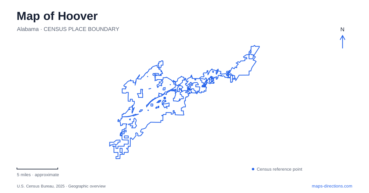
Street tiles load from OpenStreetMap when opened. The blue line shows the 2025 Census boundary.
- State
- Alabama
- Population · July 2025
- 93,550
- Land area
- 49.7 sq mi
- Water area
- 1.0 sq mi
Hoover’s recreation map brings together a sandstone valley, a former private estate, and a major sports campus. These places are connected by roads such as Preserve Parkway, Lorna Road, and Stadium Trace Parkway, but their internal landscapes differ sharply. Moss Rock follows streams and rock formations, Aldridge Gardens organizes planting around a lake, and the Met complex arranges fields and event buildings across developed grounds. Recognizing those differences gives the city’s map a useful physical structure.
The valley inside Moss Rock
Moss Rock Preserve occupies a highland valley between the south-facing slope of Shades Mountain and the north-facing slope of the lower Pine Mountain. Hurricane Branch runs west to east through its bottom, crossing shoals and waterfalls. This stream explains the preserve’s central line more clearly than its irregular boundary on a road map.
The 349-acre preserve contains large rock outcrops, woodland, and a sandstone-glade habitat. Drier sites support longleaf pine, while more moist areas carry mixed hardwood forest. The differences in slope and water availability therefore create different plant communities within a relatively compact area. Boulders are not isolated curiosities here; they belong to a broader landscape of rock, drainage, and vegetation.
For a Hoover outing focused on geology, the Boulder Field is the most recognizable starting point. Other portions of the preserve offer streamside walking, hidden valleys, and the more pronounced terrain of Boulder Gorge. The setting rewards attention to contours and drainage rather than distance alone.
Trail colors describe different parts of the terrain
The preserve’s approximately twelve miles of trails use white, blue, red, and orange markings, except for the power-line route. Much of the white trail follows a stream, but its eastern portion becomes substantially steeper. The blue route reaches valleys and boulders; the red passes cliffs and wetlands. The orange Boulder Gorge trail extends into the northeastern addition to the preserve.
The city identifies the Simmons Middle School trailhead on Patton Chapel Road as the quickest approach to the orange trail. Preserve Parkway provides access toward the Boulder Field, while another trailhead lies along Sulphur Springs Road. These approaches enter different sections of the same natural area. A loop selected from one entrance will not necessarily offer the same terrain as a route beginning elsewhere.
The city’s trail guide also reports missing pedestrian bridges and advises against high-water crossings. That is a specific limitation within this stream-shaped landscape. The marked trail network should be interpreted together with conditions at its water crossings, rather than assuming every drawn connection has a bridge.
From an estate to Aldridge Gardens
Aldridge Gardens stands at 3530 Lorna Road, near the former Coxe estate that horticulturist Eddie Aldridge first visited in 1966 to plant magnolias. He purchased the property in 1977. The city acquired it in 1997, and the public gardens opened in 2002.
That sequence gives Hoover’s garden landscape a different origin from the nature preserve. Here a privately developed property became protected public space, with planted collections and a five-acre lake shaping the visit. Woodland paths lead around the water toward the Veterans Memorial Arbor at its back. The lake acts as an organizing feature, helping visitors relate the garden’s more formal and wooded spaces.
The institution’s attention to hydrangeas, including the Snowflake variety, adds a horticultural identity beyond the general appeal of trees and water. It is a place for observing cultivated plants and garden design, while Moss Rock emphasizes the natural relationships among rock, slope, and vegetation.
Stadium Trace Parkway and the sports campus
The Finley Center is at 5508 Stadium Trace Parkway, reached from the Interstate 459 Exit 10 area. Within the Hoover Met Complex, it provides indoor courts, a suspended walking track, climbing facilities, and flexible event space. The stadium, outdoor fields, tennis courts, and RV park occupy other parts of the larger campus.
The distinction between the center and stadium matters because the complex name covers several kinds of venue. Indoor tournaments and outdoor games draw people to different buildings or fields, even when they share the same overall destination. Stadium Trace Parkway is the useful road reference around which those activities are arranged.
Black Creek Mountain Bike Park offers another recreation setting along the same parkway, across from the Lake Wilborn community. Opened in 2019, its trails follow natural terrain across a 73-acre property. This provides Hoover with a striking local contrast: organized courts and fields occupy one setting, while nearby cycling routes use the ground’s existing shape. Both are recreation destinations, but the landscape determines a very different experience at each.
Map and statistics: U.S. Census Bureau, 2025 Gazetteer, January 2025 generalized place boundaries and Vintage 2025 population estimates. Local references: City of Hoover; Aldridge Gardens; Hoover Met Complex. Article prepared by Maps & Directions.