Map of Homestead
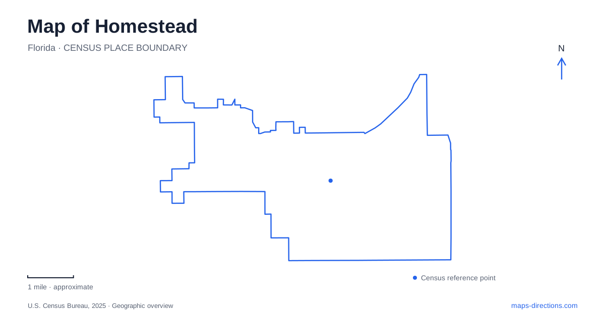
Street tiles load from OpenStreetMap when opened. The blue line shows the 2025 Census boundary.
- State
- Florida
- Population · July 2025
- 86,242
- Land area
- 15.1 sq mi
- Water area
- 0.5 sq mi
Homestead serves as a starting point for two national parks, but that does not make their entrances equivalent. The Everglades journey leads toward Royal Palm and the Main Park Road, while the Biscayne mainland destination is Convoy Point. Downtown is a third distinct setting, with its own civic and cultural stops. A useful map should preserve these differences instead of treating every nearby attraction carrying the same postal city name as part of one compact visitor district.
Krome Avenue gives downtown a specific reference
The municipal parks guide places Losner Park at 104 North Krome Avenue. The city's national parks trolley information identifies its main station stop at 4 South Krome Avenue. The north and south prefixes help distinguish the two locations even though they belong to the same downtown corridor. Retain the complete address rather than searching only for Krome Avenue and accepting whichever result appears first.
The Homestead downtown visitor description also identifies the Old Town Hall Museum and Seminole Theatre as local attractions. These can help establish the purpose of a downtown visit, but a park outing and a theater event have different arrival requirements. Choose the actual venue and meeting point before combining stops. A general downtown marker is useful for orientation, while an individual address is needed to complete the journey.
Royal Palm is a named stop inside the Everglades
The National Park Service identifies Royal Palm as an area inside the park reached from its southern entrance approach. Its directions use Palm Drive, Tower Road and Southwest 376th Street, with numbered street equivalents included for parts of the approach. This pairing of familiar road names and numbered references is helpful when different maps emphasize different labels.
For a trip from Homestead, preserve the destination name Royal Palm rather than asking only for the national park. A very large park cannot be represented adequately by one central pin. The entrance, a visitor center and a trail area can all be valid search results while serving different purposes. Once the correct approach has been identified, follow current park directions and signs for the final turn rather than assuming that reaching the boundary completes the trip.
Convoy Point is the mainland Biscayne destination
The Dante Fascell Visitor Center is at Convoy Point. The park service gives the address as 9700 Southwest 328th Street and also uses the name Sir Lancelot Jones Way. Those two road labels describe the same visitor-center address reference, which can reduce confusion when an itinerary and a map use different naming conventions.
This destination provides a mainland base with visitor facilities, a jetty walk and a canoe or kayak launch. Arriving there is not the same as having transportation to every part of the national park. Decide whether the visit concerns the mainland facilities or a separately arranged water-based activity. A map that shows islands and broad water areas should not be read as promising road access beyond the mainland arrival point.
The parking pin and the visitor-center pin differ
Biscayne's published management rules designate the road directly in front of the visitor center as a fire lane, with a specific exception for the municipal national parks trolley. A map marker attached to the building therefore does not establish a place where a private car can stop. Use the designated visitor parking arrangement rather than treating the building frontage as an automatic drop-off area.
This is a practical example of why a Homestead-area destination needs two checks: whether the attraction is correct and whether the proposed arrival action is allowed at that exact location. The same coordinates can identify a building successfully while providing an unsuitable stopping point. The map supplies location; posted site instructions determine the final approach and parking behavior.
A trolley route is not a year-round guarantee
The city describes separate national parks trolley trips for the Everglades and for Biscayne with a bayfront park stop. The published program is seasonal, and the National Park Service likewise identifies seasonal availability with schedules subject to change. A route line retained in an old guide does not prove that transportation operates on the date of a planned visit.
Check the active service period, boarding location and return arrangement before relying on the trolley. The park service also distinguishes its Everglades stops from areas farther along the Main Park Road. That makes a destination-specific plan essential: boarding a park-bound service does not imply access to every place shown inside the park boundary. Match the intended activity to the actual stop rather than merely matching the park name.
Keep the three journeys separate
A clear Homestead itinerary identifies the downtown stop, the precise Everglades destination or the Convoy Point visit before selecting transportation. Krome Avenue, the Royal Palm approach and Southwest 328th Street are separate address frameworks, not alternate routes to a single attraction. Keeping them distinct allows the map to explain the area's gateway role without concealing the different entrances, travel modes and final arrival decisions each outing requires.
Map and statistics: U.S. Census Bureau, 2025 Gazetteer, January 2025 generalized place boundaries and Vintage 2025 population estimates. Local references: City of Homestead; National Park Service. Article prepared by Maps & Directions.