Map of Hollister
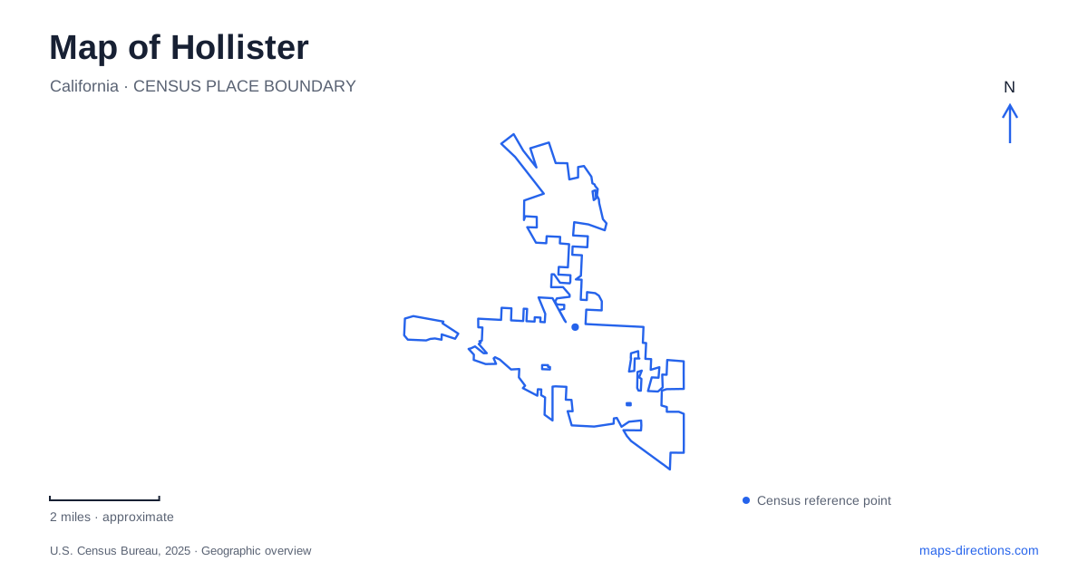
Street tiles load from OpenStreetMap when opened. The blue line shows the 2025 Census boundary.
- State
- California
- Population · July 2025
- 45,695
- Land area
- 8.2 sq mi
- Water area
- 0.0 sq mi
Hollister is a place where a street map and a geologic map can describe the same everyday landscape. The Calaveras Fault passes through the city, including downtown parkland, while nearby recreation areas reveal different terrain and fault relationships. That setting gives the town a distinctive geography: ordinary streets, lawns, and built structures occupy land whose slow movement has been studied for decades. The surrounding hills and the route toward Pinnacles add another scale beyond the urban center.
Downtown above a moving fault
The city’s park master plan traces the Calaveras Fault roughly north to south through downtown. It identifies the western portion of Vista Hill Park and Dunne Park as places along that alignment. Signs of gradual fault movement, or creep, can appear in roads and other built features. This is a long-term process, not a claim that every uneven pavement marks a fault or a recent earthquake.
A map of Hollister becomes more informative when the fault line is understood alongside the streets. Dunne Park and the hill park are not merely unrelated green spaces; their locations intersect a geologic feature that runs through the developed town. A fault overlay explains that relationship without turning every park visit into a technical field survey.
USGS research has documented differing creep rates at monitoring sites in the area and changes over time. That is a reason to avoid assigning one simple movement rate to the entire city. The useful visitor-level insight is spatial: a major geologic boundary crosses familiar urban places, and its effects are part of the town’s physical history.
The hill park and smaller neighborhood spaces
The municipal facilities directory lists Vista Park Hill at 498 Hill Court, with a softball field, playground, and barbecue facilities. Its downtown location makes it a useful named reference when comparing the older street area with parks farther into residential neighborhoods. The city’s documents use slightly different word orders for the park name, so the Hill Court address helps confirm the intended place.
Elsewhere, Apricot Park is associated with Apricot Lane and Summer Drive and includes a concrete walking path and open turf. John Z. Hernandez Memorial Park occupies a much smaller site at Central Avenue and Willow Drive. These distinct street references show that recreation is distributed among neighborhoods rather than confined to the downtown parks.
Hollister’s park map therefore has two useful readings. At close scale, it identifies play areas and neighborhood gathering places. At a wider scale, the downtown sites also help reveal the fault’s path through the city. Neither view replaces the other: the parks retain ordinary community functions even where their geology is unusual.
Cienega Road and the recreation ranches
Hollister Hills State Vehicular Recreation Area is associated with 7800 Cienega Road in the Gabilan Mountains. Its ranch names matter because they distinguish different types of recreation. The Lower Ranch serves motorcycles and ATVs, while the Upper and Hudner ranches are designated for other four-wheeled off-highway vehicles. Mudstone Ranch provides hiking, bicycling, and equestrian recreation.
The state park straddles the San Andreas Fault, a different named fault from the Calaveras alignment through downtown. State Parks describes clay-rich adobe soils and rolling grassland on one side, with granitic soils and steeper terrain on the other. That contrast helps explain why conditions and permitted activities can differ between ranch areas within one large recreation property.
The ranch names should remain visible when comparing a recreation map with a road map. Cienega Road identifies the broader destination, but it does not by itself specify a riding area or a nonmotorized route. Choosing the appropriate ranch is a substantive part of planning the visit.
The approach to Pinnacles is a separate trip
From Hollister, Highway 25 leads toward the eastern approach to Pinnacles National Park, where Highway 146 provides the final park access. The National Park Service places the east entrance roughly 30 miles from town. This is a regional excursion, not another downtown attraction.
The eastern and western park entrances are not connected by a through road. Their similar Highway 146 labels can be misleading on a broad map, because the roads terminate on different sides of the park. Keep the intended entrance explicit when planning a journey. Taken together, the urban fault corridor, Cienega Road ranches, and eastern Pinnacles approach reveal three distinct landscapes, each requiring its own level of map detail.
Map and statistics: U.S. Census Bureau, 2025 Gazetteer, January 2025 generalized place boundaries and Vintage 2025 population estimates. Local references: City of Hollister; U.S. Geological Survey; California State Parks; National Park Service. Article prepared by Maps & Directions.