Map of Hoffman Estates
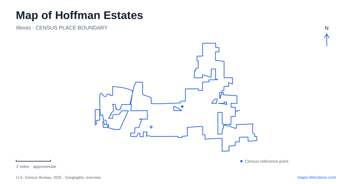
Street tiles load from OpenStreetMap when opened. The blue line shows the 2025 Census boundary.
- State
- Illinois
- Population · July 2025
- 50,858
- Land area
- 20.5 sq mi
- Water area
- 0.2 sq mi
Hoffman Estates has several strong geographic reference points rather than one traditional downtown square. The Higgins Road corridor holds a surviving farm landscape within a community park. Poplar Creek's forest preserves organize a large area of trails and open space. Farther along the regional transportation network, the Prairie Stone district and NOW Arena orient visitors arriving from Interstate 90. These settings tell different chapters of the village's development, and each deserves space on a useful local map.
Farmhouses within the suburban landscape
Vogelei Park stands on Higgins Road just west of Golf Road. Its gray stone farmhouse dates to 1916, while the brown barn replaced an earlier building after a 1937 fire. The village historian records that Edward and Amanda Sunderlage acquired the land in 1910. The house even had a battery-powered electrical system, an unusual convenience for its rural setting at the time.
The park became the community's first in 1969. Today, its pond, paved paths, arboretum, and historic buildings combine recreation with a visible remnant of agricultural life. An inclusive playground renovation was completed in 2026. The value of locating Vogelei on a map of Hoffman Estates is the way it connects everyday neighborhood activity with a farmhouse that predates the surrounding suburban streets.
A separate Sunderlage Farmhouse stands near Volid Drive and Vista Lane. Built in 1856 for Johann Sunderlage's family, it belongs to an earlier generation of settlement. The accompanying smokehouse dates to 1845 and is listed on the National Register of Historic Places. The village acquired the property in 1978, preserving the buildings as nearby land developed. Vogelei and Sunderlage should therefore be understood as two distinct farm sites, even though the family histories overlap.
Poplar Creek's nested place names
Arthur L. Janura Preserve is the broader name for a collection of sites that includes Carl R. Hansen Woods, Bode Lake, Barrington Road Pond, and the Poplar Creek Bicycle Lot. Seeing several of these labels together does not mean they represent unrelated parks. They belong to a larger preserve and trail landscape.
The entrances reveal its spread. Hansen Woods is reached from Sutton Road, south of Shoe Factory Road. Bode Lake lies along East Bode Road, east of Bartlett Road, while Barrington Road Pond sits south of Higgins Road. Those road relationships provide a more useful picture than treating the entire green area as a single point. A map of Hoffman Estates can show both the broad protected landscape and the particular edge closest to a planned walk or ride.
Within the preserve, the Red Paved Loop runs 8.9 miles. The shorter Brown Unpaved Loop covers 2.7 miles through a rolling landscape associated with Hansen Woods and the Shoe Factory Road prairie. The latter is a rare gravel hill prairie, where dry conditions support plants adapted to that exposed setting. Pavement, woodland, and prairie therefore represent different experiences within the same regional preserve.
A tollway with its own bus station
The I-90 and Barrington Road interchange is also a public transportation landmark. Pace opened its highway-based station there in 2018. Buses serve inline platforms in both directions without leaving the tollway, while a pedestrian bridge crosses the highway and tunnels carry pedestrians beneath ramps. The arrangement is distinctive enough to deserve attention before selecting a walking route to transit.
The station includes a park-and-ride lot and a south-side connection with the local On Demand service. For Hoffman Estates, this infrastructure gives the tollway a role beyond carrying private vehicles through the region. The pedestrian structures connect a large interchange to nearby residences and workplaces, although bus schedules and service coverage should be checked for the actual journey.
Prairie Stone and the arena approach
NOW Arena occupies 5333 Prairie Stone Parkway. Its parking areas are reached from Prairie Stone Parkway, Hoffman Boulevard, and Pratum Avenue. The venue's published regional approaches use the New Sutton Road interchange on I-90, with Beverly Road providing an alternative for westbound arrivals. These named roads establish the arena district's relationship to the tollway without assuming that every event uses an identical parking arrangement.
Placing the arena, Barrington Road station, farmhouses, and preserves on the same map makes the village's varied structure easier to understand. A visit centered on a concert belongs to the Prairie Stone road network; a neighborhood park outing follows the older Higgins Road landscape; a longer ride belongs to Poplar Creek's trail system. Hoffman Estates becomes more legible when those local settings are read individually and then connected through the roads that serve them.
Map and statistics: U.S. Census Bureau, 2025 Gazetteer, January 2025 generalized place boundaries and Vintage 2025 population estimates. Local references: Village of Hoffman Estates; Hoffman Estates Park District; Forest Preserves of Cook County; Pace Suburban Bus; NOW Arena. Article prepared by Maps & Directions.