Map of Hillsboro
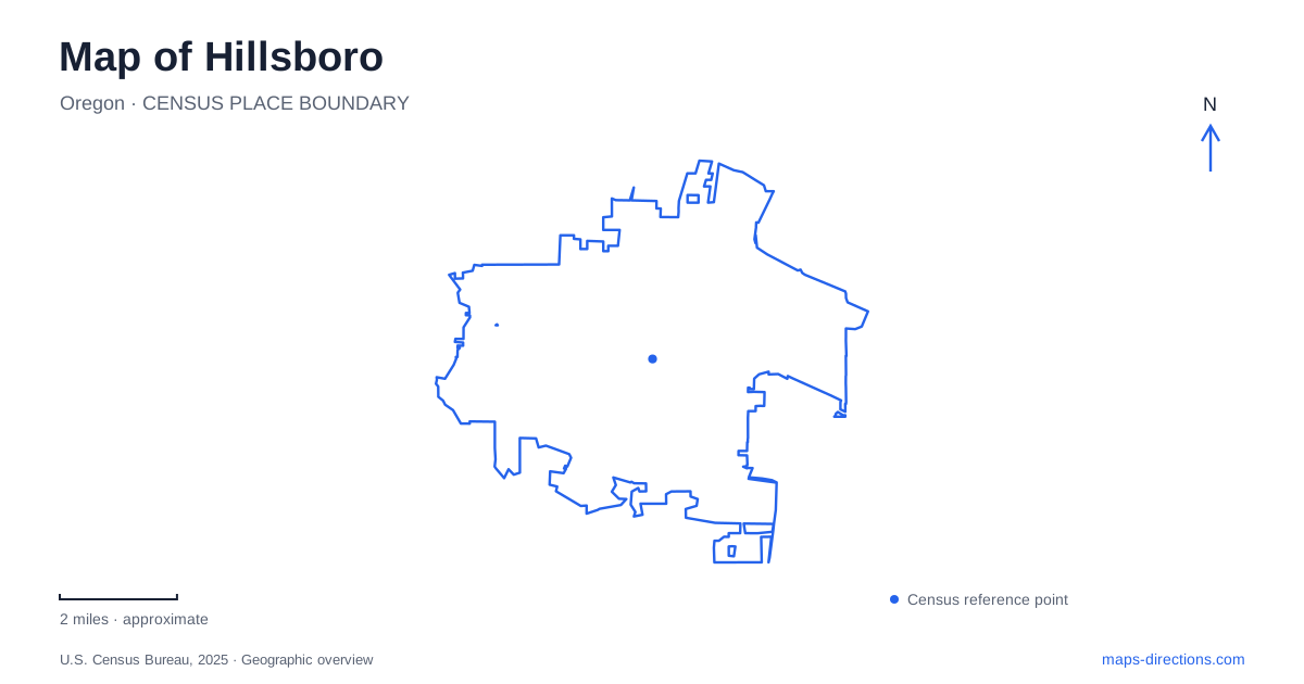
Street tiles load from OpenStreetMap when opened. The blue line shows the 2025 Census boundary.
- State
- Oregon
- Population · July 2025
- 111,126
- Land area
- 26.4 sq mi
- Water area
- 0.0 sq mi
Hillsboro's map holds several layers of development: a downtown street grid, the light-rail corridor, Orenco's nursery-town heritage, and wetlands connected with local waterways. The relationship between those places is more informative than a single city-center marker. Main Street and the numbered avenues organize cultural destinations downtown, while Orenco and the nature preserves show how earlier agricultural and ecological landscapes remain visible within the modern city.
Downtown arts and an older rail location
The central transit center stands at 333 SE Washington Street, between 3rd and 4th avenues. TriMet identifies it as the location of the original Oregon Electric Railway station. That continuity gives the present MAX Blue Line stop a historical significance beyond its role as a transfer point. Today's rail arrival occupies a place associated with an earlier generation of electric railway travel.
On East Main Street, the Walters Cultural Arts Center is at number 527, at the corner of Northeast 5th Avenue. The surrounding streets form a one-way grid, and the venue's parking lot lies on the north side, reached from 5th or 6th Avenue. These details matter because the building's public face on Main Street and its vehicle approach are on different sides.
The arts center occupies a former church built in 1949. Parishioners brought its distinctive red stones from a quarry in Camas, Washington. Performance spaces, galleries, and art studios now give that earlier religious building a different community role. For Hillsboro, the Walters is a concrete example of reuse within the downtown grid: the architecture remains part of the streetscape while the activities inside have changed.
The cultural district extends toward Shute Park
The city's Cultural Arts District, designated in 2019, reaches beyond Main Street. Its named anchors include Shute Park, Avenida Diez or 10th Avenue, and M&M Marketplace. That broader definition is useful when considering cultural activities that do not take place within the most obvious downtown blocks.
Shute Park Library is at 775 SE Tenth Avenue. The street address locates a public institution within this additional cultural area and helps distinguish it from the city's other library location. Reading the district as several connected places gives a fuller picture of civic and artistic life than treating the Walters as its only destination. It also explains why an arts-oriented outing may move from Main Street toward the park and 10th Avenue.
Orenco's name comes from a nursery company
Orenco takes its name from the Oregon Nursery Company. The historic townsite grew south of the Oregon Electric Railway, with streets named for trees, including Alder, Birch, Chestnut, Dogwood, Elm, and Fir. Those names preserve a direct connection with the activity that originally shaped the settlement.
The modern Orenco Station district developed as a mixed-use neighborhood planned in the 1990s. Housing, shops, services, and pedestrian-oriented commercial areas occupy a setting that also retains older homes once associated with nursery employees. A map of Hillsboro therefore shows two related histories within Orenco: the early company town and the later neighborhood organized around modern light rail.
The older tree-named streets and newer station-area development should be read together. They explain why a contemporary apartment or restaurant destination can sit near a streetscape with much earlier origins. The rail corridor provides continuity between those phases without making their architecture or land use identical.
Rock Creek's nature park
Orenco Woods Nature Park uses 7100 NE Birch Street, with its parking approach at Birch and 71st Avenue. The site once formed part of the nursery company property. Metro and the city later acquired the land, restored habitat along Rock Creek, and added bridges and public access improvements.
The paved Rock Creek Trail crosses the park, while separate nature trails pass through wetlands, oak savanna, meadows, and upland forest. Bicycles and leashed pets are allowed on the regional Rock Creek Trail but not throughout the other park areas. That distinction is specific to the site's dual role as a through-route and habitat preserve. A close trail map shows which part serves each purpose.
Jackson Bottom south of the urban core
Jackson Bottom Wetlands Preserve and its nature center are at 2600 SW Hillsboro Highway. Trails branch from the main parking area into wetland and upland settings, with an additional north viewing area providing seasonal access. The preserve's layout follows water and habitat rather than the downtown grid.
Flooding affects the available trail network. The city also identifies an indefinite closure on the Oregon Ash Trail between the Tualatin River overlook and Pintail Pond shelter because of unstable riverbank conditions associated with beaver activity. This makes the preserve's current trail information particularly useful before choosing a loop.
Hillsboro's urban and natural destinations thus operate at different map scales: numbered downtown blocks, a rail-linked nursery district, a creekside park, and a flood-influenced wetland preserve. Keeping those settings clear gives each address and trail a meaningful place within the wider city.
Map and statistics: U.S. Census Bureau, 2025 Gazetteer, January 2025 generalized place boundaries and Vintage 2025 population estimates. Local references: TriMet; City of Hillsboro; City development code; Metro. Article prepared by Maps & Directions.