Map of Hilliard
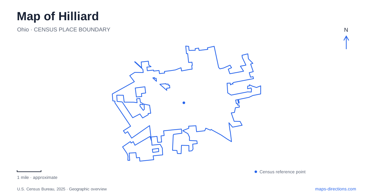
Street tiles load from OpenStreetMap when opened. The blue line shows the 2025 Census boundary.
- State
- Ohio
- Population · July 2025
- 38,898
- Land area
- 14.2 sq mi
- Water area
- 0.2 sq mi
Hilliard preserves its railway past in three different forms: a restored depot, a downtown gathering place that recalls the old station setting, and a former rail corridor used as a trail. These are connected historically but are not one destination. A map becomes much more informative when the original transport function is separated from the present location and use of each surviving feature. Recreation has also changed the local geography. Homestead Metro Park has expanded, while The Well opened on Cosgray Road in 2025. Older descriptions of a small park or a future recreation building can therefore be misleading even when the street names remain correct. The useful question is what occupies each site now and which parts are established visitor facilities.
A station site and a relocated station
Downtown's Station Park marks the setting of the early railway station and town square. The city's visitor information places it at the start of the Heritage Trail. It functions as a contemporary public space that recalls a former transport center, rather than as a working railway platform.
The restored historic depot is elsewhere, within the Historical Village at Weaver Park. The city's account explains that historic buildings were moved into the village. Their present grouping is a preservation setting, not evidence that all those buildings originally stood beside one another.
This distinction gives Hilliard an especially useful map-reading exercise. The old station location explains the development of downtown, while the preserved structure helps explain the building itself. A photograph of the depot and a pin for Station Park can both be accurate without showing the same place.
Weaver Park and the historical collection
The Historical Society identifies several different types of buildings and artifacts in its village, including the 1876 Colwell Chapel, the 1891 Grandview Schoolhouse, a log cabin representing an 1850s style, a caboose and a mobile voting wagon. Its description explicitly includes both preserved and reconstructed features. That is a more precise way to understand the collection than imagining an untouched nineteenth-century settlement.
Visitor directions make another useful distinction. The society gives 4162 Columbia Street as the walking address and 4100 Columbia Street for driving and parking, using the adjacent fairgrounds' west entrance from Columbia. Its archival library is a separate destination at 5274 Norwich Street.
These differences matter for researchers as well as casual visitors. The museum grounds display community history, whereas the archival address serves a different purpose. Building interiors also depend on scheduled access; open park space does not imply that every historic room is open at the same time.
Following the former railway northwest
The Heritage Rail Trail carries Hilliard's railway geography into a longer recreational corridor. Metro Parks describes a paved route from Main Street toward Cemetery Pike near Plain City. Its current trail page measures the full route at 6.1 miles, with a 3.6-mile northern portion under Metro Parks management. The city manages the section south of Hayden Run Road.
The division is useful when locating trailheads and interpreting maintenance notices. Heritage Trail Metro Park, at 7262 Hayden Run Road, is an access destination along the corridor rather than the name of every parcel beside the path. A separate bridle trail runs alongside the northern stretch, with horse-trailer staging at the park.
Walking, cycling and horseback riding consequently do not all use the same surface. On a small-scale map, parallel lines can collapse into what looks like a single route. The activity-specific trail designation is the better guide to which path a visitor should follow.
Homestead's established grounds and expansion
Homestead Metro Park, at 4675 Cosgray Road, has a covered bridge, a replica train station, barns and a fishing pond. Its paved loop connects with the rail trail. The station here is a replica, another important distinction from the relocated depot in Weaver Park.
Metro Parks now describes a 376-acre property following the addition of 333 acres in 2026. It identifies future prairie and wetland areas and additional trail connections as part of the expanded park's direction. Those future elements should not be read as a promise that every newly acquired acre already has a completed public path.
For Hilliard outings, this separates a familiar recreation area from a larger conservation and development footprint. Older maps may still show the smaller park, while a new boundary can include land whose visitor facilities are still evolving.
The Well on Cosgray Road
The Well is an operating recreation and wellness center at 3993 Cosgray Road. The city celebrated its grand opening on September 18, 2025. Its opening announcement describes fitness floors, gyms, an adventure track, indoor aquatics and social and programming spaces.
The building belongs on a current destination map as an established facility, not as the construction project described in earlier announcements. It is also distinct from Homestead farther along the same road. Shared street names can make these recreation destinations seem interchangeable when they serve different kinds of visits.
The resulting picture of Hilliard combines preserved railway buildings, reused transport land and newer community facilities. Each contributes a separate layer, and distinguishing those layers makes the map both historically clearer and more practical.
Map and statistics: U.S. Census Bureau, 2025 Gazetteer, January 2025 generalized place boundaries and Vintage 2025 population estimates. Local references: City of Hilliard; Hilliard Ohio Historical Society; Columbus and Franklin County Metro Parks. Article prepared by Maps & Directions.