Map of Highland
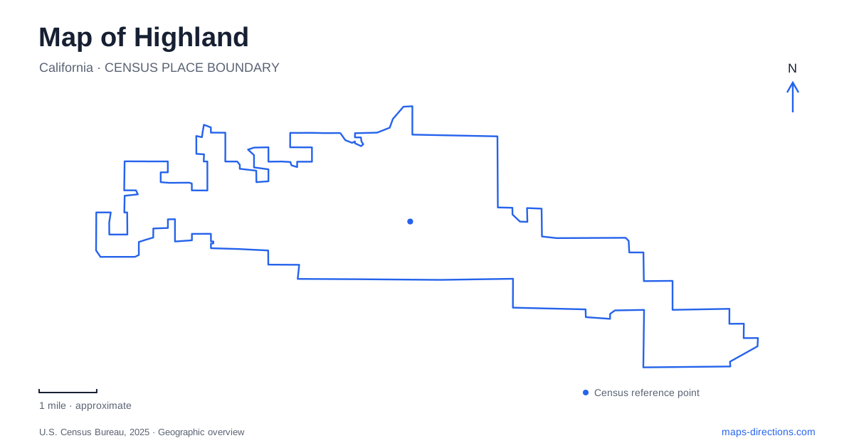
Street tiles load from OpenStreetMap when opened. The blue line shows the 2025 Census boundary.
- State
- California
- Population · July 2025
- 57,614
- Land area
- 18.6 sq mi
- Water area
- 0.1 sq mi
Highland sits at the southern base of the San Bernardino Mountains, where older town streets meet a landscape shaped by citrus cultivation and irrigation. Palm Avenue identifies the historic commercial district, while Greenspot Road and the eastern trail areas reveal more of the agricultural setting. Central Avenue supplies another local landmark: a public library that incorporates an environmental learning center. Together, these places show a community whose history is easier to understand through water, orchards and transport than through modern shopping destinations alone.
Palm Avenue and the citrus town
The historic district in Highland includes the original townsite, packing houses and the older commercial core along Palm Avenue. County history places the townsite's formal recognition in 1891. Rail access and irrigation supported citrus production, and packing facilities prepared oranges and lemons for shipment beyond the valley. The relationship between the commercial street and the agricultural economy is therefore fundamental to this part of town.
The city uses Palm Avenue and Main Street as the setting for its Citrus Harvest Festival. That location ties a present-day community gathering to the neighborhood most closely associated with the older settlement. Even outside an event, those two street names provide a useful focus for looking at the historic district rather than searching across the entire modern city.
Fifth Street also carries an older transport story. The county identifies it with the former Santa Ana Canyon Road, which carried supplies toward mining activity in Bear Valley. This helps explain why a seemingly ordinary numbered street belongs to a much longer regional history. Roads that now serve daily trips can preserve routes established for very different economic purposes.
Irrigation traces in the eastern landscape
A walk through the trail areas of Highland can reveal evidence of orchard management that is easy to overlook from a vehicle. The city's community trail guide describes former agricultural access roads, rock retaining walls, water pipes, weir boxes and flumes. These features were working infrastructure: they helped people move through sloping land and direct water toward planted groves.
Plunge Creek is particularly important in the guide's explanation of the landscape. Water from the creek supplied orange groves through pipes and open channels, and the trail interpretation points out surviving pieces of that system. A retaining wall beside a path is consequently more than an incidental pile of stone. It can mark the effort required to make a hillside usable for cultivation and harvest.
This history provides a different reason for choosing an outdoor route. Instead of considering only the distance to a viewpoint, a walker can look for the relationship between channels, walls and the grade of the land. The former farm routes also help explain why a trail may follow an alignment that differs from the adjacent residential street pattern. The terrain and the irrigation network existed before the current neighborhoods.
Central Avenue's library and animal residents
The Sam J. Racadio Library and Environmental Learning Center stands at 7863 Central Avenue. Its combination of books and living animal exhibits makes it an unusual Highland public destination. The county library presents turtles, lizards and other small animal residents as part of the learning environment, with programs that connect reading to observation of the natural world.
This is an indoor educational complement to the outdoor trail landscape. A family interested in animals can spend time with a structured program here, while a trail visit involves interpreting habitat and historical land use in the open. The two activities have different practical requirements, yet both make environmental learning part of a local outing.
The full library name can appear abbreviated in map searches, so Central Avenue and the street number are useful identifiers. It is a county library branch with a distinctive additional role, rather than a separate nature center located somewhere in the foothills. That placement brings the environmental exhibits into an everyday civic setting used for reading, classes and community activities.
Parks along Greenspot and the neighborhood streets
Aurantia Park is listed at 29700 Greenspot Road and includes a dog park. The city's community design plan highlights its native landscaping as an example of conserving water while reflecting the surrounding natural environment. That design choice links a modern recreation space to the same water-conscious landscape that shaped the earlier orchards, although the purpose of the planting is now different.
Other neighborhood parks provide smaller and more specialized settings. Canyon Oak Park is on Summertrail Place and is described by the city as a place with benches rather than a playground or restroom facility. Oak Creek Park, near San Benito and McLean streets, is an open grass area. These differences are useful when choosing a stop: a park symbol alone does not describe the kind of recreation available.
A day in Highland can therefore move between several distinct scales of place: the compact Palm Avenue district, agricultural traces along the trails, a library learning program and a neighborhood green space. The connections between those settings are rooted in the city's actual development, from citrus-era water management to present-day public recreation.
Map and statistics: U.S. Census Bureau, 2025 Gazetteer, January 2025 generalized place boundaries and Vintage 2025 population estimates. Local references: San Bernardino County; City of Highland; San Bernardino County Library. Article prepared by Maps & Directions.