Map of Hickory
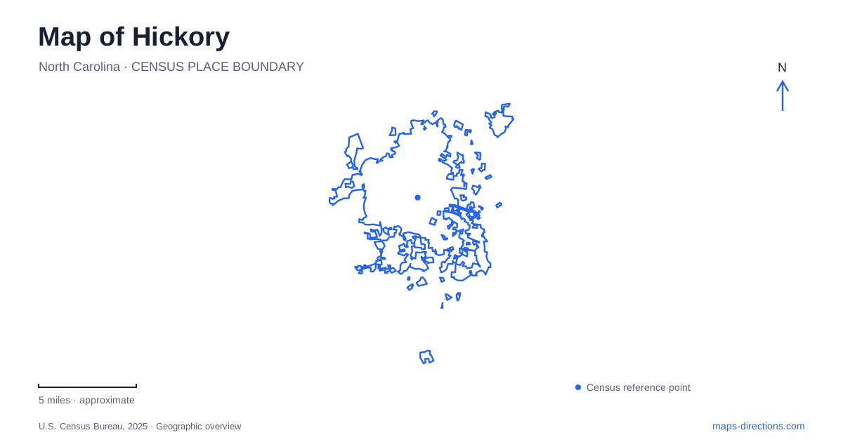
Street tiles load from OpenStreetMap when opened. The blue line shows the 2025 Census boundary.
- State
- North Carolina
- Population · July 2025
- 45,975
- Land area
- 33.2 sq mi
- Water area
- 0.1 sq mi
Hickory has developed a set of named walks that reveal different parts of the city: Main Avenue and downtown, the Catawba River waterfront, the airport corridor, and the Ridgeview neighborhood. These routes share a wider trail vision, but each has its own geography and purpose. Understanding the named segments is more useful than assuming the whole system is one uninterrupted riverside path.
Main Avenue connects the university and downtown
City Walk follows Main Avenue from Lenoir-Rhyne University through downtown toward 11th Street Northwest and Old Lenoir Road. It links academic, commercial, and former industrial settings, providing a route through the central city rather than an escape from it.
The University Mill District helps explain that mixture. Municipal trail interpretation identifies reused buildings such as Hollar Mill, Moretz Mills, and the former Lyerly Mill, now associated with offices, shops, restaurants, and event uses. Their industrial origins remain part of the district's character even as their present activities change.
For a map of Hickory, the university and downtown provide useful endpoints for understanding this corridor. Individual mills and public spaces then give a walk a focus. A person interested in industrial architecture may choose different stops from someone simply moving between campus and a downtown destination.
Bridges are part of the urban route
City Walk includes the Wyatt Bridge at Third Street and the Rudy Wright Bridge over North Carolina Highway 127. These named structures make the route easier to understand as an actual connection through a developed city. Major roads and changes in grade require designed crossings rather than a line drawn continuously across a map.
Union Square's renovation was also part of the City Walk project. That relationship places the familiar downtown gathering area within a broader network of streets and paths. The square can be a destination in itself or one stop in a longer walk along Main Avenue.
The map is most useful when those crossings and public spaces remain visible. They explain how the route functions, rather than merely showing which attractions are near one another.
Riverwalk follows a different landscape
Riverwalk extends roughly 2.3 miles through the Geitner Park setting along the Catawba River. It combines wooded and waterfront sections with an overwater bridge, offering an experience distinct from the street-oriented City Walk. Lake Hickory is part of this river landscape, so the river and lake names should be read together rather than as unrelated destinations.
Rotary-Geitner Park at 2035 12th Street Drive Northwest is a principal access reference. Another approach is from City Park at 1581 12th Street Drive Northwest, using the existing trail network. These addresses identify different ways into the broader waterfront setting.
The city also describes planned amenities and future connections around the Riverwalk. Those proposals should remain separate from the existing path. A park development illustration may show a larger eventual landscape than the facilities available during a particular visit.
Aviation Walk crosses the highway barrier
Aviation Walk connects the Old Lenoir Road area across U.S. 321 on a pedestrian bridge, passes L.P. Frans Stadium and Winkler Park, and continues toward Hickory Regional Airport. Its geography makes a clear contrast with the waterfront: the organizing feature is a link across a major transport corridor to sports and aviation destinations.
The city identifies a trailhead at 1240 U.S. 321 Northwest, with additional access near the airport and at Winkler Park. This offers a choice of starting points for different portions of the route. A short walk near the stadium and a longer trip over the highway bridge need not begin at the same place.
The airport connection does not turn the route into a passenger-flight itinerary. It is a pedestrian and bicycle connection within a district that includes aviation activity, recreation, and other institutions. Keeping that purpose clear makes the name more informative.
Ridgeview and Old Lenoir Road complete the picture
Historic Ridgeview Walk connects the neighborhood with downtown and U.S. 70 through a route associated with South Center Street, library sites, and the recreation center. The city records its opening in 2024. It adds a neighborhood connection to a system that might otherwise be understood only through the river and central business district.
City Walk, Riverwalk, Aviation Walk and Historic Ridgeview Walk identify distinct segments of the municipal trail system. OLLE Art Walk also appears in the system's development plans. When combining them, consult the city's trail guidance for the connections available between named segments. A line in a planning diagram explains an intended link, but it does not by itself establish a finished passage or a continuous route for an outing.
A map of Hickory therefore works best as a set of connected but distinct local landscapes. Main Avenue shows reuse and downtown life; the Catawba waterfront offers woods and water; Aviation Walk crosses a highway; and Ridgeview adds neighborhood destinations. Choosing a segment by its setting gives an outing a clear purpose and an understandable route.
Map and statistics: U.S. Census Bureau, 2025 Gazetteer, January 2025 generalized place boundaries and Vintage 2025 population estimates. Local references: City of Hickory. Article prepared by Maps & Directions.