Map of Hesperia
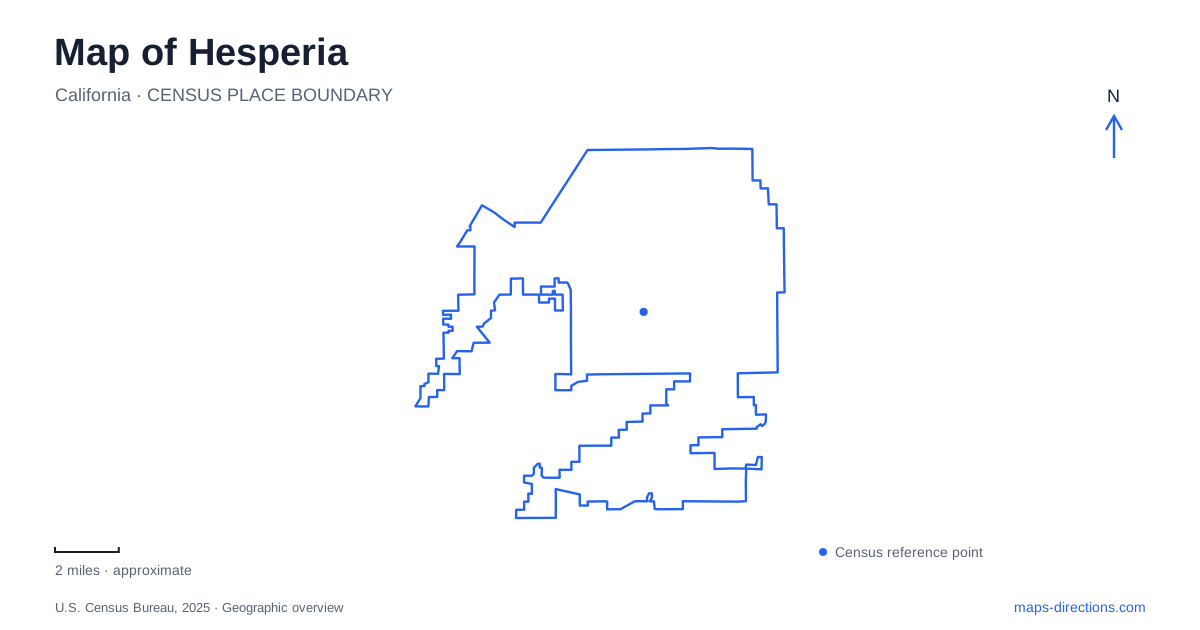
Street tiles load from OpenStreetMap when opened. The blue line shows the 2025 Census boundary.
- State
- California
- Population · July 2025
- 102,605
- Land area
- 72.7 sq mi
- Water area
- 0.1 sq mi
Hesperia's map combines a broad urban street network with recreation areas leading toward the San Bernardino Mountains. The north–south railway is an important dividing line, while Main Street and Ranchero Road provide recognizable east–west crossings. Seventh Avenue identifies the civic area, Lime Street anchors a substantial recreation complex, and Arrowhead Lake Road leads to a lakeside destination with a very different setting. Farther into the mountains, Silverwood Lake introduces another landscape and another set of access roads.
Main Street and the railway divide
The BNSF railway cuts through the city from north to south. Municipal project records explain how this corridor shaped the need for the Ranchero Road undercrossing: reliance on the Main Street bridge had made east–west movement vulnerable when incidents blocked that route. The undercrossing was completed in June 2013, adding a road connection beneath the tracks.
The project also included embankment and drainage work in Antelope Valley Wash between Santa Fe Avenue East and Danbury Road. This is a useful reminder that the crossing involved more than the railway alone. Tracks, drainage, and street approaches all influenced the route. On a Hesperia map, Main Street and Ranchero Road should therefore be read as major pieces of the connecting network, with the railway explaining why particular crossing points matter.
A civic address and a recreation headquarters
City Hall uses 9700 Seventh Avenue. Civic Plaza Park and the Smoke Tree Street setting provide another public gathering area nearby. The plaza's light poles also host the city's military-banner program, tying civic recognition to a visible public space. These details make the civic area identifiable through both an address and the landscape around it.
Lime Street Park, at 16292 Lime Street, is a separate recreation hub and the park district's administrative address. Its facilities are distributed around the community center rather than concentrated at one corner. Tennis and pickleball courts lie north of the center. The dog park occupies the west side, north of the picnic area, while the skate plaza lies on the east side above the ball fields. A basketball court sits north of the skate plaza.
This internal arrangement is particularly helpful for meeting someone at the park. A reference to the west-side dog area or east-side skating facilities communicates much more than the park's overall address. The southwest fit trail adds another identifiable corner, demonstrating how one recreation site can contain several distinct destinations.
The lake on Arrowhead Lake Road
Hesperia Lake Park is at 7500 Arrowhead Lake Road. Fishing, camping, and picnicking give it a different role from the sports-oriented facilities on Lime Street. The district directs people who intend to fish or camp to register at the Lake Store, making that building a functional starting point within the grounds.
The John Swisher Community Center shares the park setting. The district describes mountain views to its east and the lake to its west, a useful relationship for understanding the building's position. The water and mountain backdrop create an outdoor setting for community activity rather than simply another recreation hall inside the street grid.
The similarity of regional lake destinations can be misleading when planning an outing. This park on Arrowhead Lake Road is a local district facility; Silverwood is a state recreation area reached through a different road system in the mountains. Their names, operators, and access points should remain separate in a saved itinerary.
Silverwood's road and shoreline geography
Silverwood Lake State Recreation Area uses the mailing address 13990 Sawpit Canyon Road, Hesperia. State Parks places the approach off Highway 138 and Cleghorn Road. Sawpit and Cleghorn are also the names of the park's two swim beaches, while the marina and campgrounds supply other orientation points around the reservoir.
The path system links several of these places. The multi-use route starts at Sawpit Beach, passes Willows Cove and the Old Mesa campground area, and continues toward Cleghorn Beach. Graces Overlook Trail begins beyond the Cleghorn portion of that route. Miller Canyon supplies another arm of the recreation landscape, with a service-road walk toward an overlook of the East Fork of the Mojave River.
The reservoir also covers an older inhabited landscape. Before its construction, Cedar Springs developed around the junction of Cleghorn and Miller gulches, with farms in the surrounding canyon areas. That history gives the names on the modern recreation map additional meaning: they identify valleys that organized settlement before they became associated with beaches, trails, and reservoir access.
Taken together, these places show Hesperia at several scales. Railway crossings explain movement across the developed city, the civic and Lime Street areas organize community services, and the two lake destinations lead outward into increasingly mountainous terrain.
Map and statistics: U.S. Census Bureau, 2025 Gazetteer, January 2025 generalized place boundaries and Vintage 2025 population estimates. Local references: City of Hesperia; Hesperia Recreation and Park District; California State Parks. Article prepared by Maps & Directions.