Map of Hempstead
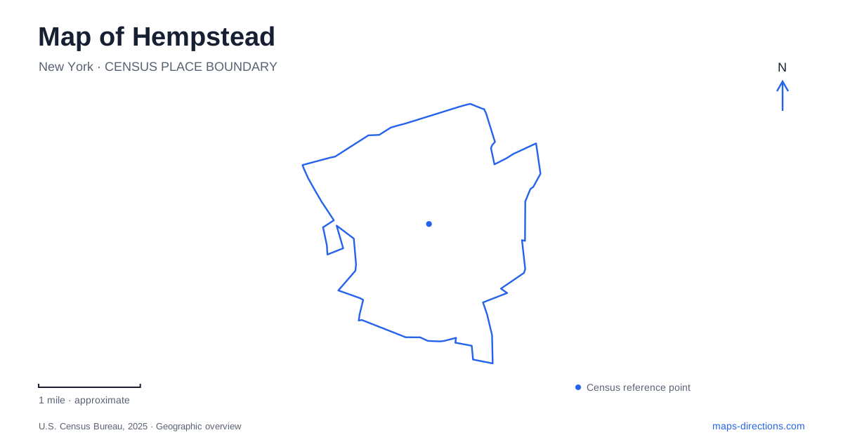
Street tiles load from OpenStreetMap when opened. The blue line shows the 2025 Census boundary.
- State
- New York
- Population · July 2025
- 59,819
- Land area
- 3.7 sq mi
- Water area
- 0.0 sq mi
Hempstead is both a village name and a wider town name, which makes geographic precision particularly useful here. This guide focuses on the incorporated village in central Nassau County: its downtown streets, rail and bus connections, civic institutions and recreation grounds. The village's compact identity is easiest to see when the transit center, government buildings and cultural destinations are displayed together, rather than relying on the much broader town label.
Downtown combines commerce and civic life
Fulton Avenue and Main Street are important references in the central business district. The village's downtown planning documents describe a mix of shops, services, housing, religious buildings and government offices rather than a district devoted to only one activity. That mixture helps explain why a trip into the center might combine an appointment, an errand and a cultural stop within the same general area.
James A. Garner Way provides a particularly clear civic address sequence. Village Hall is at number 99, and the public library is at number 115. Denton Green stands across from Village Hall and serves as an outdoor gathering place. These institutions give the downtown map recognizable anchors even when individual businesses change. A meeting at Village Hall, a library visit and a community gathering on the green all refer to the same civic setting but have different destinations within it.
For a first look at Hempstead, this cluster is more informative than a single center marker. The green introduces an open public space among the streets and buildings, while the library and municipal offices explain the area's everyday role. The downtown district is not merely a transportation interchange; it is also where civic, commercial and cultural activities overlap.
Rail and buses create a regional gateway
The Long Island Rail Road station and the Rosa Parks transit center form another essential cluster. The MTA's station-area map shows the rail facility, bus facility, library, Village Hall and courthouse together, with streets including Jackson, Main, Washington and West Columbia providing local references. That combination makes the interchange a useful orientation point even for someone who is continuing on foot.
Hempstead station is the named rail destination, while NICE buses provide connections across Nassau County. The two systems should be understood as complementary parts of a journey. For example, the bus operator identifies service from the transit center toward Nassau Community College and Roosevelt Field. Those destinations belong to the wider regional network, so their appearance in transit information should not be mistaken for a statement that they are part of the village's central blocks.
A local map and a service map answer different questions here. The first shows the relationship between the station, civic buildings and street network; the second identifies the particular train or bus needed for an onward journey. Starting with the physical arrangement helps establish where the transfer happens before considering the separate schedule details.
North Franklin Street adds a cultural destination
The Joysetta and Julius Pearse African American Museum of Nassau County is at 110 North Franklin Street. Its exhibits and programs address Black history and culture on Long Island and nationally. The county acquired the building for the museum in 1985, giving the institution a long-established physical home within the village's cultural landscape.
This address is useful to retain independently of the transit hub or civic complex. The museum is a destination with its own frontage and purpose, not an exhibit inside the library or government offices. Its collection and programming provide a reason to spend time in the area beyond making a connection. On an itinerary centered on local history, it can be the main stop around which nearby downtown activities are arranged.
Greenwich Street and a separate park outing
Kennedy Memorial Park is located at 335 Greenwich Street. Its facilities include playing fields, courts, a playground, a swimming pool and indoor recreation spaces. That range gives it a different role from Denton Green: the green supports a downtown public-space experience, while the park is a substantial recreation destination where the particular activity determines which part of the grounds matters.
The similar names of regional places can otherwise blur this distinction. Hempstead Lake State Park has a Lake Drive address in West Hempstead, so it should be treated as a separate destination from the village's Kennedy Memorial Park. Choosing between an indoor recreation program, a village sports field and a state-park outing is a geographic decision as well as an activity preference. Keeping Greenwich Street, North Franklin Street, James A. Garner Way and the station-area streets in view makes that decision clearer and gives the village a much more precise shape on the map.
Map and statistics: U.S. Census Bureau, 2025 Gazetteer, January 2025 generalized place boundaries and Vintage 2025 population estimates. Local references: Incorporated Village of Hempstead; Village of Hempstead / New York State; Hempstead Public Library; Metropolitan Transportation Authority; Nassau Inter-County Express; Nassau County; New York State Parks. Article prepared by Maps & Directions.