Map of Hemet
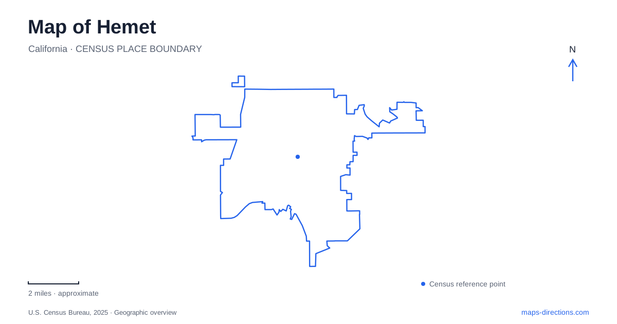
Street tiles load from OpenStreetMap when opened. The blue line shows the 2025 Census boundary.
- State
- California
- Population · July 2025
- 93,649
- Land area
- 29.3 sq mi
- Water area
- 0.0 sq mi
Hemet’s best-known cultural places occupy three quite different landscapes: the Florida Avenue street grid, a natural canyon used for outdoor theater, and the edge of a large reservoir where construction uncovered ancient fossils. A useful map keeps these settings in view together. They explain how rail transport, performance, water infrastructure, and scientific discovery have each shaped the valley, without reducing its history to a single downtown landmark.
Florida Avenue and the former depot
The Hemet Museum occupies the historic Santa Fe depot at 100 West Florida Avenue, on the northwest corner of Florida Avenue and State Street. The crossing of these two named streets gives the museum a precise position within the older commercial area. The depot’s survival also preserves a physical link with the railroad’s role in local development.
The freight house became the museum after a lengthy preservation effort. When demolition was contemplated, the Save Our Station organization brought together private residents, public officials, businesses, and community groups. Restoration was completed in 1998. The building now interprets local history through photographs, agricultural material, Native American artifacts, and objects connected with the Ramona production.
The historic theater is a separate building at 216 East Florida Avenue, near Carmalita Street. It hosts the heritage foundation’s history presentations, even though the museum itself remains in the depot. This shared programming gives the two buildings a relationship without making them the same destination. Florida Avenue supplies the connecting geographic reference.
A town shaped by water and rail
The city’s history describes two companies formed in 1887 to develop land and water resources. The plan involved a mountain reservoir supplying valley lands and townsites, while railroad negotiations sought access for prospective land buyers. Water supply and transportation were therefore intertwined in the town’s development.
This relationship helps explain Hemet beyond the familiar commercial corridor. The valley was not developed independently of its surrounding mountains: reservoir planning connected upland water storage with agricultural and settlement land below. Rail access added another connection to the wider region. A street map shows the resulting town, while these histories explain some of the decisions behind its location and growth.
The area’s earlier Cahuilla history and its period as part of Rancho San Jacinto predate those company plans. The nineteenth-century townsite is one layer within a longer inhabited landscape, not the beginning of local history.
The canyon chosen for Ramona
The Ramona Bowl stands at 27400 Ramona Bowl Road in the foothills southeast of town. Its 160-acre property surrounds a natural performance setting selected by playwright Garnet Holme in 1922. The first production followed in 1923, drawing on Helen Hunt Jackson’s 1884 novel.
Holme favored the canyon’s setting and acoustics over an earlier suggestion to stage the play on athletic fields in town. That decision made topography part of the production. The hillside and surrounding open space contribute to how the drama is presented, rather than merely providing scenery behind a conventional theater building.
For Hemet visitors, the Bowl consequently belongs to a different kind of map than the Florida Avenue venues. The approach leaves the regular commercial streets for a foothill destination. The adjoining museum adds artifacts and photographs associated with the production, including a fresco created by Milford Zornes and his students in 1942. Performance history and visual art occupy the same larger site.
Fossils beside a modern reservoir
The Western Science Center is at 2345 Searl Parkway, on the eastern side of Diamond Valley Lake. Opened in 2006, the museum preserves material discovered during the reservoir project, including remains of mastodons, mammoths, camels, sloths, dire wolves, and long-horned bison. Max, a particularly significant mastodon specimen, was later identified as the Pacific mastodon species.
This makes the museum’s location especially meaningful. Its collections are linked to excavations in the surrounding landscape, so the building is not simply an unrelated attraction placed near a lake. Modern earthmoving exposed evidence of much older environments, and the museum gives that evidence a permanent research and exhibition setting.
The science center shares its campus with Western Center Academy. Its entrance is reached along the Life on Earth pavilion from the parking area. Across the broader reservoir recreation area are a visitor center, marina, and trails, while the regional aquatic center and community park occupy adjacent property.
The contrast between the reservoir and the fossils adds depth to a Hemet map. Present-day water storage, recreation, education, and paleontology meet in one part of the valley. The landscape is simultaneously infrastructure and a record of environments that existed long before the streets, depot, and outdoor theater.
Map and statistics: U.S. Census Bureau, 2025 Gazetteer, January 2025 generalized place boundaries and Vintage 2025 population estimates. Local references: Hemet Heritage Foundation; City of Hemet; Ramona Pageant Association; Western Science Center; Metropolitan Water District. Article prepared by Maps & Directions.