Map of Hawaii
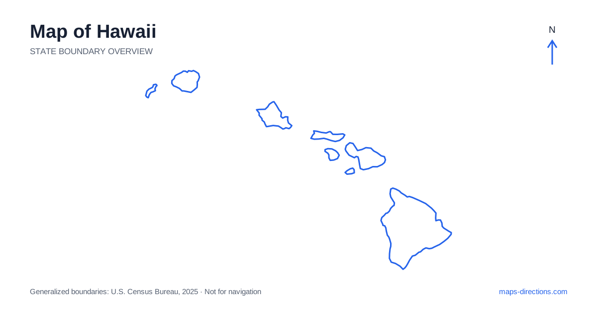
Hawaii is an island state, so its map should be read as a collection of separate land areas rather than a continuous driving region. Ocean channels divide the main islands, and each island has its own road pattern, airport locations and terrain barriers. Honolulu is an important reference point, but a trip described by the state name alone is too broad to locate an actual stay. Begin with the island, then the arrival area, and finally the road connection to the precise town or accommodation you intend to use.
Keep the islands separate in the travel plan
A map of Hawaii typically emphasizes the main southeastern islands, while the full state boundary also includes a much longer chain extending northwest. The outline above is a generalized geographic overview, not a diagram of transport services. The position of two islands on that overview does not establish how a traveler can move between them or whether a vehicle can accompany the journey.
Plan each interisland transfer as its own transport segment. Confirm the actual departure and arrival locations before joining two island itineraries together. In particular, do not draw a road route across a channel or assume that every pair of islands has a convenient vehicle ferry. The local driving plan resumes after arrival on the next island, often from a different base and with a separate set of road distances.
Identify the largest island by its own towns
The island of Hawaii, often called the Big Island, has a scale and road network distinct from the other islands. Hilo anchors the eastern side, while Kailua-Kona lies on the western coast. Volcanic terrain occupies much of the interior, and the road relationship between these sides matters when choosing a base. A coastal stay on one side does not make the entire island a small local driving area.
The central cross-island corridor and the routes around the perimeter offer different connections. For a national park visit or mountain destination, use the specific visitor entrance or access point rather than a pin on a volcanic summit. Roads do not follow every apparent shortcut across the interior. Make each day's starting coast, destination area and return route explicit before adding several widely separated stops to the same plan.
Read Oahu around its ranges and urban area
Honolulu occupies the southern side of Oahu, with the wider urban area extending beyond the familiar Waikiki district. The island's mountain ranges help separate the southern urban coast from windward communities and the North Shore. A small island outline can hide the importance of the limited corridors that cross or go around those ranges.
Choose the exact part of the island before estimating local travel. A stay in Waikiki, a visit near Kailua and a North Shore excursion involve different approaches even though they share one island. The airport is also a specific arrival point rather than a general substitute for the city center. A detailed map helps distinguish an urban street journey from a transfer across the island's terrain and road network.
Give Maui's two main landforms proper attention
In Hawaii's island geography, Maui is recognizable for its western mountain area and the much larger Haleakala landmass joined through a central lowland. Kahului is a useful central reference point, while the southern resort coast and eastern Hana area occupy different sides of the larger landform. Roads around the coast should not automatically be interpreted as a quick, uniform circuit.
The approach toward Hana includes winding sections and many individual access points. A mountain summit visit is a separate road journey from a coastal drive on the same side of the island. Use the precise destination and current access information when selecting either trip. A line that seems to complete a loop on a small map does not by itself establish a suitable through route for every vehicle or rental arrangement.
Understand Kauai's interrupted coastal pattern
Kauai's central mountains and the rugged Na Pali coastline limit the road network. Lihue is an important arrival and urban reference point, with separate routes toward the north shore and the southern and western communities. The road system does not form an ordinary continuous coastal loop around the entire island. The apparent closeness of two coastal points can therefore be especially misleading.
Organize northern and western excursions according to their actual approaches rather than trying to connect them directly across the rugged northwest. Waimea Canyon is reached from a different road pattern than the northern coastal communities. The same map-reading principle extends to the other islands: terrain and access shape the journey more strongly than the simplicity of an island silhouette might suggest.
Turn an island outline into a realistic itinerary
A useful plan records the island, the overnight base and the day's farthest road destination before listing smaller stops. This makes backtracking visible and keeps an airport transfer from being confused with sightseeing time. Mark beaches, parks and harbors at their actual access points, because a coastline label may cover cliffs, private land or shoreline without a direct road entrance.
For travel in Hawaii, the statewide map supplies orientation and the individual island map supplies the practical road detail. Keep marine and air connections separate from driving legs, and check access conditions for the date of the visit. A clear separation between islands, arrival points and local routes produces a more understandable journey than treating the entire archipelago as one interchangeable collection of nearby destinations.