Map of Hattiesburg
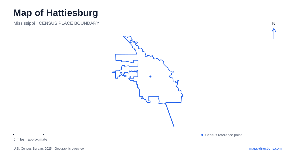
Street tiles load from OpenStreetMap when opened. The blue line shows the 2025 Census boundary.
- State
- Mississippi
- Population · July 2025
- 48,802
- Land area
- 53.4 sq mi
- Water area
- 1.0 sq mi
Hattiesburg can be understood through several connected public landscapes: the historic railway district, East Sixth Street’s museum setting, the Southern Miss campus, and the recreation corridor of the Longleaf Trace. Hardy Street and the numbered avenues provide another set of familiar references around Kamper Park. Together, these places show how transport, education, military service, and public recreation have shaped the city beyond any single downtown landmark.
The depot and its newer civic name
The railway depot at 308 Newman Street was built in 1910. Today the city identifies the building as the J. Ed Morgan Intermodal Center, following a naming decision in 2023. Its position in the Newman-Buschman Historic District connects the substantial station building with one of the oldest parts of the community.
The city describes an Italian Renaissance building with a grand hall and community space used for events. This public role adds another layer to its railway identity. Someone attending a reception may encounter the same building under a civic facility name that differs from a traveler’s familiar depot reference.
The naming distinction is useful on a Hattiesburg map because it prevents two labels from being mistaken for separate destinations. The building also provides a concrete starting point for understanding how the railway shaped the surrounding neighborhood rather than treating local history as something confined to a museum display.
East Sixth Street and Black military history
The African American Military History Museum occupies the historic USO building at 305 East Sixth Street. The USO opened the center in March 1942 for Black service members, many stationed at nearby Camp Shelby, during the era of segregation. It offered recreation and social support in a setting where military service did not protect people from discrimination outside the building.
The surviving structure makes that history spatially specific. It was a place of gathering and support before becoming a museum interpreting military service. Its current collections and educational work extend beyond one wartime moment, while the original building remains part of the evidence visitors encounter.
A municipal project opened in January 2021 connects the Longleaf Trace with the East Sixth Street museum district and the Historic Mobile-Bouie neighborhood. The landscaped pathway follows an old rail bed between East Fourth and East Sixth streets. That connection gives the museum setting a relationship with the city’s recreation network as well as with its historical street pattern.
Southern Miss as a district of its own
The University of Southern Mississippi’s main campus occupies roughly a square mile and retains five original buildings from 1912. The Lucas Administration Building, widely recognized by its dome, is one orientation point among plazas, shaded promenades, and academic facilities. A campus visit therefore benefits from identifying the particular building or landscape rather than treating the university’s general address as the final destination.
The All-American Rose Garden near the main entrance offers a smaller-scale landmark. Planting began in 1973, dedication followed in 1974, and public-garden accreditation came in 1975. Its semicircular arrangement contains separate beds, with varieties identified for visitors. The garden has also undergone recovery from severe weather, including the 2013 tornado.
For Hattiesburg, the garden represents cooperation between local rose enthusiasts and the university. It is both a horticultural collection and a familiar setting for student photographs, connecting the campus’s institutional role with everyday public experience.
Kamper Park within the Avenues
John Kamper donated the forty-acre park in 1908 for local children to enjoy. The zoo opened on part of the grounds in 1950, so the park’s public history predates the animal collection. Its setting is bounded by Hardy Street, Park Avenue, Seventeenth Avenue, and Camp Street within the area known as the Avenues.
The zoo and the wider park should remain distinct on an itinerary. A general park visit does not mean every attraction within it shares the same entrance or operating arrangements. The zoo’s carousel adds another layer of reuse: the operator identifies it as a 1941 British-made ride that moved from outside the zoo to its present location in 2013 after refurbishment.
A regional trail with local branches
The Longleaf Trace is a forty-four-mile rail-trail connecting the city with communities including Sumrall, Bassfield, Carson, and Prentiss. Its paved corridor supports longer journeys, while local spurs bring it into contact with parks and cultural destinations. The operator identifies a gateway near Southern Miss, but the network’s urban connections extend the usefulness of the trail beyond that single starting point.
Within Hattiesburg, the Trace can be read as a link between neighborhood destinations as well as a regional recreation route. The depot, USO museum, university gardens, and Kamper grounds each retain their own history. A map of Hattiesburg becomes clearer when those individual places are understood alongside the transport corridors that connect them.
Map and statistics: U.S. Census Bureau, 2025 Gazetteer, January 2025 generalized place boundaries and Vintage 2025 population estimates. Local references: City of Hattiesburg; Museum operator; United Service Organizations; University of Southern Mississippi; Hattiesburg Zoo; Pearl and Leaf Rivers Rails-to-Trails Recreational District. Article prepared by Maps & Directions.