Map of Harrisonburg
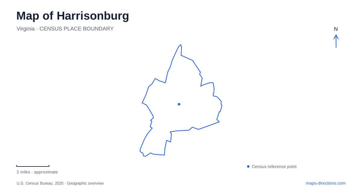
Street tiles load from OpenStreetMap when opened. The blue line shows the 2025 Census boundary.
- State
- Virginia
- Population · July 2025
- 50,839
- Land area
- 17.3 sq mi
- Water area
- 0.1 sq mi
Harrisonburg is easiest to understand by placing Court Square, the university landscape, and the western park network on the same map. The courthouse identifies the historic civic center. James Madison University's arboretum introduces woodland along University Boulevard. Hillandale Park and the Friendly City Trail reveal a different set of connections between schools, recreation grounds, and neighborhoods. Each setting contributes something that a map focused only on Interstate 81 or a single campus address would miss.
Court Square grew around water
Thomas and Sarah Harrison gave land around the Big Spring for public use in 1779, and the town received its name the following year. Court Square developed on that donated ground. The springhouse remains a recognizable feature at the square's southwestern corner, a reminder that access to water helped establish the gathering place before today's surrounding streets and commercial buildings took shape.
The present Rockingham County Courthouse was completed in 1897 to a design by T.J. Collins. Its Indiana limestone, red tiled roof, green dome, and Justice statue provide visible orientation within the downtown district. The building dates from after the Civil War; accounts of prisoners held at the courthouse in 1862 concern the earlier courthouse and its grounds. Keeping the site and the present structure's chronology separate makes the history easier to read accurately.
A map of Harrisonburg centered on Court Square can then expand outward through buildings associated with trade. Their uses and construction explain why the downtown fabric includes more than offices surrounding a government building.
The commercial city beyond the courthouse
The City Produce Exchange began construction in 1911 beside the Southern and Chesapeake-Western railway tracks. Ice making and cold storage supported the region's egg and poultry businesses, with rail access allowing products to reach wider markets. Its position demonstrates how industrial handling and agricultural commerce shaped the town just as much as the courthouse did.
Another downtown landmark, the Denton Building, originated as a furniture store built in 1921. Apartments were introduced on upper floors in 1932. That combination of commerce below and residences above helps explain the continued usefulness of substantial older downtown buildings. Looking at their scale and relationship to the street adds another layer to a walk between destinations.
The former federal post office, completed in 1939, later became a federal courthouse. Its six-column facade marks a different period of public architecture from the county courthouse. Together, these buildings give downtown Harrisonburg a sequence of civic, retail, and industrial places rather than a single historical scene frozen at one date.
A woodland classroom on University Boulevard
The Edith J. Carrier Arboretum occupies a wooded setting at 780 University Boulevard. Botany professor Norlyn Bodkin and other science faculty used the College Woods for teaching from 1964, well before the landscaped arboretum took its later form. Naming the grounds for Edith J. Carrier recognized her service to the university community.
The educational history remains visible in how the site is used: paths, gardens, trees, and a pond provide subjects for close observation rather than merely a scenic edge to campus. The Frances Plecker Education Center gives the grounds a named indoor reference point. The Family Garden and John Clayton Trail provide more detailed anchors for someone exploring the outdoor landscape.
Use the university's arboretum arrival guidance to identify parking and the approach from University Boulevard. Visitors should use its current arrival information rather than assume an old campus route still works unchanged. For Harrisonburg, the arboretum provides a public woodland destination within the university setting, distinct from the downtown street walk.
Two trail systems with different purposes
Hillandale Park lies off Route 42 on Hillandale Avenue. The Friendly City Trail passes through it, connecting school and park destinations alongside Heritage Oaks Golf Course. This hard-surfaced route links the high school and Bluestone Elementary area with Thomas Harrison Middle School and Westover Park. It is a cross-neighborhood connection, not simply a circuit around one recreation field.
The Rocktown Trails at Hillandale offer stacked shared-use loops with different difficulty levels. Vehicle access is available within the park across from Shelter 11. The South Avenue and South Dogwood Drive access is for pedestrians and cyclists, with no vehicle parking. That arrangement allows nearby neighborhoods to meet the trail system without turning every trail entrance into a parking area.
Farther across the city, the Bluestone Trail connects the university with Stone Spring Road through Purcell Park and intervening neighborhoods. It includes a short on-street connection and appreciable grades. These routes make Harrisonburg's map more informative when shown separately: downtown walking, campus woodland, neighborhood transportation, and technical trail recreation each follow their own local geography.
Map and statistics: U.S. Census Bureau, 2025 Gazetteer, January 2025 generalized place boundaries and Vintage 2025 population estimates. Local references: Harrisonburg Tourism; James Madison University; City of Harrisonburg. Article prepared by Maps & Directions.