Map of Greenville
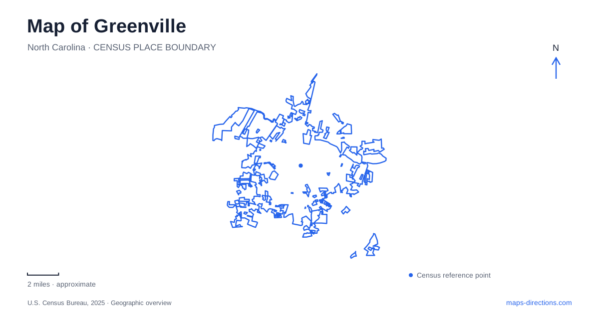
Street tiles load from OpenStreetMap when opened. The blue line shows the 2025 Census boundary.
- State
- North Carolina
- Population · July 2025
- 96,443
- Land area
- 38.3 sq mi
- Water area
- 0.8 sq mi
Greenville's central geography begins with the Tar River, but the city is more than a riverfront university district. Town Common links the urban core to the water, greenways follow both the river and a tributary, and East Carolina University's facilities occupy distinct campuses. Across the river, River Park North offers ponds and nature trails on a much larger property. These relationships provide a useful framework for deciding where a visit should begin.
Town Common connects the center with the river
Town Common stands at 105 East First Street, between the central business district and the Tar River. Its roughly twenty acres include an amphitheater, inclusive playground, and riverfront walking space. First Street is therefore a useful reference for the transition from downtown blocks to a public landscape beside the water.
The waterfront's redevelopment history includes a construction contract awarded in May 2025 to replace the aging bulkhead and redesign the esplanade. Project drawings describe an elevated boardwalk, terraced seating and access to a floating dock. Those features occupy different levels along the water, while parking and playground facilities have their own entrances. Use the city's park information to identify usable facilities rather than reading a design illustration as a complete visitor itinerary.
Those distinctions matter when reading a map of Greenville during the project. Town Common remains a major central place, but an older image of the full riverfront walkway may not represent the available route. Planned improvements should also remain identified as a project until completion is confirmed.
Sycamore Hill gives the open space historical depth
At First and Greene streets, Sycamore Hill Gateway Plaza commemorates an African American community that once occupied the area. Its neighborhood extended between the Tar River and Fourth Street, and from Greene Street east toward Reade Street. Houses, businesses, and the church formed a closely connected district before urban renewal displaced residents.
The congregation's history began with meetings in the home of Ruth Armond on North Greene Street. In 1865, members publicly established the church that became Sycamore Hill Missionary Baptist Church. The memorial marks its former site and recognizes the broader community rather than treating the riverfront as land without a previous social history.
This adds an important layer to a walk through the park. The open lawn and waterfront facilities are the present landscape; the memorial explains an earlier one. A visitor can use the same street names to understand both, locating the former neighborhood within today's downtown map.
Two greenway names describe a changing route
The South Tar River Greenway links Thomas Foreman Park, Town Common, the off-leash dog park, and Green Springs Park. Near Green Springs, the route connects with the Green Mill Run Greenway. The change in name reflects a shift from the main river corridor toward the tributary landscape and other city destinations.
For Greenville walkers and cyclists, these connections create alternatives to an outing confined to the waterfront. The city map distinguishes established greenways, primitive trails, and future connectors. That legend matters: a line representing a future connection is not equivalent to an existing paved route.
Green Springs Park and the university area help orient the inland portion of the network. A route can therefore be planned around the river, a park-to-park segment, or a connection toward campus. Each uses the same wider system but emphasizes a different part of the city.
University and science destinations occupy separate areas
East Carolina University distinguishes its Main Campus from its Health Sciences Campus. The university's published location information places main-campus facilities along the East Fifth Street area, while health-sciences destinations use addresses around Moye Boulevard and Campus Loop. A department or building name is more useful than the university name alone when choosing between those areas.
A separate science destination is the North Carolina Museum of Natural Sciences' local branch at 226 West Eighth Street. Its exhibits and educational programs serve northeastern North Carolina. It should not be confused with the museum's Contentnea Creek outdoor learning center in Grifton, which occupies a different community and landscape.
North of the river, ponds shape the park
River Park North at 1000 Mumford Road offers Greenville a substantial nature destination beyond the central riverfront. The city identifies 324 acres, five fishing ponds, trails, and a wildlife observation platform. Its Walter L. Stasavich Science and Nature Center contains a large freshwater aquarium, live animals, and interactive exhibits.
Here the outdoor experience is organized around ponds, woodland, and nature interpretation rather than downtown streets. The park's street address also places it in the Mumford Road area near the airport, providing a separate regional reference from First Street or the university campuses.
A map of Greenville becomes clearer when these districts retain their own identities: a civic riverfront with a significant community history, a connected greenway system, distinct university campuses, and a large nature park across the river. The river ties them together without making them interchangeable destinations.
Map and statistics: U.S. Census Bureau, 2025 Gazetteer, January 2025 generalized place boundaries and Vintage 2025 population estimates. Local references: City of Greenville; Visit Greenville NC; Sycamore Hill Gateway Plaza; East Carolina University; North Carolina Museum of Natural Sciences. Article prepared by Maps & Directions.