Map of Greensboro
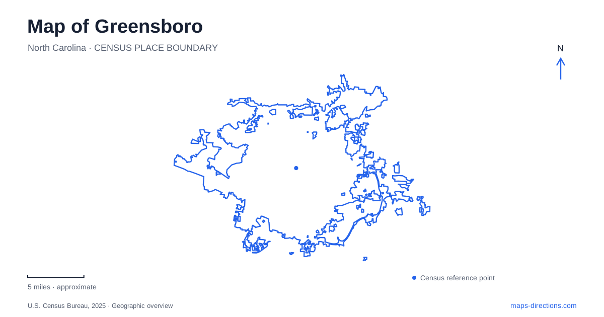
Street tiles load from OpenStreetMap when opened. The blue line shows the 2025 Census boundary.
- State
- North Carolina
- Population · July 2025
- 308,667
- Land area
- 134.7 sq mi
- Water area
- 5.2 sq mi
Greensboro's public landmarks span very different scales of history and landscape. A downtown lunch counter connects one building with a national civil rights movement, while a preserved battlefield uses roads and wooded terrain to explain an eighteenth-century military encounter. Gardens and reservoirs add another layer, showing how public recreation fits within cultivated landscapes and working water infrastructure. A useful map keeps these settings in view together without reducing the city to either its downtown or its outdoor destinations.
A downtown address with national significance
The International Civil Rights Center & Museum stands at 134 South Elm Street, preserving the original Woolworth lunch counter in its historic location. On February 1, 1960, four freshmen from North Carolina Agricultural & Technical College sat at the whites-only counter. David Richmond, Frank McCain, Ezell Blair Jr., and Joseph McNeil challenged segregation through nonviolent direct action.
The museum places that specific event within a broader account of the struggle for civil rights. Its location matters because visitors encounter the place where the action occurred, rather than only a reconstruction elsewhere. The surviving counter connects a national story with an ordinary commercial setting in the central street grid.
For a map of Greensboro, South Elm Street therefore carries more than a shopping or dining function. It identifies a site where students changed the meaning of a public commercial space. Understanding the building's historical role makes the surrounding downtown geography part of the story rather than merely the route used to reach it.
A greenway around the center
The Downtown Greenway forms a four-mile loop around the heart of the city. Its completed circuit connects neighborhoods and public spaces with landscaped walking and cycling infrastructure. Public art is an important part of the route, giving individual corners and gathering places a community identity.
The city's access information identifies Morehead Park on Spring Garden Street and Five Points at Eugene and Bragg streets as trailhead locations. These points help place the loop within the street network. Rather than running through the middle of one park, the greenway links multiple edges of downtown and connects with the life of nearby neighborhoods.
This pattern adds an alternative way to understand central Greensboro. Streets usually organize a trip around an address; the greenway organizes movement around a continuous circuit. Its landscaped buffers, benches, bicycle facilities, and public artworks make that circulation route a public space in its own right.
Terrain explains the Revolutionary War battlefield
Guilford Courthouse National Military Park preserves the setting of the March 15, 1781 battle between forces led by Nathanael Greene and Lord Cornwallis. The National Park Service emphasizes the terrain, woods, and hills that shaped Greene's defense in depth. The landscape is therefore essential evidence for understanding the battle, not simply a backdrop for monuments.
The paved Tour Road makes a 2.25-mile loop with eight interpretive stops. Footpaths and Historic New Garden Road offer additional ways to explore the battlefield's interior. The layout allows visitors to connect individual memorials and interpretive panels with the ground over which the fighting unfolded.
A battlefield visit involves a different reading of a Greensboro map from a downtown walk. Distances between positions, changes in terrain, and the relationship between wooded areas and routes become the important features. The park's loop and internal paths provide a framework for examining those relationships at a human scale.
A cultivated garden on Hobbs Road
Tanger Bicentennial Garden occupies 7.5 acres at 1105 Hobbs Road. Paved paths connect planted areas, public art, a gazebo, and a sensory garden. The Old Mill feature represents the kind of grain-milling structure associated with the area's earlier farming landscape; it is a replica, rather than an intact original mill.
Adjacent David Caldwell Historic Park adds a further historical connection. The gardens and historic grounds combine ornamental planting with interpretation of local land use, creating a setting distinct from the battlefield's larger wooded landscape. Hobbs Road provides a precise reference for this garden complex within the broader urban area.
Reservoirs shape the northern landscape
Lake Higgins, Lake Brandt, and Lake Townsend supply surface water from a protected watershed in northern Guilford County, within the upper Cape Fear River Basin. Lake Higgins can replenish Lake Brandt, while treatment plants process water from Brandt and Townsend. Their connection is functional as well as geographical.
The lakes also support recreation. Brandt has trails and boating facilities, while Townsend lies beside Bryan Park and accommodates sailing activities. These uses coexist with the reservoirs' water-supply role. Including them on a Greensboro map reveals a northern landscape where recreation depends on the management of shared water resources, complementing the city's downtown history, connected greenway, gardens, and preserved battlefield.
Map and statistics: U.S. Census Bureau, 2025 Gazetteer, January 2025 generalized place boundaries and Vintage 2025 population estimates. Local references: International Civil Rights Center and Museum; Downtown Greenway; City of Greensboro; National Park Service. Article prepared by Maps & Directions.