Map of Greenacres
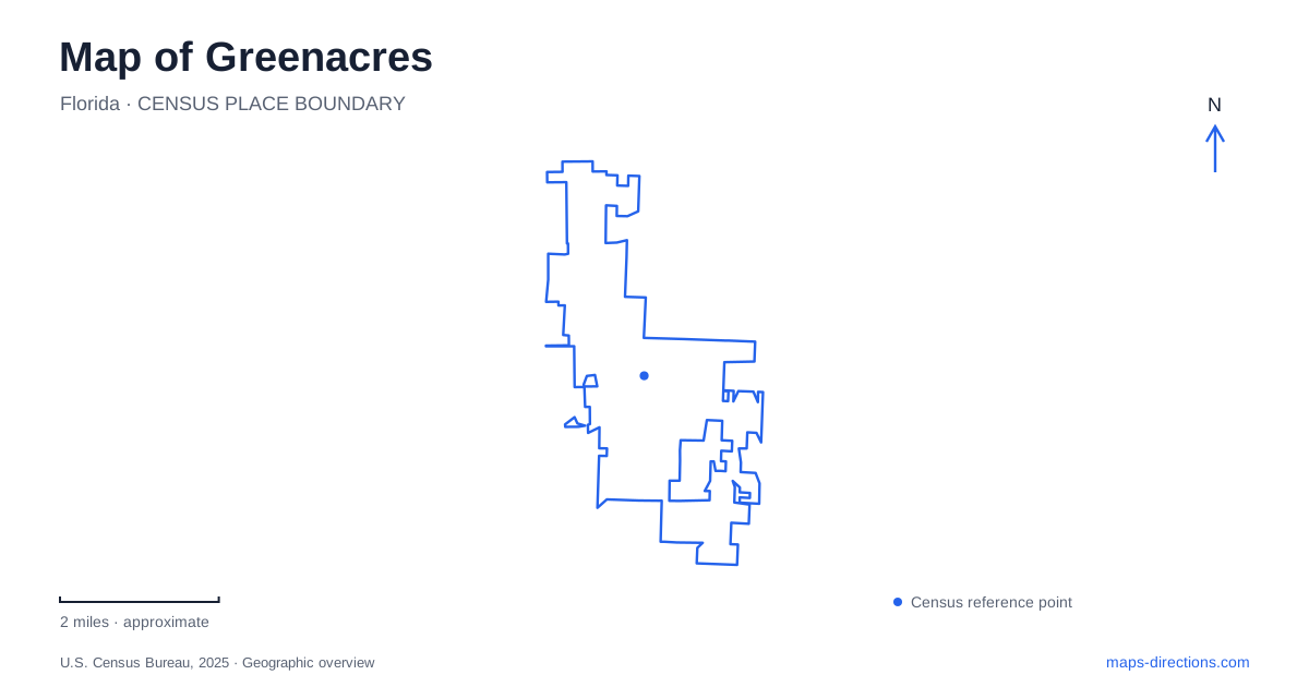
Street tiles load from OpenStreetMap when opened. The blue line shows the 2025 Census boundary.
- State
- Florida
- Population · July 2025
- 44,736
- Land area
- 6.1 sq mi
- Water area
- 0.0 sq mi
Greenacres began with a deliberate effort to create housing for people outside the coastal resort economy. That origin remains visible in the Original Section, a compact street grid west of Military Trail. The city's later geography extends beyond that early neighborhood to larger roads, recreation complexes, and paths near county parkland. Looking at both the original blocks and the newer outdoor destinations reveals a community with several distinct scales of public space.
The Original Section preserves the early plan
Lawrence Carter Swain began assembling property in 1923 after moving from Massachusetts. The city describes his aim as providing a community for middle-class households at a time when affluent coastal developments attracted much of the region's attention. One part of his holdings, Plat II, lay about half a mile west of Military Trail and became the Original Section. Municipal incorporation followed in 1926.
The Urban Land Institute's local study reproduces the early plat, showing evenly arranged parcels and streets including Perry, Jennings, and Broward. Those names refer to former Florida governors, although the study does not establish why that naming theme was selected. Space for public use was included within the development rather than added only after the neighborhood filled in.
For Greenacres, the grid is a useful historical document in its own right. Individual properties have changed, but the repeating blocks reveal the original method of laying out the community. The plan also helps explain why the neighborhood's public spaces and civic buildings form a close grouping rather than a set of unrelated destinations scattered along major roads.
Perry Avenue and Swain Boulevard form a community cluster
Ira Van Bullock Park is at 520 Perry Avenue, while the Community Center uses 501 Swain Boulevard. The park's facilities include a multipurpose field, basketball courts, playground space, and picnic areas. The institute's study identifies the park and nearby community facilities as continuing uses of the land originally set aside for the public.
This gives the area a particular significance within Greenacres. Its open space represents continuity of purpose even where buildings and recreation facilities have evolved. The original planners reserved land for collective use, and the neighborhood still contains places for gathering and activity. A detailed map of Perry Avenue and Swain Boulevard therefore shows more than convenient addresses: it helps reveal the relationship between residential blocks and the public land embedded within them.
The compact grouping also differs from a large destination park. Activities are distributed among a park and community buildings with separate entrances and programs. The neighborhood setting remains part of the experience, rather than merely the route used to reach a standalone recreation complex.
Pinehurst Drive serves a larger sports setting
Freedom Park occupies just over fifty-one acres at 2400 Pinehurst Drive. Its facilities include lighted soccer fields, sand soccer and volleyball courts, pickleball, a jogging path, and exercise space. A StoryWalk and playground add uses beyond organized sport.
The variety makes this a different type of Greenacres public space from the Original Section's civic cluster. Large playing areas require broad open ground, while paths and smaller activity zones allow several uses around them. On a park map, the field arrangement matters as much as the street address. A team gathering, a pavilion meeting, and an independent walk can all occur within the same park but occupy different portions of it. The landscape is structured for simultaneous activities rather than a single central feature.
Jog Road and the paths toward county parkland
Samuel J. Ferreri Community Park is at 2905 Jog Road. City planning documents identify it as an important public gathering place, and the local pedestrian network includes the Ferreri Park and Dillman shared-use paths. Those routes bring users near the county's Okeeheelee Park, north of Forest Hill Boulevard.
The distinction between road corridors and shared-use paths is useful here. Jog Road and Forest Hill Boulevard organize larger-scale movement, while the paths offer their own routes through the area. A planning map can show both existing paths and proposed improvements, so the current path network should be read separately from future connections. The relationship is nonetheless clear: local recreation spaces sit near a much larger county outdoor destination.
Pine flatwoods offer another kind of outing
Okeeheelee Nature Center uses the Forest Hill Boulevard entrance at 7715. The county describes ninety acres of native pine flatwoods and wetlands, with both paved and softer-surface nature trails. That setting emphasizes habitat observation rather than the field sports offered at Freedom Park.
For a Greenacres visit, comparing these places produces a more useful choice than simply selecting the nearest green area. The Original Section offers neighborhood history, Pinehurst Drive supports active recreation, and the county nature center introduces native habitats. Their differences reflect the city's development from a planned residential grid into part of a broader network of communities and public landscapes.
Map and statistics: U.S. Census Bureau, 2025 Gazetteer, January 2025 generalized place boundaries and Vintage 2025 population estimates. Local references: City of Greenacres; Urban Land Institute; Palm Beach County. Article prepared by Maps & Directions.