Map of Grants Pass
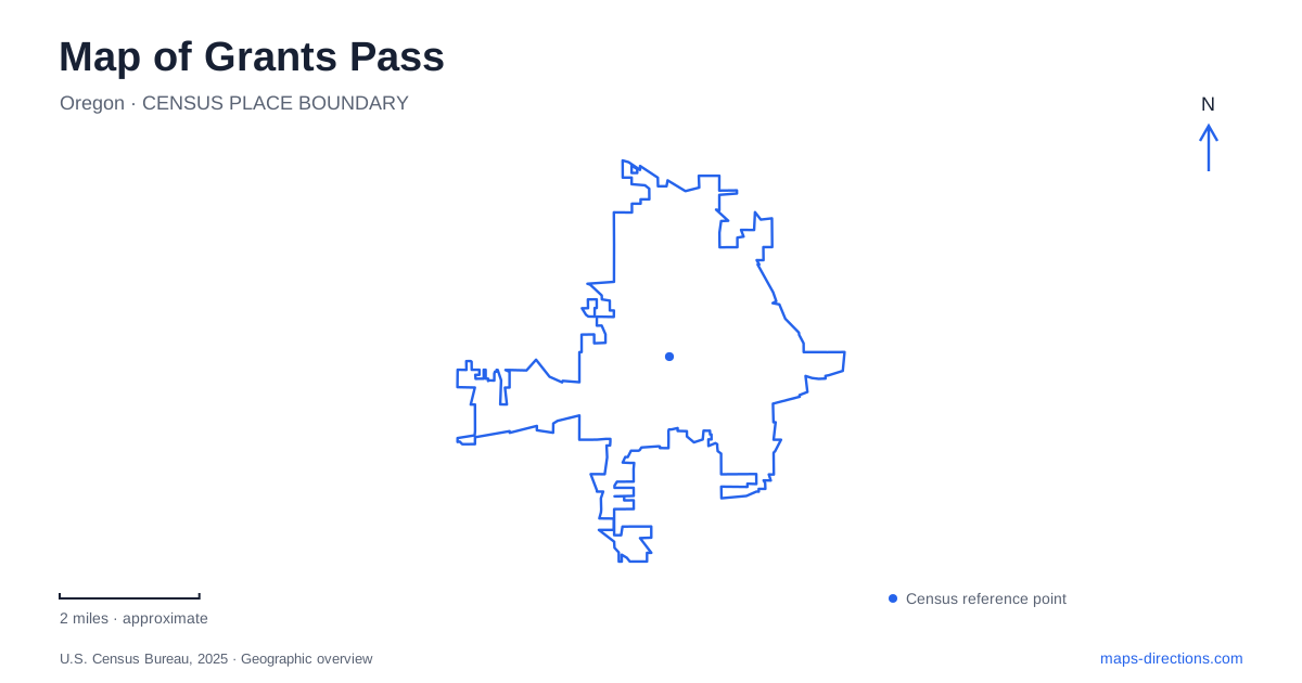
Street tiles load from OpenStreetMap when opened. The blue line shows the 2025 Census boundary.
- State
- Oregon
- Population · July 2025
- 39,239
- Land area
- 11.5 sq mi
- Water area
- 0.2 sq mi
Grants Pass combines a compact historic center with a recreation landscape organized around the Rogue River and nearby wooded hills. The river is a strong visual reference, but it also separates destinations that can look deceptively close on a map. Road bridges and a park footbridge serve different journeys. Beyond the urban streets, Cathedral Hills introduces another network, where named trailheads and connected loops matter more than a general address for the surrounding community.
Railway growth and an older street pattern
The settlement served as a stagecoach stop in the 1860s and became a railhead when the Oregon-California Railroad arrived in 1884. Its name commemorates Ulysses S. Grant's victory at Vicksburg. The transport history helps explain why the older town center and the later highway approaches have different spatial roles.
The city's historic-landmark program recognizes commercial and residential buildings as well as structures and landscapes such as Caveman Bridge and Riverside Park. Preservation here therefore extends beyond individual shopfronts. A river crossing, a park, and a house can each explain a different phase of development. In Grants Pass, the historic map is most useful when these places are considered together: transport supported commercial growth, residents built homes near the center, and public recreation subsequently developed along the river.
A family house and its neighboring research office
The Schmidt House Museum is at 508 Southwest Fifth Street. Claus Schmidt, who operated a grocery business in the late nineteenth century, built the house with his family. Only members of that family lived there before daughters Anna and Flora deeded it to the historical society in 1978.
The house contains original pieces and fixtures alongside other local historical material. Guided visits begin with check-in at the society's office next door, at Fifth and K streets, rather than by treating the house as an unstaffed exhibit. The office and research library have their own role within the property. This small distinction between the preserved home and the adjoining administrative building is helpful when matching addresses to a planned visit. The site offers a domestic perspective on the community's past, complementing the larger commercial and transport landmarks nearby.
Caveman Bridge and the riverfront
Caveman Bridge carries the southbound Highway 99 route across the Rogue River at the southern side of downtown. The concrete arch structure was designed by Conde McCullough, whose bridge work is an important part of Oregon's transport history. Riverside Park occupies ground around its southern end, making the bridge both infrastructure and a prominent element in the park landscape.
For a map of Grants Pass, the crossing explains more than a route over water. It links the older center with southern approaches while creating a recognizable riverfront scene. The city's scenic-resources study treats the bridge and surrounding views as a resource in their own right. The direction carried by the bridge matters when interpreting a road route; proximity to the riverbank alone does not describe how to cross or return by vehicle.
A separate crossing between two parks
Reinhart Volunteer Park, also known as All-Sports Park, is at 1690 Southwest Webster Road. It was built largely through volunteer effort and contains facilities for numerous sports alongside ponds, walking paths, and picnic shelters. Its identity comes from that combination of organized recreation and community participation.
A pedestrian bridge connects it with Tussing Park across the Rogue. This is a different crossing from the highway bridge near downtown, and it creates a useful relationship between public spaces on opposite banks. The city closes the footbridge overnight, with different seasonal schedules. It should therefore be understood as a managed park connection rather than an unrestricted road link. In Grants Pass, choosing the river crossing is part of choosing the activity: a drive through town, a walk between parks, and access to a sports field are distinct trips.
Cathedral Hills is a network of loops
Cathedral Hills contains about ten miles of trails across wooded BLM land. Douglas-fir and ponderosa pine form part of the setting, with routes used by walkers, runners, mountain bikers, and equestrians. Espey, Sky Crest, and Walker are separate trailheads with different approaches and parking arrangements.
The network allows outings of different lengths, but the entry point still matters. A BLM administrative-office address does not identify a trailhead, and the three entrances should not be treated as substitutes without considering the intended loop. Fuels management can affect individual trail sections, so consult BLM's recreation guidance for the chosen entrance and loop. Brush cutting and pile burning are land-management activities, not indications that an entire recreation area has the same access conditions.
The combination of urban history, river recreation, and working woodland makes Grants Pass more varied than a single scenic-road stop. Reading each setting at its appropriate scale keeps the historic center, park crossings, and hill trails connected in the larger picture while preserving the practical differences between them.
Map and statistics: U.S. Census Bureau, 2025 Gazetteer, January 2025 generalized place boundaries and Vintage 2025 population estimates. Local references: City of Grants Pass; Josephine County Historical Society; Bureau of Land Management. Article prepared by Maps & Directions.