Map of Grand Island
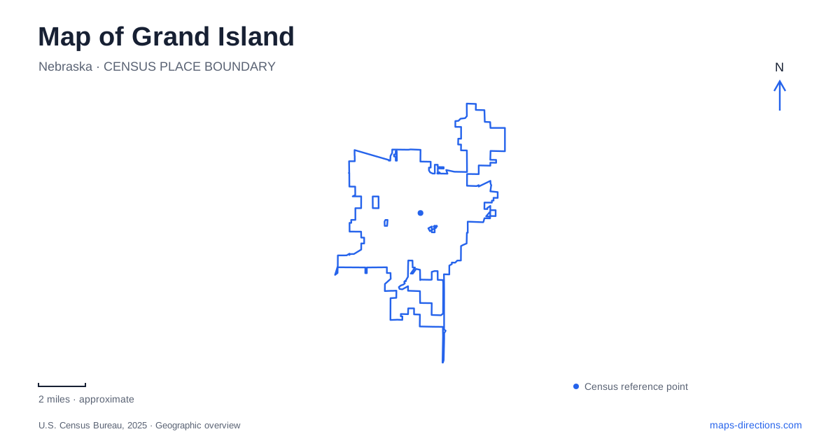
Street tiles load from OpenStreetMap when opened. The blue line shows the 2025 Census boundary.
- State
- Nebraska
- Population · July 2025
- 53,943
- Land area
- 30.3 sq mi
- Water area
- 0.2 sq mi
Grand Island takes its name from a former island between channels of the Platte River, not from a modern downtown surrounded by water. The city and the river landscape should therefore be read at different scales. Railside contains the historic commercial district; highways reach museum and fairground destinations; and the river's recreation areas lie farther south and west. That distinction is particularly useful for visitors combining an urban stay with spring wildlife viewing, since the most recognizable regional attractions are spread across several communities.
Railside expresses the railway city's origins
The historic downtown district is known as Railside. Its name reflects a working transportation landscape rather than a decorative theme applied to an unrelated neighborhood. Railways played a major role in the city's nineteenth-century growth, with Union Pacific developing shops and a roundhouse and another railway arriving in the early 1870s. The local tourism history places rail development alongside the earlier settlement by German-speaking immigrants in 1857.
Third Street is a useful reference for exploring central Grand Island. Official walking tours divide the historic district into eastern and western portions, drawing attention to places such as the Hall County Courthouse and the Liederkranz German club. Railside Plaza at 304 West Third Street serves as a gathering space for summer concerts. Together, these landmarks reveal the district as a collection of civic, social, and commercial places, rather than simply a row of stores beside railway tracks.
The western retail corridor has a different form. Known locally as Merchandise Mile, it follows Highway 281 and contains larger shopping centers, restaurants, and national retailers. Its highway orientation contrasts with Railside's older blocks. Choosing between them is as much a choice of setting as a search for a particular kind of shop.
Stuhr Museum contains several historical landscapes
Stuhr Museum stands at 3133 West US Highway 34. Its Railroad Town recreates a prairie community of the 1890s, including a depot, school, post office, planing mill, and tradespeople's shops. The arrangement shows how transportation, education, commerce, and skilled work supported one another in a town of that period. The depot belongs to the museum interpretation; it is not a passenger station for present-day travel.
Other portions of the grounds interpret different settings. A farmstead represents rural life, while the Road Ranche complex explores settlements that supplied travelers along emigrant routes during the 1850s and 1860s. These are distinct historical environments within one museum property. The modern Stuhr Building, designed by Edward Durell Stone, adds an architectural layer quite unlike the small structures in Railroad Town.
For a Grand Island itinerary, the museum deserves its own substantial stop rather than being treated as a brief downtown exhibit. Seasonal staffing affects the living-history experience in Railroad Town, while some structures elsewhere on the grounds are intended for exterior viewing. The museum's internal map explains those differences more clearly than a single attraction symbol on a highway map.
Fonner Park is a large event destination
The Nebraska State Fair takes place at Fonner Park. Official fair information distinguishes the grounds' physical address at 700 East Stolley Park Road from the administration office at 501 East Fonner Park Road. Those roads frame different aspects of the same event complex. An office address can identify the organization without describing the best arrival point for a specific fair activity.
This is another reason to separate the city into recognizable destination areas. Railside, the museum, and the fairgrounds each support a different pattern of movement and a different kind of visit. Fairground parking and circulation are organized around the event layout, whereas the downtown district is more naturally explored through its streets and blocks.
The Platte landscape extends beyond the city
South of Grand Island, Mormon Island State Recreation Area is at 7425 South US Highway 281 near Interstate 80, with a Doniphan address. It offers camping, fishing access, marked swimming beaches, and boating on no-wake lakes. The ponds and river surroundings place it within the broader Platte landscape, even though its most obvious visitor facilities are organized around recreation lakes rather than a downtown riverwalk.
The Crane Trust Nature & Visitor Center is farther west at 9325 South Alda Road, reached from I-80's Alda exit. Its trails use footbridges to reach prairie and river habitat. Spring crane migration is seasonal, with numbers generally building in March before dispersing in early April; a year-round nature center does not imply the same bird spectacle in every month.
A complete map of Grand Island therefore joins an urban railway center with a larger river region. Railside explains the city's commercial growth, Stuhr interprets earlier communities, Fonner Park hosts major gatherings, and the Platte-area sites reveal the habitat that gives the surrounding country its distinct seasonal character.
Map and statistics: U.S. Census Bureau, 2025 Gazetteer, January 2025 generalized place boundaries and Vintage 2025 population estimates. Local references: Grand Island Tourism; Stuhr Museum; Nebraska State Fair; Nebraska Game and Parks Commission; Crane Trust. Article prepared by Maps & Directions.