Map of Goose Creek
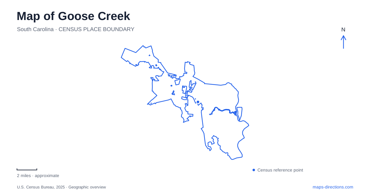
Street tiles load from OpenStreetMap when opened. The blue line shows the 2025 Census boundary.
- State
- South Carolina
- Population · July 2025
- 52,010
- Land area
- 43.5 sq mi
- Water area
- 0.5 sq mi
Goose Creek has a modern municipal history within a much older Lowcountry landscape. Incorporated in March 1961, the city expanded as farmland gave way to neighborhoods and military employment encouraged residential growth. Earlier plantation sites and a surviving colonial church belong to a different period. A useful map brings those histories into the same view while recognizing that today's parks, shopping roads, and residential districts organize most everyday journeys.
The main road junction and its branches
U.S. Highway 52 carries the local boulevard name and meets the St. James Avenue and Red Bank Road corridor. These names are important reference points because they recur in city descriptions of sidewalks, trails, and neighborhood facilities. A broad map establishes this junction first, then shows how smaller roads reach particular residential areas. This approach is more informative than treating every destination as a point scattered evenly across the municipality.
The city's trail maintenance inventory identifies paths along Westview Boulevard and between St. James Avenue and Pineview Drive. It also includes a corridor on Montague Plantation Road and Henry Brown Boulevard, from Highway 52 toward Burnt Mills Road. These are useful examples of how walking and cycling infrastructure follows named suburban roads. The network is made of identifiable sections, with the road names providing a framework for understanding where a particular path leads.
Central Creek as a gathering place
Central Creek Park, at 147 Old Moncks Corner Road, provides a concentrated recreation destination. Its all-inclusive playground sits alongside courts, a walking trail, and a stage with a lawn. The combination gives the park several uses within one property: a family outing, informal exercise, or a public gathering. It is a helpful starting point for understanding the contemporary civic landscape of Goose Creek.
The park's internal arrangement matters as much as its position on the road. Courts and play areas serve different activities, while the stage and open lawn support gatherings that use a larger shared space. For a group with mixed interests, locating these facilities together can be more useful than choosing several separate neighborhood stops. The address establishes the common destination; the park's mix of spaces shapes the visit.
Smaller parks reveal the neighborhoods
John McCants Veterans Park is on Anita Drive and combines walking trails with a veterans plaza, playground, and dog park. A food forest lies along the walking path across from the plaza. Lake Greenview Park, on East Pandora Drive, has a lake with trails and picnic facilities. These two settings add woodland and water references to the residential street pattern without requiring a trip to a regional recreation area.
Fairfax Park occupies the St. James Avenue and Fairfax Boulevard corner, while Red Bank Graffiti Park is on Red Bank Road. Their positions demonstrate how a park map can explain neighborhood geography. Some public spaces sit directly on prominent corridors; others are embedded among smaller residential streets. Looking at both kinds of setting gives a more complete picture of local outdoor life.
Crowfield's old and new landscapes
Crowfield is an especially layered part of Goose Creek. The surviving plantation-house ruins recall an agricultural landscape transformed over time into a residential golf community. The city's historical planning account records severe damage to the house in the 1886 Charleston earthquake and later timber ownership before residential development. Those changes explain why remnants of an earlier estate can appear within a map dominated by modern neighborhoods.
Crowfield Golf Club is at 300 Hamlet Circle, within the Hamlet subdivision. It is an eighteen-hole public facility, giving the area a substantial recreational destination as well as its residential identity. The golf course and historic ruins represent different periods and functions within the broader Crowfield landscape. Understanding that relationship is more useful than assuming the plantation name refers only to an intact historic house or only to a present-day development.
A colonial landmark in a twentieth-century city
Historic St. James Church predates the incorporation of Goose Creek by more than two centuries. Construction of the surviving brick building began around 1713 and was completed in 1719. National Park Service documentation describes a compact, one-story church, with stucco over its masonry. Its small physical scale contrasts with the long history represented by the site.
The church, Crowfield landscape, neighborhood parks, and trail corridors offer distinct ways to read Goose Creek. The colonial building helps establish historical depth; the residential roads reflect later growth; Central Creek Park provides a contemporary gathering place. Keeping these layers visible produces a map that explains how the community developed as well as where a visitor might spend time today.
Map and statistics: U.S. Census Bureau, 2025 Gazetteer, January 2025 generalized place boundaries and Vintage 2025 population estimates. Local references: City of Goose Creek; City of Goose Creek Recreation; National Park Service. Article prepared by Maps & Directions.