Map of Goodyear
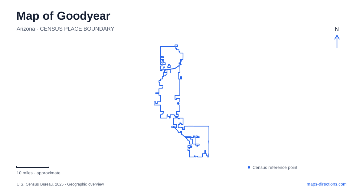
Street tiles load from OpenStreetMap when opened. The blue line shows the 2025 Census boundary.
- State
- Arizona
- Population · July 2025
- 125,359
- Land area
- 191.3 sq mi
- Water area
- 0.0 sq mi
Goodyear's map reflects several different periods of development. The older streets around Western Avenue and Litchfield Road relate to cotton and aircraft production. Civic Square represents a newer government and public-space center near McDowell Road. South of Interstate 10, the baseball complex and the approach toward Estrella Mountain Regional Park introduce further destination clusters. These places share a city name, but their street relationships and origins are quite different.
Western Avenue and the industrial town
The city's history begins with land acquired in 1917 for the tire company, when cotton was needed for aircraft tires. In 1941, construction began on an aircraft plant on land leased from the Southwest Cotton Company. Housing followed on forty acres north of Western Avenue and east of Litchfield Road. The cotton company also built a business district along the north side of Western Avenue.
These details explain why the Western–Litchfield area matters on a historical map. The streets were associated with workers' homes and everyday services as well as industrial production. Businesses faced both Western Avenue and Litchfield Road, establishing a small commercial setting around the developing community. This was an earlier urban center than the present Civic Square development.
A map of Goodyear is therefore easier to interpret when this older setting remains distinct. The industrial history is not an abstract story detached from place: it is connected to named streets and a particular arrangement of housing and businesses. Looking at those streets provides a way to understand how an agricultural undertaking grew into a town with a manufacturing role.
Civic Square and the newer public center
Civic Square was dedicated in August 2022. Its first phase combined City Hall, a two-story library, a two-acre park, an office building, and a parking garage. The project occupies a setting associated with 150th Drive between McDowell Road and Monte Vista Road. The city identifies 1900 North Civic Square as its address.
The previous City Hall was at Litchfield and Van Buren. This distinction is useful because older descriptions of the civic center may refer to that earlier location. The present square consolidates public services with a gathering space, making the park and library part of the same development rather than separate citywide destinations.
Goodyear thus has a civic geography that has moved over time. Western Avenue helps explain the early town; Litchfield and Van Buren identify an earlier municipal office location; Civic Square identifies the current purpose-built center. Keeping these stages separate prevents the word “downtown” or “city center” from implying that every public institution occupies one historic cluster.
Baseball south of Interstate 10
The ballpark is at 1933 South Ballpark Way, approximately two and a half miles south of Interstate 10 and beyond Yuma Road. Its official directions use Bullard Avenue or Estrella Parkway as approaches from the freeway. These north–south streets provide the broader orientation, while Ballpark Way and Festival Way describe the immediate stadium setting.
The home-plate plaza is on the west side at Ballpark Way and Festival Way. The right-field entrance is on Festival Way toward Wood Boulevard. The Guardians and Reds development complexes are farther south on South Wood Boulevard. These relationships reveal a baseball district with more than the main stadium: a training-field visit may have a different destination from a game inside the ballpark.
On a Goodyear map, distinguishing the stadium from the development complexes is especially useful. The team names may appear across several facilities, but the street references identify which part of the site is relevant. The freeway approach gets a visitor into the correct area; the ballpark and complex layout explains the final part of the journey.
Estrella Mountain and the meeting of rivers
Estrella Mountain Regional Park is near the meeting of the Gila and Agua Fria rivers. The county identifies its main address as 14805 West Vineyard Avenue. The park encompasses roughly 19,840 acres of desert and mountain terrain and became the county system's first regional park in 1954. Its scale is much larger than a neighborhood park or the lawn at Civic Square.
The river setting adds an important qualification to the desert landscape. County information notes seasonal wetland or riparian areas during winter and monsoon rains. The park therefore includes relationships between mountain terrain, drainage, and river-associated habitat rather than one uniform stretch of dry open ground.
Vineyard Avenue gives this landscape a specific road reference south of the developed city. A regional park visit belongs to a different map scale from a walk through Civic Square or an outing around Western Avenue. Reading those settings together shows Goodyear as a place shaped by industrial origins, a relocated civic center, a specialized sports district, and the natural geography where rivers meet the mountains.
Map and statistics: U.S. Census Bureau, 2025 Gazetteer, January 2025 generalized place boundaries and Vintage 2025 population estimates. Local references: City of Goodyear; Goodyear Ballpark; Maricopa County Parks and Recreation. Article prepared by Maps & Directions.