Map of Glendora
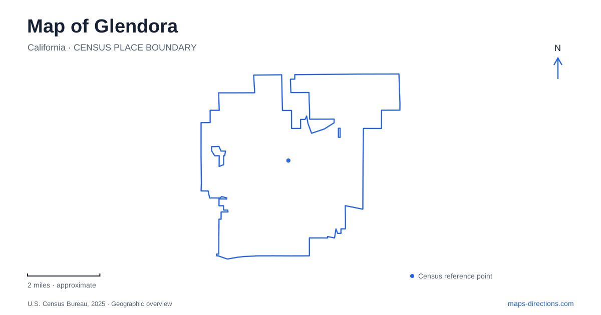
Street tiles load from OpenStreetMap when opened. The blue line shows the 2025 Census boundary.
- State
- California
- Population · July 2025
- 49,671
- Land area
- 19.5 sq mi
- Water area
- 0.2 sq mi
Glendora sits at the base of the San Gabriel Mountains, but its map contains more than a single foothill edge. The historic Village, the railway station, the northeastern canyon land, and the centrally located South Hills form separate orientation areas. Foothill Boulevard helps locate the civic center, while the A Line station lies on South Vermont Avenue. Beyond the developed blocks, two different wilderness areas offer distinct approaches to the landscape. Keeping these pieces separate makes the city's history and terrain easier to understand.
The Village and two civic buildings
The present City Hall stands at the southeast corner of Foothill Boulevard and Glendora Avenue. Built in 1921, it once accommodated a much wider collection of services than municipal offices alone, including the library, police, fire functions, and court proceedings. Its location at the edge of the Village makes it a useful anchor for the relationship between civic space and the older commercial center.
The first City Hall survives farther north on the same avenue, at number 314. Built in 1913, it also served as a jail and firehouse and is now the historical society's museum. Comparing the two buildings reveals how a small city's public functions expanded and moved. The old museum building should therefore be read as part of the civic history, not simply as a separate exhibition space added to the town later.
Citrus history and the modern rail approach
The community was founded in 1887 and incorporated in 1911. The city's account describes a citrus-producing settlement that changed substantially as residential development replaced agriculture after the middle of the twentieth century. That transition helps explain the combination of an older village core, established houses, and larger developed corridors visible today.
The Metro A Line station is at 410 South Vermont Avenue. The extension serving the eastern San Gabriel Valley opened in 2025 and connects through San Dimas and La Verne to Pomona, with the wider line continuing toward Los Angeles and Long Beach. Older material describing the station as a future Gold or L Line stop is therefore outdated. The city's commuter shuttle uses locations including the Cullen and Mountain View transit plaza and the Crowther Teen & Family Center, showing how local transport feeds into the regional rail line.
Rubel Castle as a constructed landscape
Rubel Castle offers a very different form of historical experience. The historical society describes a handmade environment of towers, stonework, salvaged objects, and unconventional construction. It is a folk-art site rather than a conventional fortified building inherited from an earlier military period. Its interest lies in the accumulated materials and the community effort that shaped them into a singular place.
The society owns and stewards the property and provides a limited schedule of volunteer-led tours. The hillside site includes steps, tunnels, gravel, and uneven ground. Those physical qualities are part of the experience and also distinguish it from a level museum gallery. A visit should be arranged around the society's tour access rather than treated as an unrestricted public park. The castle adds another layer to the city: imaginative reuse alongside the more formal civic architecture of the Village.
Big Dalton Canyon lies toward the mountains
Big Dalton Canyon Wilderness Area occupies the northeastern foothills, with the main approach from Glendora Mountain Road onto Big Dalton Canyon Road. The city identifies about 563 acres and a network of hiking and multi-use trails. Picnic and day-camp facilities are clustered within that larger natural setting, so the recreational buildings and the wider trail landscape are different parts of the same destination.
The Rowley Amphitheater area includes a picnic setting, restrooms, and a pedestrian bridge. Its development involved local volunteer work and the city's trails committee. The campground name can be misleading without that context: the city reserves group tent camping for official Scout groups and does not offer ordinary public or recreational-vehicle camping there. The canyon is primarily useful to most visitors as a trail and day-use destination.
South Hills is a separate wilderness area
South Hills occupies a more central location within the developed city. The city's trail guidance identifies access from South Hills Park on Mauna Loa Avenue and from Bonnie Cove beneath the 210 Freeway. This is a separate landscape from the northeastern canyon, even though both appear in the municipal wilderness trail system.
For an outing in Glendora, that distinction allows a clear choice between a Village and museum visit, a rail-based arrival, a castle tour, or a walk in one of the two wilderness areas. The map of Glendora becomes a record of changing land uses: citrus agriculture and civic growth in the older center, regional movement at the station, and protected terrain in two different settings. Each area contributes something specific rather than repeating the same foothill experience.
Map and statistics: U.S. Census Bureau, 2025 Gazetteer, January 2025 generalized place boundaries and Vintage 2025 population estimates. Local references: City of Glendora; LA Metro; Glendora Historical Society. Article prepared by Maps & Directions.