Map of Gilroy
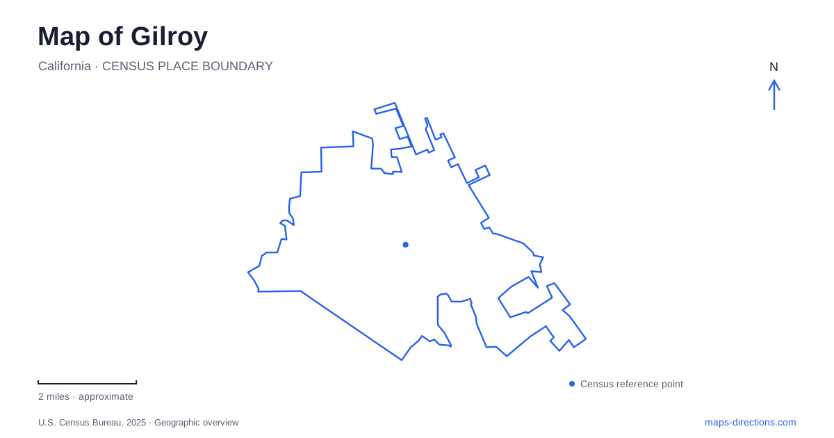
Street tiles load from OpenStreetMap when opened. The blue line shows the 2025 Census boundary.
- State
- California
- Population · July 2025
- 60,764
- Land area
- 16.6 sq mi
- Water area
- 0.0 sq mi
Gilroy sits where a historic downtown street, regional highways, and a creek-side recreation corridor create several different ways to understand the same city. Monterey Street supplies the clearest downtown reference. Uvas Creek organizes a park and trail landscape away from the commercial blocks, while Hecker Pass Highway leads west toward a different setting of gardens and surrounding hills. These features form a more useful introduction than treating the community solely as a highway stop or a collection of attractions bearing its name.
Monterey Street and the downtown blocks
The visitor bureau identifies Monterey Street as the core of the historic downtown walking area. Numbered cross streets help divide the corridor into manageable blocks, with the city's streetscape description focusing on Fourth through Eighth streets. The result is a relatively clear local pattern: follow the named main corridor, then use a cross street to locate a particular block within it.
For a map of Gilroy, this is a useful place to distinguish the historic center from the larger commercial destinations shown elsewhere. A downtown walk involves adjacent street blocks, civic and cultural landmarks, and the station area shown on the visitor map. The museum and Willey Cultural Center appear on Fifth Street, while City Hall is on Rosanna Street. Those references show that the civic district extends beyond Monterey itself.
The important relationship is between the main commercial spine and the parallel or crossing streets around it. A destination described as downtown may sit just off the principal corridor. Keeping Fifth Street and Rosanna visible provides a better picture of that district than enlarging only the line of Monterey Street businesses.
Uvas Creek and the Christmas Hill grounds
Christmas Hill Park is on Miller Avenue. Its recreation facilities include fields, picnic areas, playground space, and trails. The Ranch Site is separately identified on the other side of the address sequence, at 7049 Miller, while the main park is listed at 7050. Both belong to the broader park setting, but the distinction appears consistently in city facility information and event descriptions.
Uvas Creek gives this area its larger shape. The city's trail inventory describes a route from the Ranch Site upstream toward the Santa Teresa Boulevard bridge. That establishes a clear relationship among the recreation grounds, creek corridor, and western road crossing. A trail map here is therefore telling a different story from the downtown street map: movement follows the watercourse rather than a sequence of rectangular commercial blocks.
This is one of the most useful geographic contrasts within Gilroy. Monterey Street concentrates attention on buildings and intersections; the creek corridor draws it toward bridges, banks, and linked recreation spaces. They are both local destinations, but they call for different reference points when explaining where to go.
Miller Avenue and the creek crossing
Silva's Crossing is located at Uvas Park Drive and Miller Avenue. The city has closed this crossing after rain and directed travelers toward West Luchessa Avenue or Santa Teresa Boulevard as alternate ways across Uvas Creek. That history reveals an important physical distinction among crossings: the creek intersects the road network in places with different characteristics, rather than behaving like an invisible line beneath every street.
The practical map lesson is specific to this landscape. If a trip combines the Ranch Site, main park, and another destination across the creek, the chosen crossing is part of the route's geography. West Luchessa and Santa Teresa provide recognizable alternatives in the broader network. A past closure notice does not establish today's status, but it does explain why the low crossing deserves separate attention from the larger bridges.
Keeping all three road names visible helps make sense of a route that appears to travel away from the destination before returning toward it. The road network is responding to the creek, and the available crossings determine how that movement works.
West along Hecker Pass Highway
Gilroy Gardens is at 3050 Hecker Pass Highway, on Highway 152 west of the city center. This places the theme park on a different corridor from the Monterey Street walking district. The park's own directions distinguish the highway turn from the internal fork leading to the main parking and entrance area, reinforcing its character as a large site reached from a regional road.
The visitor map places Mount Madonna County Park and the route toward Watsonville farther west, while Highway 152 also extends east in the direction of Pacheco Pass. The highway number alone therefore does not describe which side of the city a visitor intends to explore. Hecker Pass is the useful western qualifier.
A broad view of Gilroy becomes coherent when these three settings remain visible together: downtown around Monterey and its numbered cross streets, the Uvas Creek recreation corridor, and the westward Hecker Pass approach. Each has its own landmarks and movement pattern, giving the local map more depth than a single route through town.
Map and statistics: U.S. Census Bureau, 2025 Gazetteer, January 2025 generalized place boundaries and Vintage 2025 population estimates. Local references: Visit Gilroy; City of Gilroy; Gilroy Gardens. Article prepared by Maps & Directions.