Map of Gilbert
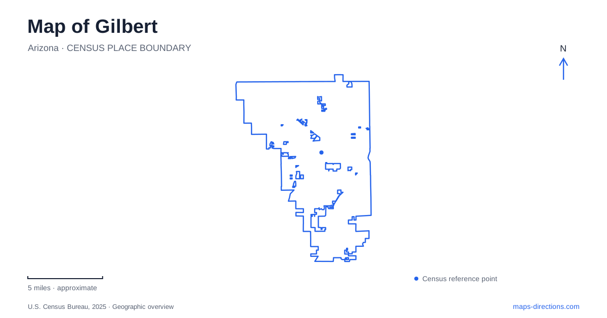
Street tiles load from OpenStreetMap when opened. The blue line shows the 2025 Census boundary.
- State
- Arizona
- Population · July 2025
- 287,285
- Land area
- 68.8 sq mi
- Water area
- 0.2 sq mi
Gilbert's public places reveal a town shaped by farming, water management and the reuse of historic buildings. The Heritage District concentrates restaurants, cultural venues and a recognizable water tower, while the Riparian Preserve at Water Ranch presents a very different setting of ponds, trails and wildlife habitat. Farther south, a large regional park occupies land associated with a flood-control basin. Together, these places make the local map more informative than a simple grid of residential streets and shopping destinations.
Agriculture behind the Heritage District
Alfalfa cultivation and later cotton and dairy farming helped shape the early community. The arrival of the Phoenix and Eastern Railroad in 1902 supported its growth and connected local production with markets beyond the immediate area. Agriculture is therefore part of the town's physical history, rather than merely a theme adopted by present-day businesses.
The Heritage District is the name used for downtown Gilbert. Historic buildings have found new roles as dining and social spaces, while murals, galleries and a theater add cultural activity. Water Tower Plaza at 45 West Page Avenue provides a particularly clear reference point, with seating and a splash pad beneath the tower. The district can be explored as a compact sequence of public spaces and reused buildings. Its modern restaurant scene is one layer in a longer story about a community whose work and identity originally depended heavily on the surrounding farmland.
A school that became a museum
HD SOUTH occupies the former elementary school at 10 South Gilbert Road, at the southern end of the Heritage District. The school opened in 1913, originally with four classrooms serving about 85 students. It closed for classroom use in 1977, and the historical museum opened in the building in 1982. The historical society purchased the property in 1985 following a donation from Otto and Edna Neely.
The building is an appropriate setting for local history because it was itself part of the community's everyday life. Museum displays cover farming, home life, schools and earlier families. Agricultural exhibits address alfalfa, cotton and dairy production, while maps show how the town's boundaries changed over time. Visitors can therefore move between the history of an individual building and the expansion of the wider settlement. The museum's position at the district's southern end also gives a walking visit a useful historical anchor beyond the central dining blocks.
Water Ranch as a working wetland landscape
The Riparian Preserve at Water Ranch is at 2757 East Guadalupe Road. Its 110 acres include seven water-reclamation ponds, a separate recreational fishing lake, paths and wildlife-viewing areas. The different bodies of water have distinct roles: the reclamation basins are part of the landscape's water-management function, while the fishing lake supports a designated recreational use.
Vegetation ranges from marshland to desert, and more than four miles of trails provide ways to observe those changes. The preserve combines habitat, education and recreation in one setting. A boardwalk, viewing blinds and an ethnobotanical garden offer different perspectives on the relationship between water, plants and wildlife. This is especially significant in a desert community, where a wetland landscape reflects both scarce natural resources and deliberate management.
The observatory adds another educational use to the site, extending interest from the ponds and their wildlife to the night sky. A visit focused on bird observation may follow a different pattern from a fishing outing or an astronomy program. The preserve's variety is best understood through these specific activities and environments, rather than by assuming that every pond or path serves the same purpose.
A regional park within a basin setting
Gilbert Regional Park is located at 3005 East Queen Creek Road, near Higley Road. The overall park site covers 272 acres. Its planning history is closely connected to the Chandler Heights Basin: part of the land belongs to the town, while a much larger portion was made available through an agreement with the county flood-control district.
The site lies south of Queen Creek Road and west of Higley Road, with Queen Creek Wash and the East Maricopa Floodway helping define its wider setting. These features explain why an expansive recreation area occupies this particular location. The park includes a lake, playground, splash pad and sports courts, but its map also records a relationship between recreation and drainage infrastructure. Concept plans contain future possibilities as well as existing facilities, so the current park information is the appropriate guide to what is available for a visit.
Reading the town through its public places
A map of Gilbert brings these different histories together. The school museum and downtown buildings describe community life and agricultural change. Water Ranch shows how reclaimed water can support habitat and outdoor education. The regional park illustrates another way public recreation shares space with water infrastructure. These connections give meaning to places that might otherwise appear as unrelated attraction symbols, and they help explain how the town has adapted its inherited landscape as it has grown.
Map and statistics: U.S. Census Bureau, 2025 Gazetteer, January 2025 generalized place boundaries and Vintage 2025 population estimates. Local references: Discover Gilbert; HD SOUTH; Gilbert Public Schools; Town of Gilbert. Article prepared by Maps & Directions.