Map of Gastonia
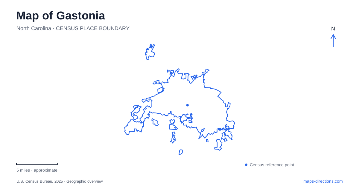
Street tiles load from OpenStreetMap when opened. The blue line shows the 2025 Census boundary.
- State
- North Carolina
- Population · July 2025
- 87,067
- Land area
- 54.8 sq mi
- Water area
- 0.2 sq mi
Gastonia began around a railroad junction, and that origin remains a useful way to understand its later textile and urban landscape. The city's history dates its early depot settlement to 1873, when intersecting rail interests and steam-powered manufacturing helped create a new center. Today, the map includes mill buildings, a civic corridor along Garrison Boulevard, creek greenways and the nearby mountain landscape to the west. These places represent different stages of growth rather than a single uniform downtown district.
Rail connections preceded the textile city
The municipal history identifies two important influences: the realignment of the Atlanta and Charlotte railway and the crossing route of the Chester and Lenoir narrow-gauge line. Their meeting helped establish the depot settlement. Steam-powered textile production then provided another reason for businesses and workers to concentrate in the area.
For Gastonia, the railway story explains why the city's industrial history belongs in its map. Transportation and manufacturing developed together, with the junction supplying a practical location for moving goods. A mill was not an isolated landmark placed randomly within a later street grid. It belonged to a network of production, transport and housing. Looking for those relationships gives more context than reading a historic building name without considering the surrounding district.
Loray Mill includes the history of labor
Loray Mill's construction in 1900–1902 marked a major expansion of the local textile industry. Its size made it an important industrial complex, but its history also includes the bitter labor conflict of 1929. Workers protested conditions and intensified production demands; the strike and associated violence included the deaths of police chief O. F. Aderholdt and worker and ballad singer Ella May Wiggins.
The mill should therefore be understood as both an industrial structure and a place associated with workers' lives. The surrounding mill-village landscape helps connect the factory with the domestic setting of the people employed there. Gastonia's textile heritage is more informative when it includes these social relationships alongside architecture. The preserved building and neighborhood do not tell a simple story of industrial achievement; they also preserve the setting of nationally significant conflict over work and organizing.
Lineberger Park links downtown to creek recreation
Lineberger Park lies about seven blocks from downtown. The city traces its creation to a land gift from the Lineberger family matched by an additional municipal purchase. That origin established a public recreation space close to the urban core rather than a distant destination outside the city.
The Avon and Catawba Creeks Greenway connects Lineberger Park with Ferguson Park over a route the city describes as approximately three miles. The creek names help explain the alignment: this is a corridor following water-related open space between established parks. A map can therefore show both the individual recreation sites and the connection between them. The greenway's value lies partly in that relationship, allowing the parks to function as pieces of a larger local network instead of disconnected green patches.
Garrison Boulevard has a concentration of civic uses
The Garrison LEARNS corridor brings together the Schiele Museum, Grier Middle School, the main county library, Lineberger Park and a greenway trailhead. The city's transportation project uses these existing institutions as anchors for planned improvements to walking, cycling and other connections. The project description is a statement of intended work, so it should not be read as proof that every proposed street improvement is already complete.
This concentration gives Gastonia a civic landscape distinct from its mill district. Education, recreation and natural-history interpretation sit along the same broader corridor. Their proximity is part of the reason transportation connections matter here: the destinations already exist, while the ways people move among them can continue to change.
The Schiele's outdoor exhibits add another scale
The Schiele Museum's nature trail covers about seven-tenths of a mile through pine and mixed-hardwood forest, pond and stream environments characteristic of the Piedmont. Its outdoor grounds also include interpretive installations such as the Catawba Village, which presents different periods of Indigenous history through reconstructed building types and educational exhibits.
These features should be read as museum interpretation within an outdoor landscape, not as an untouched historic village discovered beside the trail. The museum distinguishes the trail from other outdoor exhibits and notes seasonal operation for the village. A site map is useful here because woodland paths, exhibit areas and indoor galleries serve different purposes within one institution.
Crowders Mountain belongs to the regional setting
West of the city, Crowders Mountain State Park protects striking rock outcrops and the peaks of Crowders Mountain and the Pinnacle. They rise sharply above the surrounding Piedmont, creating a regional landmark that contrasts with the lower urban landscape. The state park map identifies separate access areas, including Sparrow Springs and Linwood Road, with different trail connections.
This nearby landscape gives Gastonia a setting beyond its industrial streets. The railroad junction, mill village, connected creek parks and mountain ridges each explain a different aspect of place. Keeping them distinct produces a more useful map: one that shows how the city developed, where its public institutions cluster and how the surrounding terrain changes beyond the built-up area.
Map and statistics: U.S. Census Bureau, 2025 Gazetteer, January 2025 generalized place boundaries and Vintage 2025 population estimates. Local references: City of Gastonia; North Carolina Department of Natural and Cultural Resources; Preservation North Carolina; Schiele Museum; North Carolina State Parks. Article prepared by Maps & Directions.