Map of Gary
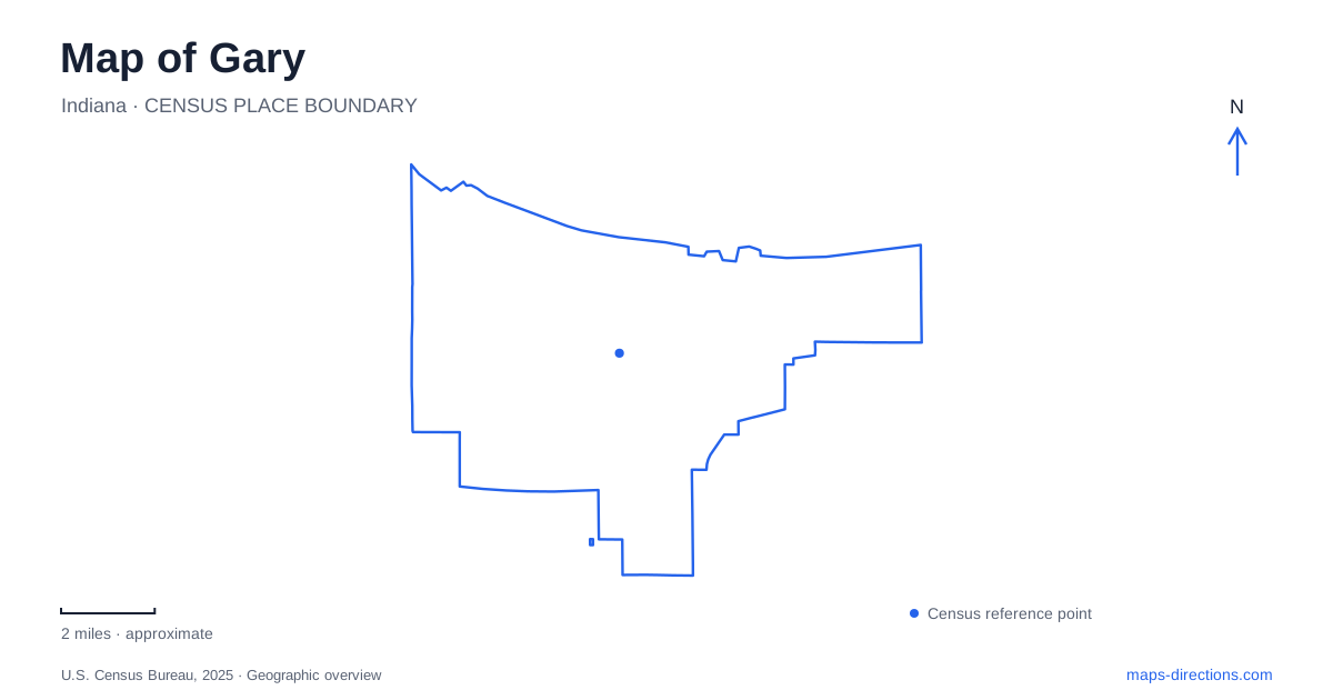
Street tiles load from OpenStreetMap when opened. The blue line shows the 2025 Census boundary.
- State
- Indiana
- Population · July 2025
- 67,289
- Land area
- 49.9 sq mi
- Water area
- 0.7 sq mi
Gary's map contains a striking contrast between a planned industrial-era civic center and the dunes, wetlands, and public beaches of its eastern lakefront. Broadway and Fourth Avenue explain one part of that landscape; Lake Street and Miller Woods explain another. The distinction matters because the city is not represented adequately by either its steel history or its shoreline alone. Both are visible in the arrangement of buildings, rail stations, parks, and preserved habitats.
Broadway gives the civic center a formal axis
The National Register nomination for the city-center historic district describes two major periods of construction: the first years after 1906 and a more ambitious building campaign in the 1920s. Earlier commercial buildings were generally smaller brick structures, while later development introduced larger buildings, more stone and architectural terra cotta, and varied revival styles. These changes help explain differences in scale along the commercial streets.
City Hall and the courthouse were constructed as a visually coordinated pair at Broadway and Fourth Avenue in 1927. Their setting formed a ceremonial entrance to the commercial corridor while emphasizing the relationship with the steelworks gate beyond the railway. For a map of Gary, this is a particularly useful historical relationship: civic architecture, commerce, rail infrastructure, and industry were deliberately aligned. The arrangement tells a story about the city's organization that survives beyond the original functions of individual storefronts.
The railway serves more than one local district
The South Shore Line lists the downtown Metro Center at 200 West Fourth Avenue and Miller station at 760 South Lake Street. These are separate arrival points for different parts of the city. The first relates to the Broadway civic and commercial landscape; the second establishes a Lake Street reference for the Miller area.
Check the operator's Metro Center station information for the exact boarding point and any replacement bus arrangements before planning a connection. The broader geographical lesson remains stable: a citywide destination name is less useful than identifying the district and station together. Gary's railway entries sit within different street patterns and should be matched with the actual destination, especially when a trip continues from a station toward the lakefront or a nature trail.
Marquette Park preserves a designed recreation landscape
Marquette Park's history includes land purchased by U.S. Steel and donated for public recreation. The bathing pavilion opened in 1922, followed by the recreation pavilion in 1924. The two buildings had different original roles, a distinction still worth retaining when reading references to the park's architecture. The former bathing building is now known as the Aquatorium.
The recreation pavilion combines Prairie School and Italian Renaissance Revival influences associated with George W. Maher's office. Around it, the lagoon and public grounds create a designed setting rather than an untouched stretch of dunes. Patterson Island, built during the Great Depression, connects the main pavilion with the picnic grounds through two historic bridges. These relationships make the interior of the park as interesting as its Lake Michigan frontage. Paths, bridges, event buildings, and the beach each occupy a particular position within the landscape.
Miller Woods changes character on the way to the lake
The Paul H. Douglas Trail begins at 100 North Lake Street and crosses several habitats within Indiana Dunes National Park. Wetlands and black oak savanna give way to open dunes and beach. The National Park Service distinguishes a shorter loop near the environmental education center from the approximately 3.4-mile beach outing.
The transition across the Grand Calumet River is especially informative. Beyond the bridge, the route enters the more exposed dune landscape before reaching Lake Michigan. This gives a walk through Miller Woods a sequence of ecological settings rather than one consistent forest environment. In Gary, the proximity of these habitats to neighborhood streets is part of the interest. The shoreline is reached through a landscape of ponds, savanna, and sand, not simply by following a paved urban promenade. The park service prohibits bicycles on this trail, distinguishing it from a general-purpose cycling connection.
The Douglas Center interprets the surrounding habitats
The Paul H. Douglas Center for Environmental Education provides exhibits, live animals, ranger-led activities, and an outdoor Nature Play Zone. It introduces the landscape through both indoor interpretation and outdoor exploration. A short visit centered on the building can therefore have a different purpose from the longer walk to the lake, even though both begin in the same vicinity.
The center is part of the national park's western area, while Marquette Park is a municipal recreation landscape in the Miller Beach community. Their adjacency does not erase their different management and physical character. Reading them alongside Broadway and the separate rail stations gives Gary a map with several distinct layers: a formal civic axis, regional transportation, historic public recreation, and surviving dune ecosystems. Each layer helps explain the others without reducing the city to a single image.
Map and statistics: U.S. Census Bureau, 2025 Gazetteer, January 2025 generalized place boundaries and Vintage 2025 population estimates. Local references: Indiana Department of Natural Resources / National Register; Northern Indiana Commuter Transportation District; City of Gary; National Park Service. Article prepared by Maps & Directions.