Map of Garner
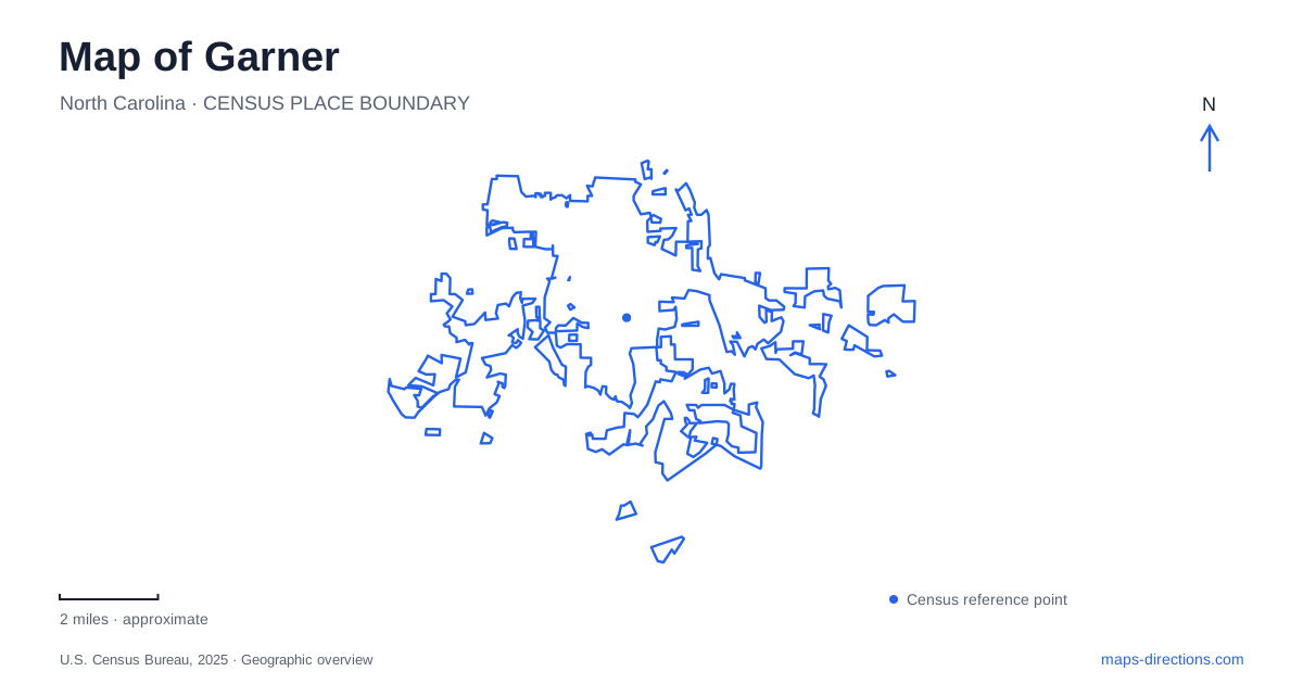
Street tiles load from OpenStreetMap when opened. The blue line shows the 2025 Census boundary.
- State
- North Carolina
- Population · July 2025
- 41,562
- Land area
- 20.7 sq mi
- Water area
- 0.0 sq mi
Garner has a historic center shaped by the railroad and a substantial park landscape around Lake Benson. These settings tell different parts of the town's story: a former rural rail stop developed into a commercial community, while schools, cultural facilities and outdoor spaces acquired new roles as the town grew. Main Street, the old school campus, Aversboro Road and Buffaloe Road are useful reference points for seeing how that history is distributed across the map.
The railroad center and the highway bypass
The North Carolina Railroad encouraged settlement in the area during the nineteenth century. Before a formal depot, a wood-and-water stop helped establish activity near the present downtown. Cotton and tobacco farming supplied an important economic background, and a post office was needed by 1878. The rail corridor therefore belongs to the town's beginnings rather than being a later addition to an already substantial urban center.
The history of Garner also includes African American landownership and business activity near the tracks. Carpenter and farmer Henry Fort purchased land on the railroad's north side in 1874 and sold portions to other Black families. In 1877, schoolteacher Allen Haywood acquired a lot on what is now Main Street. These details add a community history to the transportation line visible on the map.
US 70 was rerouted around the downtown commercial district in the early 1950s. Shopping centers and subdivisions subsequently developed around and north of the bypass. The resulting distinction between the older center and the larger highway corridor reflects a change in how people and businesses moved through the area. Downtown's scale makes more sense when understood as the product of its earlier railway and local-road setting.
A school auditorium becomes a cultural destination
The Garner Performing Arts Center occupies the auditorium of the former high school, with its entrance address at 742 West Garner Road. The historic school building also contains senior apartments in former classrooms. This combination preserves an educational landmark through two different continuing uses: housing and public performance.
The 471-seat auditorium supports theater, music, dance and other events. Its reuse gives the historic district a destination whose purpose extends beyond preserving a building's exterior. The same structure that once gathered students now brings audiences together, while the residential use sustains a daily presence elsewhere in the building.
That shared arrangement has a practical spatial consequence. Some parking serves residents rather than the performance venue, and the theater identifies additional parking near Avery Street. The former campus functions as a group of related spaces, so its architectural unity should not be mistaken for one unrestricted event parking area.
White Deer Park's educational landscape
White Deer Park, at 2400 Aversboro Road, combines outdoor recreation with conservation and nature education. The Nature Center presents live animals, mounted specimens and hands-on programs focused on North Carolina species and habitats. Trails and meadows extend that learning into the surrounding landscape.
Different shelter areas occupy distinct parts of the park. Pine and Holly shelters are near the Nature Center on the western side, while eastern shelters relate to playgrounds, meadows and the former homestead site. Those relationships give the park an internal geography beyond its single street address. A family gathering near the nature exhibits and a walk toward the meadow areas can use different portions of the same grounds.
Lake Benson Park and the memorial
Lake Benson Park is approached from 921 Buffaloe Road. Open spaces, trails, playgrounds and picnic shelters accommodate everyday visits as well as larger community events. The veterans memorial adds a place for reflection within that recreational setting, with interpretation connecting military service to the history of the nation's wars and conflicts.
The memorial was dedicated in 2013. Its position within the park means that an outdoor visit can combine broad lawns and walking routes with a more focused commemorative space. These are complementary uses of public land, but they invite different kinds of attention: the park supports movement and gathering, while the memorial asks visitors to pause and consider the people and events it interprets.
The boathouse has its own approach
Lake Benson Boathouse is down the road at 975 Buffaloe Road. It provides rentals and dock fishing during operating hours. The town prohibits launching personal watercraft on the lake and also prohibits swimming and wading. A lake on the map therefore does not imply the same recreational choices as a public beach or an unrestricted boat ramp.
The separate park and boathouse addresses help explain how access is organized. Shoreline walking, a memorial visit and a boat rental can all belong to the same lake landscape while starting at different facilities. Read together with the railroad district and reused school, these places give a map of Garner both historical depth and a clear picture of its public destinations.
Map and statistics: U.S. Census Bureau, 2025 Gazetteer, January 2025 generalized place boundaries and Vintage 2025 population estimates. Local references: Town of Garner; Greater Raleigh Convention and Visitors Bureau. Article prepared by Maps & Directions.