Map of Garland
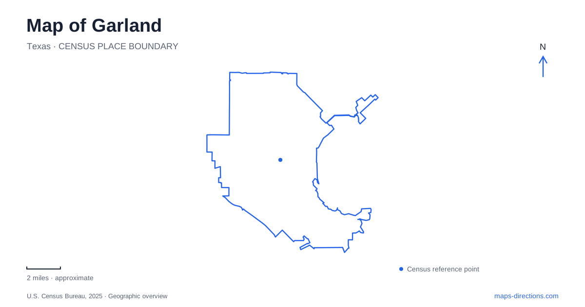
Street tiles load from OpenStreetMap when opened. The blue line shows the 2025 Census boundary.
- State
- Texas
- Population · July 2025
- 249,625
- Land area
- 56.9 sq mi
- Water area
- 0.1 sq mi
Garland's map connects three notably different landscapes: a downtown shaped by competing railroad settlements, northern creekside woodland, and a southern lakefront. The central square gives the older street network a clear focus, while trails and parks follow waterways beyond that compact center. Looking at these settings together explains why a visit can involve both short downtown walks and separate journeys to forest or lakeshore recreation. The waterways do not form one continuous visitor corridor; each has its own geography and access points.
How the square acquired its shape
The downtown story began with old Duck Creek, Embree and New Duck Creek. When railroads arrived in 1886, they bypassed the original business district. Development gathered around the depots instead, with the Santa Fe laying out Embree and other investors creating New Duck Creek nearby. Harbison Street, now State Street, became the dividing line between the competing communities.
A post-office compromise helped unite the area under the Garland name. The public square came later, after a destructive fire in November 1899 cleared the town center. Lots were acquired for an open civic space, and brick commercial buildings rose around it. That sequence makes the square more than a convenient empty block on the map: its shape records both rivalry and rebuilding.
The redesigned square reopened in October 2023 with wider sidewalks and renewed public space. At 520 West State Street, it remains an anchor for the surrounding businesses and events. Its current appearance is therefore another stage in a place repeatedly adapted to civic life, rather than a fully unchanged nineteenth-century town center.
Rail arrival at Walnut Street
Downtown Garland Station serves DART's Blue Line at 430 West Walnut Street, near Fifth Street. Its clock tower and depot-inspired details recall the railroad history of the center, while the present service links it into the metropolitan transit network. A crosswalk connects the rail station with the central bus transit facility.
DART's station diagram identifies Fourth and Fifth streets, Walnut Street and the direction of the Granville Arts Center. These are useful close-scale references for walking from the platforms into the civic and commercial blocks. The railway still supplies a major organizing line, but modern passenger access sits within a district where the square, arts venues and historic streets serve different daily purposes.
Spring Creek's older woodland
In northern Garland, Spring Creek runs through a greenbelt just south of the Bush Turnpike. The protected forest consists of several parcels within that larger corridor, with old-growth woodland, regenerating forest and prairie communities. Its varied vegetation is part of what distinguishes this area from the more open urban parks elsewhere in the city.
Holford Road provides two important access references: the Park Preserve is at 1787, while the Forest Preserve and Greenbelt are at 1770. The tourism bureau lists both paved and natural-surface trails in these areas. Additional approaches at Winters Park on Spring Creek Drive and Halff Park on Ranger Drive descend into the wooded corridor.
Those names describe related parts of a greenbelt rather than a single uniform park. A visitor interested in woodland interpretation will use the Holford Road areas differently from someone arriving through a neighborhood playground and paved connector. The creek supplies continuity to the landscape even where separate parcels and roads divide the public access network.
Loops along Rowlett Creek
Rowlett Creek Preserve is at 2525 Castle Drive, off Centerville Road between State Highway 66 and Firewheel Parkway. Its natural-surface routes use a system of connected loops. The city's trail page describes 14 loops that can be combined for outings of different lengths, a layout especially relevant to mountain bikers and runners.
The network offers a different experience from following a single creekside pavement. A route can turn back through connecting loops instead of requiring the full extent of the preserve, so the trail diagram is useful for choosing a sequence before starting. In the eastern Garland landscape, the preserve adds a substantial wooded recreation area between major road corridors.
The southern lakeshore
Lake Ray Hubbard Greenbelt, at 3200 Zion Road, covers 24.5 acres of wooded lakefront near Captain's Cove Marina. Its limited parking and bank-fishing setting make it a relatively modest shoreline access point. Farther along the lake, Windsurf Bay Park occupies about 42 acres at 5556 Locust Grove Road, roughly a mile south of Interstate 30.
Windsurf Bay combines open space, a playground and picnic facilities; consult the city's operating schedule before choosing it for a lakefront outing. Its park-specific arrangements matter when comparing it with other places along the water. The two parks illustrate the variety along the shore, from wooded greenbelt to open recreation land, and neither should be treated as evidence of unrestricted access along the entire water's edge.
Map and statistics: U.S. Census Bureau, 2025 Gazetteer, January 2025 generalized place boundaries and Vintage 2025 population estimates. Local references: City of Garland; DART; Visit Garland. Article prepared by Maps & Directions.