Map of Garden Grove
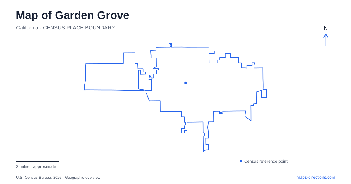
Street tiles load from OpenStreetMap when opened. The blue line shows the 2025 Census boundary.
- State
- California
- Population · July 2025
- 170,455
- Land area
- 18.0 sq mi
- Water area
- 0.0 sq mi
Garden Grove is best understood through several small historical and cultural settings within a broader Orange County street grid. Main Street preserves a link to the early village, Euclid Street provides a route past heritage buildings, and Chapman Avenue leads to the distinctive glass architecture of Christ Cathedral. Parks add further evidence of the area's transformation from agricultural land to a developed city. These places explain different aspects of local history, so a useful map should give each its own context rather than reducing the city to its proximity to neighboring attractions.
A village name before an urban landscape
In 1874, Alonzo Cook bought 160 acres in the area. He later donated land near Main Street for the first schoolhouse and post office, helping establish a center for the surrounding settlement. The name he proposed expressed an aspiration for a planted and attractive community rather than describing a landscape already filled with mature groves.
The city's forestry history recalls a grassy plain that supported agriculture, including beans and chili peppers. Homes, a church, a school, and a railroad depot subsequently gave the village a more established form. That sequence is useful when reading the older center: civic and commercial uses grew within an agricultural setting, rather than farms appearing around an already large city.
For a map of Garden Grove, Main Street near Euclid remains a meaningful historical reference. Its compact shopping-street character differs from the larger road corridors around it, preserving a recognizable village-scale setting within the modern urban area.
Heritage buildings along Euclid Street
Stanley Ranch Museum and Historical Village occupies two acres at 12174 Euclid Street. The historical society describes a collection of original and replica buildings, making it an interpretive setting assembled to preserve local history. The ranch house, general store, water tank, and windmill are among the features identified in city planning documents.
This grouping makes the relationship between domestic life, commerce, and agricultural infrastructure easier to see. A house alone would tell only part of the story; the store and water-related structures broaden the picture of how a small community functioned. The distinction between original and replica buildings also matters, because the village presents historical interpretation rather than an untouched block surviving exactly as it once stood.
The Euclid Street location gives Garden Grove a heritage destination connected geographically to the older center. It provides a different experience from Main Street itself: one is a working commercial street, while the other gathers buildings and objects for historical understanding.
Citrus land becomes a public park
Magnolia Park preserves another connection to the agricultural landscape. Ernest and Myrtle Wakeham established their home amid Valencia orange groves at Magnolia Street and Orangewood Avenue. The property at 11402 Magnolia Street later became the park site.
In 1962, the city bought 4.5 acres of the estate, including the house and citrus grove. An additional acquisition along Joyzelle Street expanded the property to the north. These transactions explain a specific way farmland entered the public park system: an existing residential and agricultural property became land for community use.
This history adds substance to the green patch on the map. It is not simply vacant land that happened to become a park. Its location, former home, and citrus background connect it to the people and crops that shaped the area before surrounding development intensified.
A playground with its own design identity
Atlantis Play Center at 13630 Atlantis Way opened in 1963. Its four-acre setting uses sea creatures, whale slides, and other imaginative structures to create an underwater-themed play environment. The city identifies it as a historic landmark, reflecting the importance of a public recreation design created during the community's postwar growth.
The play center is intended for children and accompanying adults, with a seasonal splash pad adding another activity. Its themed structures make it distinct from an ordinary open park. For families exploring Garden Grove, it represents a local recreational landmark whose appeal and purpose are tied to young visitors rather than a general sightseeing promenade.
A glass cathedral on Chapman Avenue
Christ Cathedral stands at 13280 Chapman Avenue. The glass building was completed in 1980 as the Crystal Cathedral, then adapted for Catholic worship and dedicated under its current identity in July 2019. The larger campus includes buildings associated with architects Richard Neutra, Philip Johnson, and Richard Meier.
Those different structures and periods make the campus an architectural ensemble as well as an active religious destination. Older references to Crystal Cathedral describe an earlier identity of the same prominent glass building, while the current name reflects its later use.
Together, these sites give Garden Grove a specific local geography: a village center, an interpretive historical collection, a park formed from citrus property, an imaginative midcentury playground, and a major religious campus. Their addresses and histories provide a clear framework for exploring the city on its own terms.
Map and statistics: U.S. Census Bureau, 2025 Gazetteer, January 2025 generalized place boundaries and Vintage 2025 population estimates. Local references: City of Garden Grove; Garden Grove Historical Society; Diocese of Orange; Christ Cathedral. Article prepared by Maps & Directions.