Map of Gaithersburg
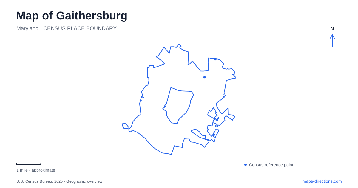
Street tiles load from OpenStreetMap when opened. The blue line shows the 2025 Census boundary.
- State
- Maryland
- Population · July 2025
- 71,113
- Land area
- 10.3 sq mi
- Water area
- 0.1 sq mi
Gaithersburg has several centers of interest with very different origins. Olde Towne grew around a railroad setting, Observatory Park preserves a site of international scientific work, and the Kentlands arts facilities reuse buildings from a former estate. Bohrer Park adds a broad recreation landscape at Summit Hall Farm. These places provide a useful framework for reading the city: each has a recognizable address and a distinct relationship between its historic structures and present public use.
Olde Towne and the railway still in motion
The Community Museum occupies the historic B&O rail complex at 9 South Summit Avenue. Its grounds include the 1884 Freight House, History Park, and preserved rolling stock, with the train station of the same year next door. The active rail line remains beside the museum, allowing the transport setting to be understood as more than a display removed from its original context.
A 1918 steam engine, a 1953 Rail Diesel Car, and a 1982 caboose represent different periods of railway equipment. Their dates make the outdoor collection a compact timeline of changing technology. Olde Towne Plaza, beside the station, adds an interactive water feature to the surrounding public space.
On a Gaithersburg map, South Summit Avenue therefore marks a cluster rather than just a museum address. The freight building, station, outdoor exhibits, and plaza can be considered together. Their proximity makes it possible to appreciate how passenger travel, freight handling, historical interpretation, and contemporary gathering occupy the same small district.
A park designed around the Earth's motion
Observatory Park at 100 DeSellum Avenue preserves a very different connection to travel. The latitude observatory participated in an international effort to measure the Earth's wobble on its polar axis by observing stars. Those measurements helped improve navigation. The scientific work took place from 1899 to 1982, linking this modest site with observatories elsewhere in the world.
The park's design interprets that work through its layout. Benches and planting define an ellipse between the observatory and the meridian pier, while the path represents the Earth's wobble when seen from above. The geometry is consequently part of the exhibit. A visitor following the path is moving through a diagram of the scientific problem investigated there.
This gives Gaithersburg an unusual map-related landmark: a place where precise observation helped people understand their position on the planet. It also offers a contrast with the railway museum. One site concerns the vehicles that carried people and goods; the other concerns the measurements that made navigation more accurate.
Summit Hall Farm as a recreation landscape
Bohrer Park stands at 506 South Frederick Avenue on the former Summit Hall Farm property. Its roughly fifty-eight acres contain two ponds, open fields, picnic areas, playground space, and a paved path used for walking, skating, jogging, and cycling. The park also includes miniature golf, a skate park, a water park, and the Activity Center.
The center contains gymnasiums, a fitness area, and multipurpose rooms, so the site supports indoor recreation as well as outdoor activity. At the same time, the log smokehouse survives as the city's oldest standing building. That small structure changes the reading of the grounds: the modern recreation complex occupies land with a much older working history.
For a Gaithersburg family outing, this is a useful place to compare activities within one park rather than moving among several separate venues. The ponds and walking path offer a quieter use of the landscape, while the specialized recreation facilities have their own spaces and programs. A close view of the grounds helps show those relationships.
Kent Square Road and the estate's second life
The Arts Barn at 311 Kent Square Road was once a stable on the Tschiffely estate. Its conversion created a ninety-nine-seat theater, exhibition space, classes, workshops, and other arts programming. The preserved building now brings audiences and participants into a structure designed for a very different purpose.
Across the street, Kentlands Mansion at 320 Kent Square Road forms the other part of this historic grouping. The city's facilities history dates the mansion to 1900 and describes its later conversion to community use and an art gallery. Locating the two addresses together makes the relationship clear: they are neighboring estate buildings adapted for public cultural life.
A Gaithersburg exploration can use these four settings as separate chapters. Olde Towne presents the rail corridor, the observatory turns scientific measurement into a designed landscape, Summit Hall combines a farm remnant with recreation, and Kent Square Road brings performance and art into former estate buildings. Their differences make the city more intelligible than treating every park or cultural venue as the same kind of destination.
Map and statistics: U.S. Census Bureau, 2025 Gazetteer, January 2025 generalized place boundaries and Vintage 2025 population estimates. Local references: City of Gaithersburg. Article prepared by Maps & Directions.