Map of Gainesville
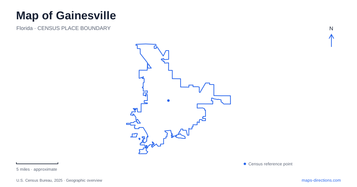
Street tiles load from OpenStreetMap when opened. The blue line shows the 2025 Census boundary.
- State
- Florida
- Population · July 2025
- 148,671
- Land area
- 64.0 sq mi
- Water area
- 1.2 sq mi
Gainesville has a landscape in which water is often more informative than the street grid. A downtown park treats runoff, constructed wetlands improve water flowing toward Paynes Prairie, and a deep sinkhole exposes the limestone beneath north-central Florida. These places connect urban development with geology and ecology. They also show why a city map should distinguish several similarly named parks and separate a museum's permanent location from whether its exhibits are currently open.
A former industrial site becomes a downtown park
Depot Park opened in August 2016 as a thirty-two-acre public space following environmental cleanup and redevelopment. The city received a brownfields pilot grant in 1997, cleanup began in 2000, and the historic railroad depot was restored in 2012. The park therefore preserves part of the railway story while giving a previously damaged site a new civic purpose.
The Blue Grotto splash pad, playground, lawns, and walking and cycling paths make it a gathering place near the South Main Street corridor. Yet the ponds and wetlands are working infrastructure as well as scenery. The city's design sends runoff through successive treatment stages, including debris collection, settling areas, ponds, a braided stream, and wetlands. Gainesville's downtown recreation space is consequently part of a larger water-quality system. Reading the park only as a lawn beside an old station would miss the reason so much of its layout is devoted to water.
Three Sweetwater names, different destinations
Sweetwater Branch Park is a small downtown creek-side space at 500 East University Avenue. It follows roughly three blocks of shaded creek bed, with a paved path, picnic facilities, and a playground. The Matheson Museum, historic Matheson House, and downtown library are nearby. Its scale and urban setting suit a short outing among central streets and cultural destinations.
Sweetwater Wetlands Park is a separate place at 325 Southwest Williston Road. The city describes more than 125 acres of wetlands and ponds, with approximately 3.5 miles of gravel paths and boardwalks. These are constructed wetlands intended to improve the water quality of Paynes Prairie and the Floridan Aquifer. The open basins and viewing platforms offer a very different landscape from the smaller shaded park downtown.
Sweetwater Preserve is another named area in the downstream sequence described by the city. Its appearance between Depot Park and the wetlands on water-management maps does not make the three sites interchangeable. For Gainesville, the repeated name records a shared drainage relationship across distinct public spaces. The correct destination depends on whether the intended outing is a downtown creek walk, a preserve visit, or exploration of the constructed wetland cells.
How the wetland cells work
The wetlands' forebay buffers changes in flow and captures fine sediment. In dry conditions, water moves into three treatment cells; during storms, excess flow can use a forested slough and overflow channel. That arrangement protects the planted cells from sudden water-depth changes. Natural biological processes within the wetlands reduce nitrogen, while active vegetation management helps maintain the system.
This is a landscape where engineering and habitat are deliberately combined. The berms and paths make the treatment system visible, and educational signs explain why the site has been shaped this way. Bicycles may be used to reach the entrance but are not permitted on the park's internal paths. A map-based cycling trip and a walk through the wetland cells thus involve different parts of the same visit.
Limestone exposed at Devil's Millhopper
North of central Gainesville, Devil's Millhopper Geological State Park reveals a much deeper water story. Acidic groundwater dissolved limestone below the surface until a cavity roof collapsed, producing the sinkhole. More than one hundred feet of rock layers are exposed in its walls, including sediments of the Hawthorn Group above older Ocala Limestone. The geological sequence helps explain how surface drainage and the underlying aquifer relate.
The nature trail's bridges determine whether a mapped circuit can actually be followed as a loop. Check the state park's route guidance before setting off, and identify the return path if a crossing is unavailable. The sinkhole and upland woodland are different settings within the same park, so understanding the trail connection matters as much as recognizing the two landscapes on a map.
A museum destination during renovation
The Florida Museum of Natural History adds an indoor interpretation of the region's natural history through its public-exhibition setting at Powell Hall. The Butterfly Rainforest is a visitor facility with its own admission arrangements; research collections elsewhere are not substitute public galleries. Confirm the museum's visitor information for exhibitions and access before traveling, especially when expansion work changes how the campus is used.
For a Gainesville itinerary, that distinction keeps a permanent institutional address from becoming a false promise of an available attraction. The city still offers a connected outdoor story through its depot redevelopment, wetland treatment system, and exposed geology, with each place revealing a different relationship between people, land, and water.
Map and statistics: U.S. Census Bureau, 2025 Gazetteer, January 2025 generalized place boundaries and Vintage 2025 population estimates. Local references: City of Gainesville; Florida State Parks; Florida Museum of Natural History. Article prepared by Maps & Directions.