Map of Fuquay-Varina
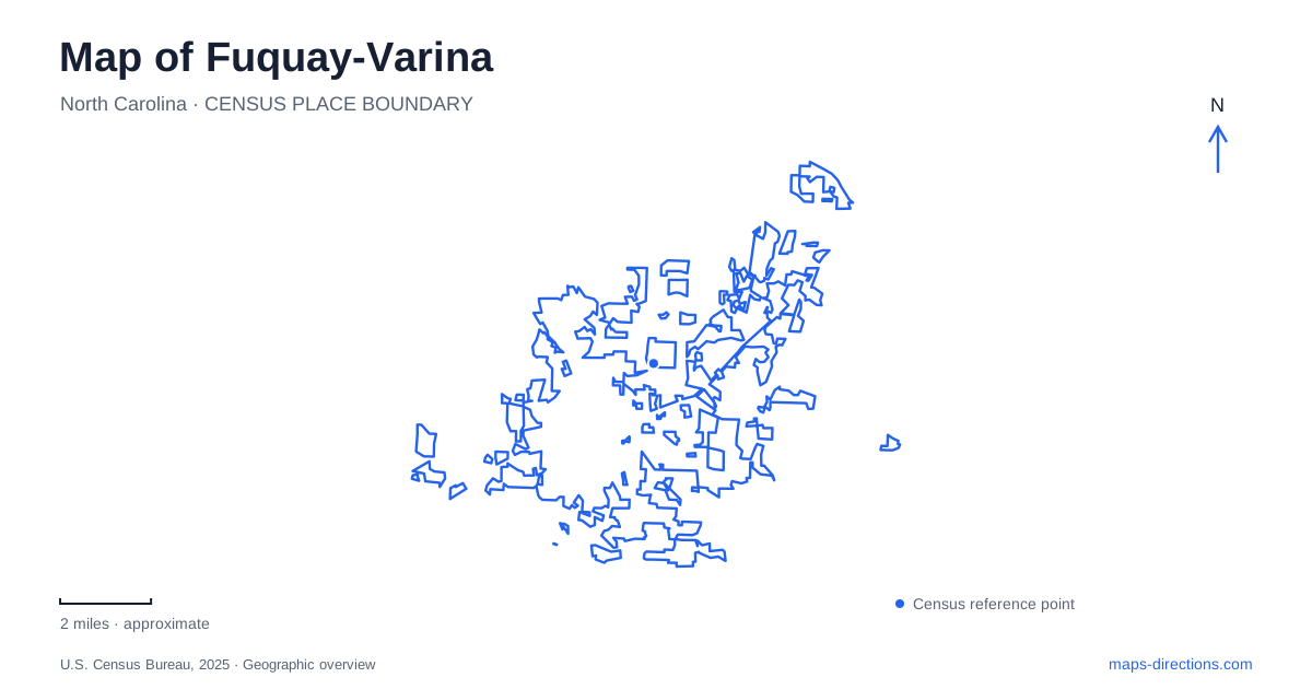
Street tiles load from OpenStreetMap when opened. The blue line shows the 2025 Census boundary.
- State
- North Carolina
- Population · July 2025
- 48,536
- Land area
- 19.8 sq mi
- Water area
- 0.1 sq mi
Fuquay-Varina has two historic downtown centers, and that is the most useful fact to establish before reading its local map. The Fuquay district developed near the mineral spring and Main Street, while Varina’s commercial setting relates to Broad Street and the railway station. The modern municipality joins these histories, but the two centers remain distinct destinations. A restaurant, museum, or event described simply as downtown may belong to either setting.
A spring and a railway community
The town’s historical account places discovery of the mineral spring around 1858. Visitors later came because they believed the water had healing qualities. That belief belongs to the history of the resort and should not be mistaken for a present-day medical claim. The spring’s importance was that it attracted people and commercial activity to a particular location.
Varina developed through a different chain of events. A post office and mercantile business took the name used by a Civil War correspondent, and intersecting timber rail lines helped establish Varina Station. Tobacco farming and trade later strengthened commercial activity around both Main Street and Broad Street.
Fuquay Springs incorporated in 1909, and the neighboring communities joined as one municipality in 1963. This explains the hyphen in Fuquay-Varina and the continued presence of two historic districts. A map should connect them without erasing the different reasons each developed.
The spring as a small public landscape
Fuquay Mineral Spring Park is listed at 105 West Spring Street. A restored spring house, footbridge, picnic tables, and short walking paths commemorate the site’s earlier role. The park is a compact historical landscape rather than a large natural reserve or a spa complex.
Its setting gives the town’s origin story a physical reference. The spring house is the principal feature, while the paths allow visitors to understand its relationship with the surrounding ground. The short scale of the walk also distinguishes it from the woodland trails elsewhere in the municipal park system. Someone seeking historical context and someone planning a longer nature outing may therefore choose different destinations despite both looking for green space.
Ashworth Park's collection of local buildings
The museums at Ashworth Park occupy 131 South Fuquay Avenue. The grounds were the home place of Rufus and Cornelia Ashworth, whose family residence developed on Aiken Street during the twentieth century. The public park was dedicated in October 2014, adding another layer of community use to a former family property.
The collection includes the J.D. “Squire” Ballentine School, the first local post office, and the Centennial Museum. A tobacco barn, playhouse, and caboose add further evidence of work, domestic life, and transport. These objects and buildings address several parts of the town’s past, so the site is best understood as a group of exhibits rather than one historic house.
For Fuquay-Varina, the museum grounds complement the mineral spring: one preserves a particular place of origin, while the other assembles a broader collection of community history. Their different street addresses keep the two visits distinct.
A department store becomes an arts destination
The arts center at 123 East Vance Street opened in March 2019. Its design combines renovated space from a former Belk department store with new construction. The reused portion contains a gallery, studios, classrooms, and administrative space, while a 294-seat theater supports performances.
That change of use is a visible example of downtown adaptation. A building originally associated with shopping now supports painting, dance, digital work, and live performance. An older reference to a department store and a current arts-center listing can therefore describe stages in the life of the same site. The combination of gallery and theater also means that visitors may be attending different activities within the same overall facility.
Woodland education and the South Park connection
Carroll Howard Johnson Environmental Education Park stands at 301 Wagstaff Road. A twenty-acre gift in 1992 and an additional eight acres in 1998 created the present protected setting. Its roughly two-mile nature trail, overlooks, bridges, and amphitheater emphasize environmental learning rather than organized field sports.
The Jeff Wells Trail provides a paved connection from South Park at 900 South Main Street to the environmental park. That relationship allows the map to show a connected outing while preserving the different character of each place. The paved connector and the woodland paths are separate parts of the experience.
Fuquay-Varina’s local geography consequently combines two commercial centers, a historic water source, collected museum buildings, a reused arts venue, and connected recreation landscapes. A map of Fuquay-Varina is most informative when it preserves those individual identities instead of treating the town as one undifferentiated downtown surrounded by generic parks.
Map and statistics: U.S. Census Bureau, 2025 Gazetteer, January 2025 generalized place boundaries and Vintage 2025 population estimates. Local references: Town of Fuquay-Varina. Article prepared by Maps & Directions.