Map of Friendswood
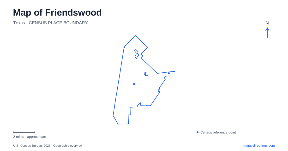
Street tiles load from OpenStreetMap when opened. The blue line shows the 2025 Census boundary.
- State
- Texas
- Population · July 2025
- 41,319
- Land area
- 20.6 sq mi
- Water area
- 0.1 sq mi
Friendswood grew from a Quaker farming settlement into a suburban city, but its earlier history remains useful for understanding the map. The historic sites, central recreation grounds, and creekside open spaces tell different parts of that story. A productive first look follows the relationship between the civic area and its parks, then expands toward Clear Creek and the larger athletic facilities.
The community before the subdivisions
Galveston County's history dates the settlement to 1895, when a group led by T. Hadley Lewis and Frank J. Brown established a colony of Friends, also known as Quakers. Church and school were closely connected from the beginning. After the 1900 storm destroyed their small shared building, residents erected a two-story replacement called the Academy, which accommodated both education and worship.
Farming remained central to the community through the 1940s, with Magnolia figs and their preservation contributing to the economy. Subdivision development became increasingly important after 1950, and incorporation followed in 1960. That progression helps explain why a present-day residential map needs a historical layer: much of the housing landscape followed an older agricultural community.
The Frank J. Brown Heritage Museum, Perry Home, historic barber shop, and Quaker Marker Trail preserve aspects of that earlier life. These names are useful starting points for exploring local history without assuming that every historic site performs the same role. A house, a museum, and a sequence of markers offer different ways to encounter the settlement's past.
Civic space and a bridge between parks
Stevenson Park is at 1000 South Friendswood Drive. Its recreational facilities include the municipal pool, tennis and pickleball courts, sand volleyball, basketball, playgrounds, and a walking surface. Named gathering places include the gazebo and the large and small Rotary pavilions. The park consequently combines ordinary daily recreation with places intended for group activities.
A pedestrian bridge connects it with Old City Park. That connection is a significant detail on a local map because it joins two separately named public spaces into a possible walking outing. Someone studying only the road approaches could miss the relationship visible at pedestrian scale. The two parks retain separate identities even though the bridge allows a visit to extend between them.
Nearby civic history has another landmark. The veterans memorial beside City Hall was dedicated on Memorial Day in 2010. Its central stainless-steel flag is flanked by granite columns bearing military emblems, with a globe on one column and an eagle sculpture on the other. An arched entry and limestone benches give the memorial a defined setting rather than leaving it as an isolated sculpture.
Clear Creek and the memorial park landscape
A map of Friendswood should also give the waterways room to explain the open spaces around them. The 2025 parks master plan places 1776 Memorial Park beside the Imperial Estates subdivision, south of Frankie Carter Randolph Park, with access from Old East Edgewood and Imperial Drive off the FM 2351 area.
Dedicated on July 4, 1976, the park honors people who served in the armed forces. Mary Louise Fitch Soule and Harold M. Soule donated the land. Its canoe and kayak ramp provides access to Clear Creek, while the site also serves as the Harold Whitaker Storm Water Basin. Recreation, remembrance, and drainage therefore overlap in one landscape.
That overlap is important when reading the broad areas of open land on the map. They have a water-management function as well as a recreational one. The master plan also discusses possible future improvements, but those proposals should be distinguished from established features such as the creek access. A planning drawing describes an ambition as well as a place.
Centennial's fields and performance space
Centennial Park, at 2200 South Friendswood Drive, brings a different emphasis. Its municipal inventory includes lighted soccer and football fields, a recreational track, a basketball pavilion, picnic pavilions, and a playground. The Evelyn B. Newman Amphitheater adds a performance setting to a park otherwise strongly associated with athletics.
The presence of both fields and an amphitheater makes the park more varied than a single sports-ground label suggests. A team visit, a walking circuit, and an organized performance use different parts of the same public property. In contrast, the central parks emphasize a compact mixture of courts, play areas, gathering places, and their connecting footbridge.
Together these locations make Friendswood legible through specific local relationships: an agricultural and religious beginning, civic landmarks beside everyday recreation, and creek landscapes that combine public access with drainage. Those relationships provide a stronger sense of place than simply counting the green patches between residential streets.
Map and statistics: U.S. Census Bureau, 2025 Gazetteer, January 2025 generalized place boundaries and Vintage 2025 population estimates. Local references: Galveston County; City of Friendswood. Article prepared by Maps & Directions.