Map of Fremont
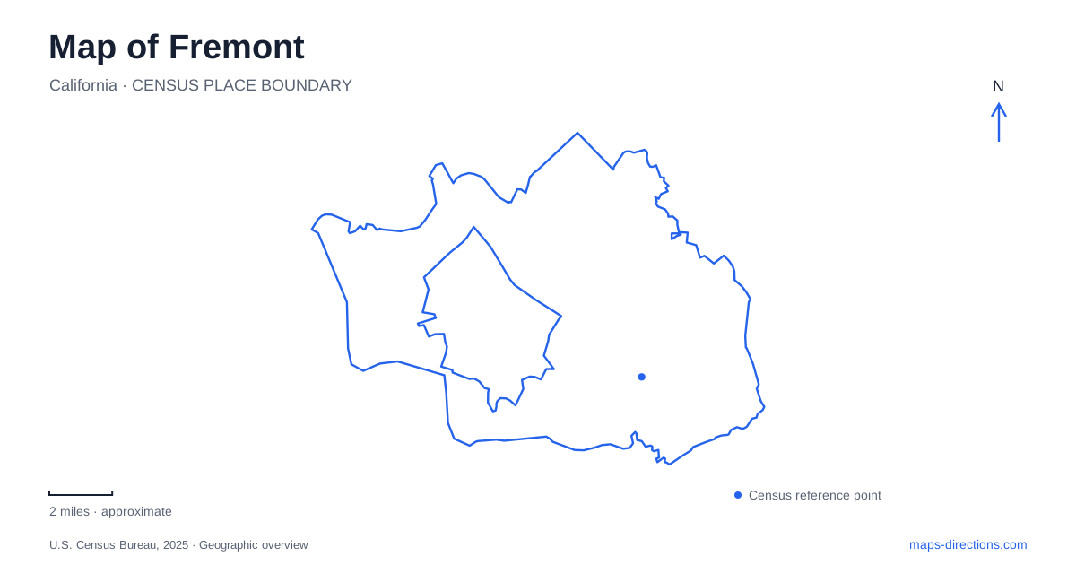
Street tiles load from OpenStreetMap when opened. The blue line shows the 2025 Census boundary.
- State
- California
- Population · July 2025
- 226,442
- Land area
- 78.1 sq mi
- Water area
- 10.1 sq mi
Fremont stretches across a landscape where old town centers, creekside gravel pits, bay wetlands and steep hills all remain visible. Its modern municipal identity dates to 1956, when Centerville, Niles, Irvington, Mission San José and Warm Springs joined together. Those five names are still useful for reading the city. They explain why historic commercial areas occur in several places rather than around one central square, and why a trip between landmarks can cross very different kinds of terrain.
Five communities with different origins
The older settlements developed distinct economic roles. Centerville became a center for canning, produce packing and shipping. Irvington, earlier known as Washington Corners, grew as a trading place serving the surrounding agricultural district. Niles combined milling and quarrying with railroad activity, then became an important silent-film production location between 1912 and 1916. Warm Springs developed through resort, winery and farming uses.
These histories help interpret the distribution of older buildings on a map of Fremont. A former packing center, railroad town and mission settlement did not require identical street patterns or building types. Their commercial districts preserve different pieces of the area's development, even where later roads and neighborhoods connect them into a continuous urban landscape. The historic names therefore convey more than directional subdivisions of the present city.
Mission Boulevard's historical and hillside destinations
Mission San José was established in 1797 at the Ohlone village of Oroyom. The city's historical overview describes a complex of adobe buildings, with many original structures later lost to the 1868 earthquake and subsequent fires. Surviving and reconstructed elements must be understood together when interpreting the present site. The mission is at 43300 Mission Boulevard, within this city despite the name it shares with the larger city to the south.
Farther into the hills, Mission Peak Regional Preserve presents a very different destination. Its two principal approaches begin at Ohlone College and the eastern end of Stanford Avenue. The park district describes the college route as longer but more gradual, while the Stanford approach climbs more steeply. These routes give an important geographic choice: the same summit is approached through different terrain and starting points, rather than by a single road ending at the top.
Water with an industrial past
Quarry Lakes records a history of extraction and water management. Gravel removed from the banks of Alameda Creek helped build the western portion of the transcontinental railroad. After quarrying ended, the excavated pits became part of the Alameda County Water District's groundwater-recharge system, receiving water diverted from the creek. The lakes' shape and placement therefore reflect both industrial activity and a continuing public-water function.
The regional recreation area covers 471 acres, with roughly 350 acres occupied by lakes. Trails, picnic areas and other recreation facilities surround this water landscape. On a map of Fremont, the large blue shapes should be read as more than natural lakes left within a growing suburb: they are working infrastructure adapted for public recreation through cooperation between the water and park districts.
Lake Elizabeth has another dual role. The 83-acre freshwater lake in Central Park supports recreation while providing flood control and stormwater storage. Its location within a municipal park distinguishes it from the former gravel pits, even though both places combine water management with public open space. Comparing them shows how two superficially similar map symbols can represent different histories and purposes.
The bayward landscape at Coyote Hills
Coyote Hills Regional Park preserves wetlands and Tuibun Ohlone shellmound sites dating back about two thousand years. Later land uses included ranching, farming, salt production and quarrying. The park's layered history extends well beyond its present recreational identity, and the surviving cultural sites belong to a much longer human relationship with the bay landscape.
The main park entrance is reached from Patterson Ranch Road, with access from Paseo Padre Parkway after leaving Highway 84. A restoration and public-access project opened in March 2026, adding nearly 300 acres associated with Patterson Ranch, along with trails, observation decks and other facilities. Older maps may consequently show a smaller public park landscape than the one now available.
From film-town streets to preserved slopes
Niles retains a historic shopping district and institutions associated with silent film and the canyon railway. The railway's Niles boarding location is on Mission Boulevard at the Sullivan Underpass, while its other boarding area is in Sunol. Those locations connect the old railroad story with the canyon beyond the city.
Together, Niles, the mission, managed lakes and bayward wetlands reveal Fremont through more than a single era. The five-community history explains the dispersed centers; the creek, bay and hillside landscapes explain the spaces between them. Reading both layers gives Fremont a coherent shape without erasing the distinct places that formed it.
Map and statistics: U.S. Census Bureau, 2025 Gazetteer, January 2025 generalized place boundaries and Vintage 2025 population estimates. Local references: Washington Township Museum of Local History; City of Fremont; East Bay Regional Park District; Niles Main Street Association; Niles Canyon Railway. Article prepared by Maps & Directions.