Map of Freeport
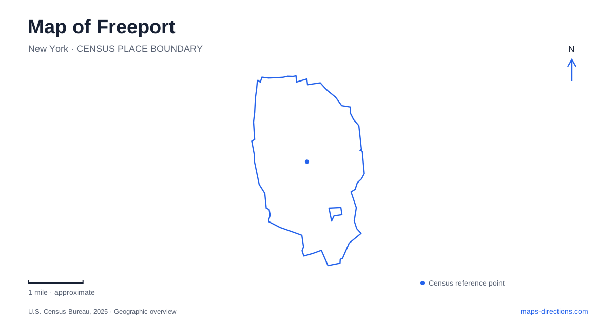
Street tiles load from OpenStreetMap when opened. The blue line shows the 2025 Census boundary.
- State
- New York
- Population · July 2025
- 44,174
- Land area
- 4.8 sq mi
- Water area
- 0.3 sq mi
Freeport's southern landscape is organized around canals, bayfront parks, and roads that approach the water from the developed village. The Nautical Mile follows Woodcleft Avenue, with different public spaces marking its northern and southern ends. Farther inland, the Long Island Rail Road and major east-west roads serve another pattern of movement. Understanding the distinction between the village center, canal waterfront, and barrier-island beaches is the key to reading this part of Long Island's South Shore.
Woodcleft is a constructed waterway
Woodcleft Canal was dredged around 1897 by the firm of Randall and Miller. John J. Randall and William G. Miller acquired farmland and marshland as they developed summer-home areas during the late nineteenth century. The canal was later widened and straightened, so its present shape records deliberate engineering rather than an untouched natural channel.
That history gives the Nautical Mile a particular character. Woodcleft Avenue follows a working waterfront created through land development, with the canal providing water access beside the street. The close relationship between road and water is central to the district: activity can face the avenue on one side and the boating channel on the other.
A historical marker at 211 Woodcleft Avenue explains the dredging and the developers involved. Its location makes the infrastructure story part of the waterfront itself. In Freeport, the canal is both a present-day geographical feature and evidence of how the village expanded toward the bay.
Two parks define the waterfront corridor
Randall Park sits near the northern end of Woodcleft Avenue, with its listed address at 500 Guy Lombardo Avenue. The 8.2-acre park contains outdoor pools, a large sports field, picnic facilities, and playground space. Its facilities make it an active neighborhood recreation area rather than simply a landscaped entrance to the waterfront.
The park also occupies the former setting of the Woodcleft Inn, built in 1897. The inn was later demolished, and the playground and swimming-pool area took its place. This change of use links the late nineteenth-century summer-resort landscape with the public recreation facilities seen today.
At the southern foot of the Nautical Mile, Sea Breeze Park opens toward the bay. The village describes a five-acre space with a waterfront boardwalk for pedestrians and cyclists, benches, boat slips, volleyball courts, and a multi-use field. The contrast between the two parks helps explain the corridor: Randall concentrates active facilities near its northern end, while Sea Breeze provides a broad water-facing conclusion.
The bay is part of a larger paddling network
Sea Breeze Park is a designated stop on the South Shore Blueway, a network intended for small-watercraft exploration. That designation places the park within a water-based geography extending beyond the streets of Freeport. The same shore can be approached as a place to sit and look outward or as one point in a route across the bays.
The distinction matters because a blueway is not a continuous land trail. Water routes depend on conditions, navigable channels, and appropriate landing points, while the boardwalk remains a defined path along the park edge. The two forms of access share a location but create different relationships with the surrounding landscape.
Cow Meadow combines parkland and preserve
Cow Meadow Park and Preserve occupies approximately 171 acres along the South Main Street approach. The village identifies it as a combination of nature and sports facilities, with a recreation history dating to 1970. Its scale gives it a different role from the smaller spaces along Woodcleft Avenue.
For Freeport, this adds a broader open-space destination alongside the more tightly developed canal district. The preserve component means that the green area on the map includes habitat as well as places intended for organized recreation. Reading those functions together provides a fuller understanding of the southern shoreline than treating every park as a field or playground.
Rail travel and the barrier islands
The LIRR station belongs to the Babylon Branch, placing the village within the east-west rail corridor across the South Shore. MTA beach-travel information also identifies the station as a transfer point for seasonal NICE bus service to Jones Beach. The beach is a separate onward journey, not the same waterfront reached by following Woodcleft Avenue.
The Meadowbrook State Parkway along the eastern side of the community connects with Sunrise Highway and Merrick Road and continues toward the barrier-island setting. These roads help explain how regional beach traffic differs from a local trip to the Nautical Mile. A map of Freeport is most informative when it shows the rail corridor, the southbound village streets, and the bays together, preserving the distinction between an inland arrival point and the several waterfront landscapes beyond it.
Map and statistics: U.S. Census Bureau, 2025 Gazetteer, January 2025 generalized place boundaries and Vintage 2025 population estimates. Local references: William G. Pomeroy Foundation; Village of Freeport; South Shore Blueway; Metropolitan Transportation Authority; New York State. Article prepared by Maps & Directions.