Map of Frederick
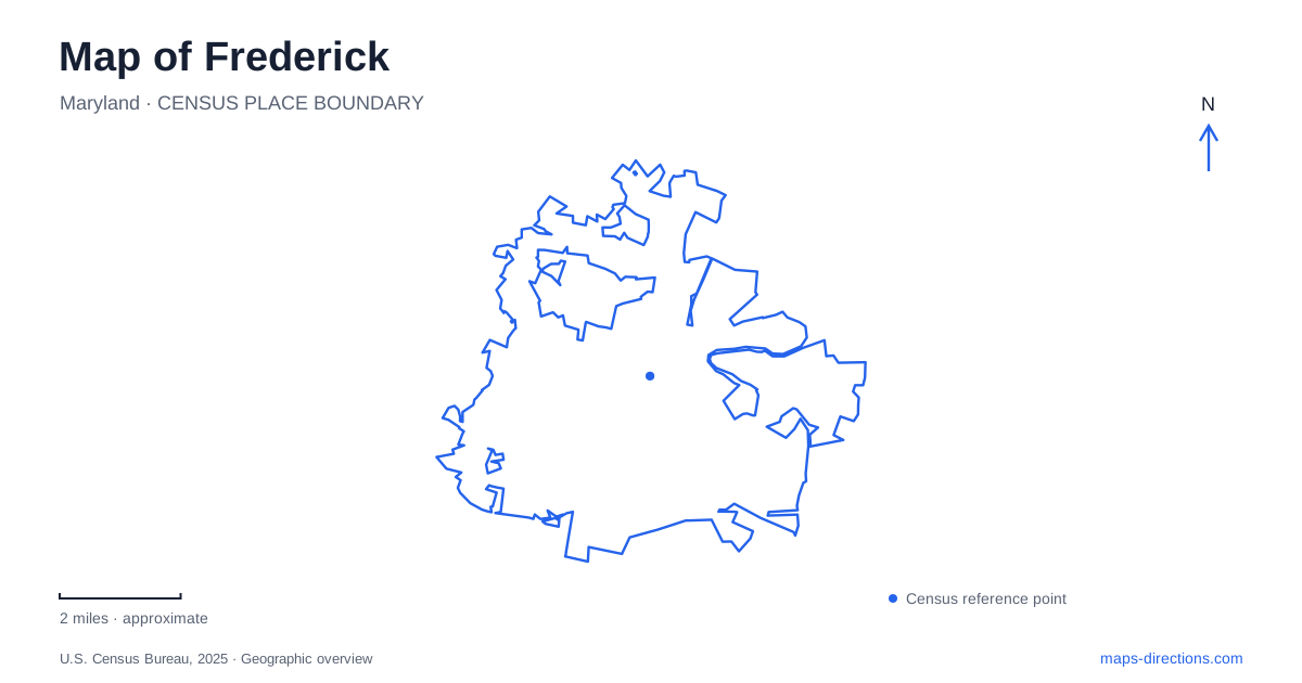
Street tiles load from OpenStreetMap when opened. The blue line shows the 2025 Census boundary.
- State
- Maryland
- Population · July 2025
- 92,059
- Land area
- 24.6 sq mi
- Water area
- 0.1 sq mi
Frederick's most useful walking route also explains a major part of its history. Carroll Creek passes through the historic center, linking public art and commercial streets with the longer green landscape of Baker Park. The waterway helped shape the original market town, but repeated flooding eventually required substantial engineering. Today's promenade is therefore both a public space and a visible reminder of how the city adapted to its setting.
Carroll Creek and the downtown street pattern
Daniel Dulany laid out Fredericktown beside the creek in 1745. The water powered mills, making the site useful for trade and production, but floods damaged nearby homes and businesses. The particularly destructive 1976 flood became a turning point in the development of the modern flood-control project. Reading the creek as infrastructure as well as scenery makes its landscaped channel more meaningful.
Market and Patrick streets form familiar downtown commercial corridors. Carroll Street offers another approach, crossing the creek at the Community Bridge beside the Delaplaine Arts Center. East Street and the Shab Row–Everedy Square area add further destinations beyond the central intersection. These streets give downtown Frederick several connected areas to explore rather than one shopping block surrounded by incidental side roads.
The creek path provides an alternative organizing line. Instead of repeatedly returning to Market Street, a visitor can follow the water and use its bridges to connect with adjoining streets. Art, galleries, and former industrial settings become part of the same walk, with the channel maintaining a clear east–west reference through the district.
Bridges that do more than cross water
The Community Bridge began as a plain concrete road bridge. Artist William Cochran and volunteers transformed it with illusionistic painting between 1993 and 1998, adding apparent stonework and other architectural detail. Its appearance rewards a closer look because painted surfaces are central to the work, rather than merely decorating an otherwise traditional stone bridge.
Nearby, the Iron Bridge incorporates wrought-iron trees, plants, flowers, and water creatures. Completed in 2006, it stands near the Delaplaine and All Saints Street parking garage. The William O. Lee pedestrian bridge, also completed in 2006, honors an educator, historian, alderman, and cultural heritage leader. Near Market Street, the Stone Arch Bridge includes a zodiac-themed sculpture and working clock.
These crossings offer more than interchangeable routes to the opposite bank. Their different forms and dedications turn a creek walk into a sequence of recognizable places, useful both for orientation and for understanding the public art woven into downtown.
West through Baker Park
Baker Park extends the open-space experience beyond the more closely built commercial center. Its 58-acre linear landscape includes Culler Lake and paths that connect toward Schifferstadt. A route from the museum end passes Fairway Avenue and the covered footbridge, then the lake, before continuing across West College Avenue and College Avenue toward the carillon and North Bentz Street.
That progression gives a Frederick walking map several distinct landmarks: a historic house, a covered bridge, a lake, and a bell tower. The Joseph Dill Baker Memorial Tower was erected in 1941 and now holds 49 carillon bells. Its height and sound make it a different kind of reference point from the creek's smaller bridges.
Culler Lake also contains a memorial to fly-fishing teacher and author Bernard “Lefty” Kreh. Created by Antonio Tobias Mendez and installed in 2023, the statue adds a commemorative layer to the park. A walk here connects recreation with local people whose influence extended well beyond the city.
Schifferstadt's domestic landscape
Schifferstadt Architectural Museum stands at 1110 Rosemont Avenue, with visitor access described from West Second Street. Elias and Albertina Brunner built the stone house in 1758. Thick masonry, a tightly turning stair, and a barrel-vaulted cellar reveal how German building traditions were adapted to a new home in Maryland.
The heritage garden interprets a colonial four-square kitchen garden, giving the grounds a domestic purpose alongside the architecture. The museum's operator describes a walking connection from downtown through Baker Park, so this site can be understood as the western historical destination of a longer park walk through Frederick rather than an unrelated address.
The battlefield south of downtown
Monocacy National Battlefield belongs to a separate landscape along Urbana Pike and the Monocacy River. Its visitor center is at 5201 Urbana Pike; the park's Araby Church Road mailing address serves a different function. The July 9, 1864 battle delayed a Confederate advance toward Washington, and the redesigned visitor-center museum uses a central battle map alongside soldiers' and civilians' stories.
This is a change from Frederick's downtown walking scale to a battlefield visit involving its own roads and historic properties. Beginning with the visitor-center map makes the river, fighting positions, and wider setting understandable before exploring the grounds.
Map and statistics: U.S. Census Bureau, 2025 Gazetteer, January 2025 generalized place boundaries and Vintage 2025 population estimates. Local references: Visit Frederick; Frederick County Landmarks Foundation; National Park Service. Article prepared by Maps & Directions.