Map of Franklin
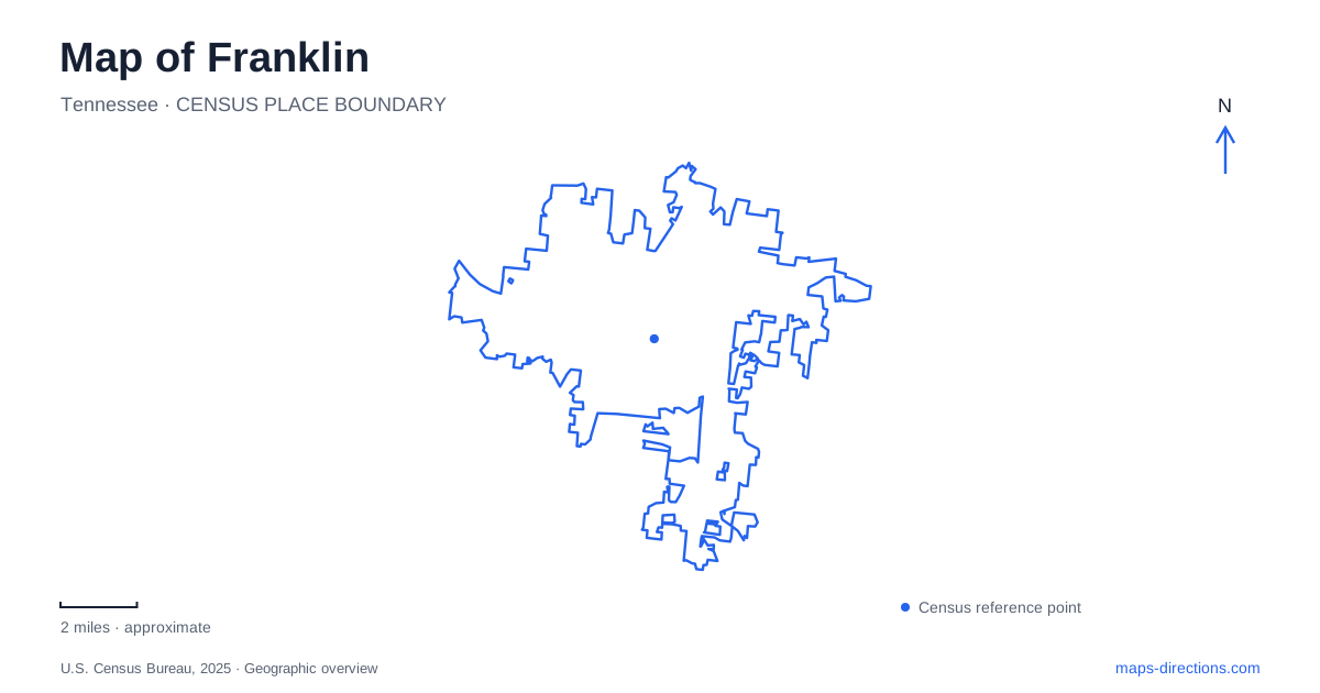
Street tiles load from OpenStreetMap when opened. The blue line shows the 2025 Census boundary.
- State
- Tennessee
- Population · July 2025
- 90,226
- Land area
- 44.5 sq mi
- Water area
- 0.2 sq mi
Franklin's historic landscape extends well beyond its downtown streets. Carter House, Carnton, Fort Granger and the Eastern Flank occupy different pieces of the Civil War geography, while the Harpeth River and Harlinsdale Farm add other reasons to study the map. These sites should be understood as separate places with connected histories. A single battlefield label can conceal the distances, terrain and different experiences involved in visiting them.
A family house at the center of combat
Carter House was built around 1830 for Fountain Branch Carter and his wife, Mary, known as Polly. Their farm expanded substantially before the Civil War, and enslaved people supplied labor on the property. By 1860, Carter enslaved 28 people. That fact belongs to the house's agricultural history as much as its architecture or later battlefield role.
On November 30, 1864, Federal general Jacob Cox used the house as headquarters. During the fighting, members of the Carter family, neighbors and several enslaved people sheltered in the basement. The building therefore connects military decisions with the experience of civilians trapped in a battle. Franklin's preserved houses are strongest as historical evidence when both experiences are retained.
The present visitor entrance is on West Fowlkes Street. This is more precise than directing someone to the general Columbia Avenue battlefield area. The property's tour also involves steps into the house and basement, so an accessible visitor-center entrance does not mean every historic room has step-free access. The operator provides alternative printed interpretation for spaces visitors cannot reach.
Carnton and the aftermath of battle
Carnton, built in 1826, represents another plantation property with a distinct role. John and Carrie McGavock enslaved 44 people by 1860. During the 1864 battle, the house and grounds became a large field hospital for wounded Confederate soldiers. In 1866, the family set aside land beside its cemetery for the reburial of nearly 1,500 Confederate dead.
The house, cemetery and surrounding ground thus describe different stages of the same event: antebellum agriculture, emergency treatment and burial after the fighting. Carnton is not another name for Carter House. Its entrance is at 1345 Eastern Flank Circle, approached from Lewisburg Pike, and the operator identifies the circle as a one-way road. Visitors coming from another historic site need to follow the correct entrance rather than turn into the exit.
The Eastern Flank Battlefield Park preserves approximately 110 acres nearby. Its open ground helps explain the broader scale of Franklin's battlefield, which cannot be represented by house interiors alone. A guided house visit and an outdoor battlefield walk answer different questions about the past, even when they are planned for the same day.
River-level recreation and higher ground
Pinkerton Park lies beside the Harpeth River on Murfreesboro Road. Its paved walking circuit, playgrounds and picnic facilities serve a present-day recreation purpose. The Sue Douglas Berry Memorial pedestrian bridge connects the park with downtown, making it possible to understand the river crossing as part of a walking itinerary rather than only a road approach.
Fort Granger occupies higher ground north of the park. Surviving trenches and an overlook distinguish it from the flatter recreation space below. The two places are geographically close, but they are not one uniform park experience. The earthworks require attention to the landform and surviving historic features, while the lower park provides more conventional paths and gathering areas.
This pairing gives Franklin a useful contrast between terrain that shaped military positions and terrain used for everyday recreation. Reading the river, slope and overlook together explains more than plotting both attractions as nearby dots. It also helps visitors recognize that an easy park circuit does not describe every adjoining hillside route.
A horse farm preserved as open space
Harlinsdale Farm adds a twentieth-century agricultural story. W. W. Harlin established the farm in 1933, and it became closely associated with Tennessee Walking Horses and the stallion Midnight Sun. The city later acquired the property with the aim of preserving its agricultural character, and the first phase of public park use opened in 2007.
The approximately 200-acre landscape has a main south entrance at 239 Franklin Road and a separate north entrance. Walking, open pasture and the historic farm setting make this a different outing from the battlefield properties. The pond is managed for catch-and-release fishing; swimming, wading and boating are prohibited. Its presence on a map is not an invitation to enter the water.
Planning around these distinct settings produces a fuller visit. The Carter and McGavock properties connect domestic life, slavery and war; Pinkerton and Fort Granger show river access and elevation; Harlinsdale preserves a later breeding-farm landscape. Their shared value is not that they tell one simple story, but that they reveal different uses of the land around the city's historic center.
Map and statistics: U.S. Census Bureau, 2025 Gazetteer, January 2025 generalized place boundaries and Vintage 2025 population estimates. Local references: Battle of Franklin Trust; City of Franklin. Article prepared by Maps & Directions.