Map of Fort Mill
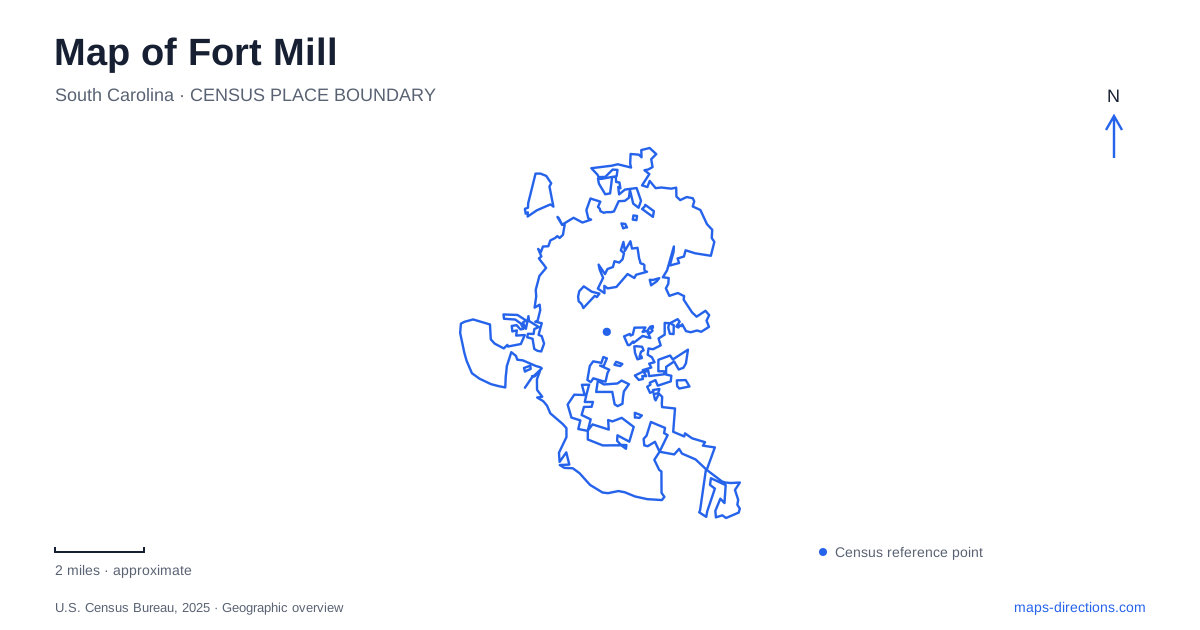
Street tiles load from OpenStreetMap when opened. The blue line shows the 2025 Census boundary.
- State
- South Carolina
- Population · July 2025
- 38,673
- Land area
- 19.5 sq mi
- Water area
- 0.3 sq mi
Fort Mill's name links two older landmarks: a colonial British fort and a grist mill on Steele Creek. Its later downtown grew with textile manufacturing and regional transport. These layers explain why the town should be read at several scales, from individual Main Street buildings to the wider network of roads and protected land near the North Carolina border. The town's official history recognizes the Catawba presence before the arrival of Scotch-Irish settlers in the eighteenth century. Municipal establishment in 1873 therefore marks a government milestone within a much longer inhabited landscape. Main Street's surviving nineteenth-century buildings tell only part of that history, even though they provide a visible starting point for exploring it.
The textile town behind Main Street
The manufacturing company established in 1887 helped transform the settlement into a textile center. Its successor, Springs Industries, remained a major influence for more than a century. The town's history also emphasizes transport links ranging from Nation Ford Road and the Catawba River to the railway, U.S. 21 and Interstate 77.
Those connections explain the relationship between a compact business street and a much wider industrial economy. The older center served people and enterprises whose activities extended beyond the storefront blocks. A map focused solely on present shops can obscure that larger working landscape.
Fort Mill's downtown is best approached as a group of buildings with individual histories. The local history museum offers a self-guided walking-tour resource and building-specific interpretation. That encourages a closer reading of each address rather than assuming every historic facade dates from the same decade or served the same trade.
A museum address and a research resource
The history museum is at 107 Clebourne Street. Its collection includes photographs, letters, journals, artwork, family accounts and objects associated with local homes and businesses. The institution also identifies a research library within its gallery and collection spaces.
This provides a different kind of map reference from a monument. A monument generally concentrates attention on one commemorated subject; a museum can connect a street or property with several generations of use. An old photograph may show an earlier business, while a family account explains how that place fitted into daily life.
For someone investigating Fort Mill beyond a short visit, the museum's location is therefore an entry point to evidence as well as an attraction. The distinction matters because a historical building label alone cannot establish a full chronology. The address, the surviving structure and the archival record answer different questions.
Small parks within the downtown setting
Millstone Park occupies two acres at 104 Spratt Street, at the lower end of Main Street. The town lists walking space, a children's playground, swings overlooking downtown and picnic facilities. Its scale is appropriate to a pause within a downtown visit rather than a long trail outing.
Veterans Park, at 106 North White Street, has a more explicitly commemorative purpose. A pedestal topped by a World War I soldier figure forms its centerpiece, and granite walls create a star-shaped arrangement. The memorial names local people who died in military service and includes a paved Walk of Honor.
These two spaces illustrate how park symbols can conceal different functions. Millstone combines play and a downtown outlook; Veterans Park organizes remembrance around a designed monument. Both contribute to Fort Mill's center, but they are not interchangeable picnic or sports destinations.
The town announced completed picnic shelters at Millstone, Steele Street and Harris Street parks in April 2026, along with a new gazebo at Harris Street. That update distinguishes installed facilities from older capital-project proposals. It also shows why a current amenity description may differ from an earlier photograph of the same park.
The greenway has several gateways
Anne Springs Close Greenway is a separate recreation destination with multiple entrances. The operator's trail passport identifies Lake Haigler, Adventure Road, Dairy Barn, Greenway Stables and Blue Star access points. Its current admission system still describes access through five entrances, confirming that a single general destination pin is insufficient for every activity.
The named approaches matter because they position a visitor in different parts of the grounds. A meeting at the Dairy Barn and an outing beginning at Lake Haigler should use the entrance specified for that activity. Searching only for the overall greenway name can conceal this internal geography.
The greenway also has its own admission arrangements. It should not be assumed to operate like one of the town's small downtown parks simply because both appear green on a map. The operator's current entrance and activity information supplies the missing detail.
Connecting the local and regional views
A map of Fort Mill is most useful when the downtown walking scale remains distinct from the regional road and greenway scale. Clebourne Street's museum, Main Street's historic buildings, the Spratt Street park and North White Street memorial form specific local destinations. The greenway's separate gateways require another level of planning.
Together, those places reveal a town shaped by Indigenous history, settlement, textile production and later conservation and recreation. The map becomes a way to understand their relationships, rather than merely a collection of names beside the interstate.
Map and statistics: U.S. Census Bureau, 2025 Gazetteer, January 2025 generalized place boundaries and Vintage 2025 population estimates. Local references: Town of Fort Mill; Fort Mill History Museum; Anne Springs Close Greenway. Article prepared by Maps & Directions.