Map of Fort Lee
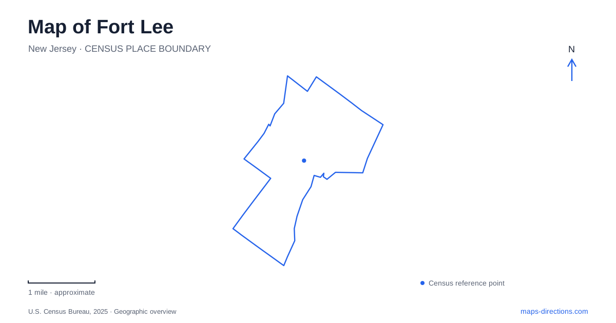
Street tiles load from OpenStreetMap when opened. The blue line shows the 2025 Census boundary.
- State
- New Jersey
- Population · July 2025
- 40,345
- Land area
- 2.5 sq mi
- Water area
- 0.3 sq mi
Fort Lee is best understood in three dimensions. The borough's streets and historic military landscape occupy the Palisades above the Hudson, while picnic grounds and a scenic road follow the river below. The George Washington Bridge crosses between those levels and Manhattan, creating a regional transportation landmark within a much smaller local geography. Early film history adds another layer, linking ordinary streets and cliff scenery with the development of American motion pictures.
Military history on the bluff
Fort Lee Historic Park occupies 33 acres on the cliff top where Continental Army batteries overlooked the Hudson in 1776. Two overlooks at the northern end frame views of the George Washington Bridge, the river, and upper Manhattan. Farther south, paths pass reconstructed military features, including a blockhouse, gun batteries, firing steps, and soldiers' and officers' huts.
The distinction between the original military location and reconstructed structures is important. The site preserves the setting of Revolutionary War activity, while the recreated buildings and equipment help explain how an eighteenth-century encampment functioned. They should not be read as an untouched collection of buildings surviving from 1776.
The visitor center opened for the American Bicentennial in 1976. Its exhibits interpret the New York campaign and the Continental Army's retreat across New Jersey. The park's combination of high-ground views and historical interpretation makes the military choice of location understandable: the bluff provided a commanding position above a major waterway.
The bridge and the streets above the river
The George Washington Bridge opened in 1931, transforming Fort Lee's relationship with New York City. Its approach roads now occupy a substantial part of the local map, but they serve regional movement rather than organizing every neighborhood destination. A route passing through the borough toward Manhattan is a different journey from reaching a museum, street, or park within it.
The bridge also carries a pedestrian and bicycle pathway. The Port Authority identifies that crossing as a separate facility for people on foot and bicycles. Its existence does not mean the surrounding highway approaches function as local walking routes; the pathway and the road network have different access arrangements.
The larger lesson is one of scale. The bridge dominates a regional map, while Hudson Terrace, Main Street, and the park entrances become more relevant at neighborhood scale. Switching between those views helps explain why a landmark visible from many places may still require a particular local approach.
Ross Dock below the cliffs
Ross Dock Picnic Area lies beside the Hudson just north of the bridge. It forms the park's largest picnic area and includes access to Carpenter's Grove and Hazard's Ramp. Tables, grills, a playground, and riverfront space give it a recreational character different from the historic park above.
Henry Hudson Drive supplies road access to these lower riverfront areas. The scenic roadway was constructed between 1912 and 1940 and begins at the Edgewater park entrance near the borough boundary. It follows the Hudson north toward Alpine, keeping close to the river rather than the cliff-top neighborhoods.
New Jersey's transportation department explicitly contrasts this lower drive with the Palisades Interstate Parkway on top of the cliffs. That elevation difference is a central feature of a Fort Lee map. Two roads can run through the same narrow river corridor while occupying very different heights and serving different destinations.
Ross Dock also has a recreation history of its own. During the 1930s it operated as a summer camp colony with rentable tents, later supplemented by small WPA-built cabins. The present picnic landscape therefore continues a long tradition of bringing visitors to the riverbank below the developed streets.
Cinema in the streets and on the Palisades
The Barrymore Film Center at 1 Park Avenue opened in 2022, with a cinema, film museum, and public gathering spaces. Its name recalls a family with direct local connections. In 1900, Maurice Barrymore organized a benefit for a firehouse on Washington Avenue in Coytesville, and his son John made his acting debut at that event.
The film center's historical timeline also connects early productions with specific local settings. The Palisades supplied the location for the 1907 production Rescued from an Eagle's Nest, while Main Street appeared in the early comedy The Curtain Pole. These examples show how cliff scenery and established streets both became usable film locations.
This history gives Fort Lee another identity beyond the bridge approaches. The bluff-top military site, lower riverfront parks, and early cinema locations represent different uses of the same distinctive landscape. A map that preserves those relationships reveals a borough shaped by elevation, transportation, recreation, and moving images.
Map and statistics: U.S. Census Bureau, 2025 Gazetteer, January 2025 generalized place boundaries and Vintage 2025 population estimates. Local references: Palisades Interstate Park Commission; Borough of Fort Lee; Port Authority of New York and New Jersey; New Jersey Department of Transportation; Barrymore Film Center. Article prepared by Maps & Directions.