Map of Forney
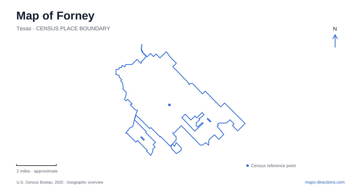
Street tiles load from OpenStreetMap when opened. The blue line shows the 2025 Census boundary.
- State
- Texas
- Population · July 2025
- 41,658
- Land area
- 16.0 sq mi
- Water area
- 0.0 sq mi
Forney's map reflects a town that moved toward a railroad, then expanded around roads, neighborhoods and public recreation grounds. Bois d'Arc Street links the downtown historical story with places farther south, while FM 548 identifies a different corridor serving Community Park and the US 80 interchange. The repeated Spellman name connects several local institutions through philanthropy, but the museum and amphitheater occupy separate settings with different purposes.
A railroad changed the town's location
The predecessor settlement was called Brooklyn, sometimes written Brooklin. Established in 1869, it anticipated the arrival of the Texas and Pacific Railway. By 1872, however, the planned line was passing approximately a mile north of that village. The railroad company laid out its own town in 1873 where the tracks crossed the older Bonham–Buffalo Road, now Bois d'Arc Street.
This shift is a useful way to understand the historic center of Forney. The railroad did more than add a transport option to an existing village: its alignment redirected the location of the town itself. The crossing between an older road and the new rail corridor became a decisive organizing point. Modern streets preserve that relationship even though surrounding development is much larger than the original settlement.
History on South Bois d'Arc Street
The Spellman Museum stands at 200 South Bois d'Arc Street in historic downtown buildings. Founded in 2001, it presents the area's history through exhibits on Indigenous people, settlement, agriculture, transportation and schools. The location places the museum within the built environment it helps explain, allowing the street outside and the collections inside to be considered together.
The museum also holds work by Coreen Spellman, a regional artist whose prints and other works add an artistic dimension to local history. Her brother Mick donated a substantial collection. The institution therefore preserves more than the equipment and records of a railroad and farming community; it also presents the creative work of someone connected to that community.
A family history gives the name additional depth. Michael Spellman arrived as a railroad construction teamster in 1872–1873 and later became a hay and cotton producer and banker. The family's Center Street house dates to 1896. Those connections link railway construction, agriculture, finance and domestic architecture within the same local story, rather than treating each surviving name as an isolated landmark.
The park and amphitheater have a related story
Forney Community Park is listed at 241 South FM 548. Its extensive grounds concentrate a large share of the city's outdoor recreation, with sports spaces, trails and the seasonal splash pad among its uses. Its scale is noticeably different from the smaller downtown blocks occupied by the museum.
The Spellman Amphitheater belongs to this park setting. A municipal account explains that Mick Spellman's estate gift helped the city purchase an additional 43 acres south of the existing park. Funds from the gift, combined with construction savings, also supported the amphitheater, multipurpose fields and an extension of walking trails. The resulting landscape connects performance, recreation and a specific act of local philanthropy.
The repeated surname can therefore be read as a relationship between places rather than as a single destination. In Forney, the museum preserves family collections and community history, while the amphitheater uses a separate public landscape for gatherings and performances. Their shared background becomes more meaningful once their different street addresses and physical settings are understood.
Mustang Creek and the trail network
Mustang Creek provides an organizing feature for park and trail planning. The city's parks master plan identifies the creek corridor as a priority for future connections, combining recreation with preservation. This gives the watercourse a role in the developing public-space network beyond simply draining surrounding land.
A December 2024 project proposal described extending the Community Park trail beneath FM 741, also called College Avenue, toward the Chestnut Meadows trail behind Claybon Elementary. It included creek crossings and a connection intended to improve travel between Community Park and Mulberry Park. These are documented project intentions, not evidence that every proposed segment is already open. On planning maps, the distinction between existing and proposed routes is essential to interpreting how the system may develop.
The regional road layer
The US 80 and FM 548 interchange supplies another reference point, separate from the older rail-centered downtown. The city's comprehensive plan treats this junction as a significant transportation location. Reading it alongside Bois d'Arc Street and the creek corridor reveals three different kinds of movement: regional road access, an inherited town axis and recreation routes shaped by open land.
A map of Forney is most informative when those layers remain visible together. The railroad explains the center's location, family history connects cultural and recreational institutions, and the creek helps explain where future public connections are being considered.
Map and statistics: U.S. Census Bureau, 2025 Gazetteer, January 2025 generalized place boundaries and Vintage 2025 population estimates. Local references: City of Forney / Forney Historic Preservation League; Forney Historic Preservation League; City of Forney. Article prepared by Maps & Directions.