Map of Fontana
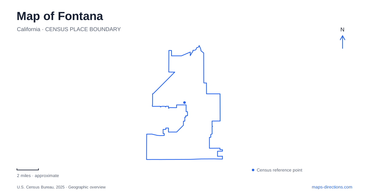
Street tiles load from OpenStreetMap when opened. The blue line shows the 2025 Census boundary.
- State
- California
- Population · July 2025
- 221,223
- Land area
- 43.3 sq mi
- Water area
- 0.0 sq mi
Fontana occupies a valley-floor landscape between mountain views to the north and the Jurupa Hills to the south. Its streets connect places shaped by farming, steel production, freight transportation and newer residential growth. The older rail corridor through downtown now carries a recreational trail, while a former freight depot hosts art. These changes make the map a record of successive uses rather than a city defined by a single industry or landmark.
From cultivated land to a steel town
The community's agricultural beginnings are associated with A. B. Miller, who acquired a large tract in 1905 and developed orchards, poultry operations and cattle farms. The settlement, previously called Rosena, received its present name in 1913. The agricultural landscape existed before incorporation, which did not occur until June 1952. Those separate dates distinguish the founding of the community from the creation of its municipal government.
Kaiser Steel began operating in 1942, transforming the area's economy during the Second World War. The mill produced steel plate for wartime shipbuilding and became a major source of local employment. Its operations ended in 1984, but the scale of the industrial development continued to influence later uses of the land. A map of Fontana consequently contains both older residential and civic places and large properties whose dimensions reflect a history of production and distribution.
Three transportation patterns
Foothill Boulevard carries the historical association with US Route 66. It belongs to an older road landscape that crossed an agricultural community before the freeway era. The city also identifies Interstate 10, Interstate 15 and State Route 210 as major trade-route connections, with the Union Pacific Railroad contributing another freight corridor. These routes operate at a regional scale quite different from the streets around downtown cultural buildings.
The Pacific Electric Trail follows a former electric railway alignment. The local seven-mile section opened in 2012, connecting downtown with parks and community facilities. Its straight corridor reflects its transportation origin, but its current users walk, run and cycle instead of boarding interurban railcars. Seeing the freeway, freight railway and converted trail together explains why lines across the map may have very different present-day purposes despite a shared history of moving people or goods.
Downtown's reused buildings
The Art Depot Gallery at 16822 Spring Street began as a freight depot in 1915. It stands beside the Pacific Electric Trail in a historical plaza and now serves the city's cultural-arts program. The relationship between building and corridor remains visible: a structure once associated with rail freight is still beside the former railway route, though both have acquired new public uses.
Center Stage Theater adds another period of local history. Built in 1937 as a single-screen movie theater, it later underwent restoration and expansion, returning to performance use in 2008. The city's financial report places it just south of the Lewis Library and Technology Center. These neighboring civic and cultural destinations provide a compact reference area within Fontana, distinct from the much larger industrial properties elsewhere.
The trail's connections also include Miller Park, Seville Park and the Cypress and Heritage centers. That combination gives the old railway corridor a practical neighborhood role as well as a recreational one. It links cultural buildings and everyday public facilities along a route inherited from an earlier transport system.
Pond, native gardens and the Jurupa Hills
Mary Vagle Nature Center sits at the foot of the Jurupa Hills at 11501 Cypress Avenue East. Its grounds include a pond-side nature trail and native gardens, while indoor displays interpret local wildlife and geology. The nearby hillside adds a different physical setting from the relatively level urban streets: the park landscape includes both a sheltered water feature and access to the surrounding slopes.
The center's educational emphasis makes this southern part of Fontana useful for understanding the local environment. Native planting, bird observation and geology displays connect the cultivated grounds with the hills behind them. A route around the pond is therefore different in character from an outing on the hillside trails, even though both begin in the same general nature-center area.
Martin Tudor Jurupa Hills Regional Park is another southern landmark, with its main address on Sierra Avenue. Municipal planning materials identify bicycle and hiking trails and views toward the northern mountains and surrounding valleys. The Jurupa Hills create a southern landscape reference that balances the prominent mountain backdrop on the other side of the city.
Across Fontana, the contrast between these hills, the downtown trail and the broad transportation corridors gives the city its shape. Agricultural origins, steelmaking and cultural reuse are not separate stories attached at random to the map; they explain why its major sites differ so much in scale, form and relationship to the surrounding streets.
Map and statistics: U.S. Census Bureau, 2025 Gazetteer, January 2025 generalized place boundaries and Vintage 2025 population estimates. Local references: City of Fontana; Center Stage Theater. Article prepared by Maps & Directions.