Map of Fond du Lac
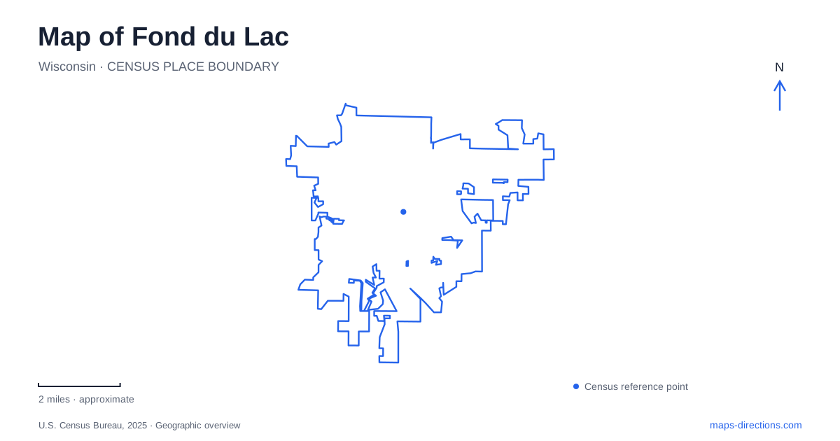
Street tiles load from OpenStreetMap when opened. The blue line shows the 2025 Census boundary.
- State
- Wisconsin
- Population · July 2025
- 44,541
- Land area
- 19.2 sq mi
- Water area
- 1.3 sq mi
Fond du Lac meets Lake Winnebago at its southern end, where a developed park shoreline, harbor, and river corridors create several different ways to experience the water. North Main Street leads toward Lakeside Park, but the lakefront is more complex than a single strip of grass beside the shore. Islands, lagoons, harbor facilities, and historic structures give the park its own internal geography. Farther inland, trails follow the river through downtown and reach smaller areas of natural habitat.
A lakefront made of islands and gathering places
Lakeside Park covers approximately 146 acres at the northern end of Main Street. Its recreational facilities range from boating and fishing to ball diamonds, playgrounds, a pavilion, gardens, and a splash pad beside North Main Street. This mixture explains why the park serves several purposes at once: it is a neighborhood recreation area, a setting for larger gatherings, and a point of departure onto the lake.
The municipal park map identifies Fountain Island, Oven Island, the marina, the lighthouse, and Frazier Point as separate features. Their arrangement rewards a more detailed look than the citywide view provides. Bridges and paths connect smaller pieces of land around the lagoons, while the open lake occupies the park's outer edge. A walk among the islands has a different setting from standing at the harbor entrance or following the broader shoreline.
Boating remains a practical part of this landscape. The municipal marina provides transient dockage, fuel, and other services at the south end of Lake Winnebago. Those facilities make the waterfront a place of movement and working infrastructure as well as scenery. The harbor and launch areas help explain the paths, parking spaces, and service access shown on the park map.
Small structures with long local histories
The lighthouse has become a recognizable symbol of Fond du Lac, but its origins are unusually specific. Local lumberman W. J. Nuss offered building materials in 1932, and construction followed in 1933. R. A. Sutherland prepared the design. The 40-foot structure combines a stone lower portion with a wooden upper section and stands at the harbor's breakwater entrance.
Its surroundings preserve other histories of movement. Fountain Island Bridge, an early bowstring bridge dating to about 1870, originally crossed the river at Scott Street. It was relocated to the park in 1920 and now carries a path from Promen Drive to the island. Its tall curved structural members make the former road crossing legible even in a recreational setting.
The streetcar waiting station adds another layer. Built in 1900 and moved to its park location in 1909, it recalls a period when a trip to the waterfront could begin on a streetcar. Read together, lighthouse, bridge, and shelter represent three distinct forms of transportation rather than merely a collection of decorative park landmarks.
Following the water inland
The Downtown Trail parallels the Fond du Lac River for about one mile, running from Brooke Street south to Morris Street. The Brooke Street Trail provides a related north-south route, extending toward Lakeside Park and south to Dixie Street. These paths connect the lakefront landscape with the built-up interior, showing how a river corridor can provide a continuous point of reference through changing surroundings.
A smaller natural setting lies along the East Branch at the Greenway Arboretum. The city describes 14 acres of habitat with several trails and access behind the Salvation Army store on Pioneer Road. This is a different scale of outdoor space from the large waterfront park: the emphasis shifts from harbor views and recreation facilities to the immediate riverbank environment.
The seven-mile Prairie Trail follows the US 151 bypass corridor, with trailheads at Winnebago Drive and at 485 Reinhardt Road. On a map of Fond du Lac, that alignment distinguishes it from the river-following routes. One uses the geometry of a transportation corridor; the others trace water through the city. The distinction is useful when selecting the kind of surroundings wanted for a walk or ride.
Sheboygan Street's cultural role
Downtown has a cultural anchor at the Thelma Sadoff Center for the Arts, 51 Sheboygan Street. Its outdoor concert programming brings performances into the street in front of the building, giving a familiar road address another role as a gathering space. The relationship between building and street is part of the attraction, rather than the arts center functioning only as an indoor destination.
This downtown setting broadens the picture of Fond du Lac beyond its famous lighthouse. The river trails, street-based cultural activity, and lakefront park reveal a city whose public spaces operate at several scales, from a compact block to the wide horizon of Lake Winnebago.
Map and statistics: U.S. Census Bureau, 2025 Gazetteer, January 2025 generalized place boundaries and Vintage 2025 population estimates. Local references: City of Fond du Lac; Thelma Sadoff Center for the Arts. Article prepared by Maps & Directions.