Map of Flower Mound
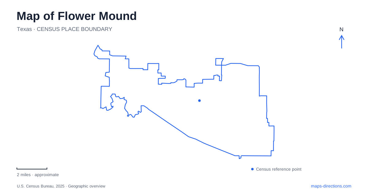
Street tiles load from OpenStreetMap when opened. The blue line shows the 2025 Census boundary.
- State
- Texas
- Population · July 2025
- 79,540
- Land area
- 41.9 sq mi
- Water area
- 2.5 sq mi
Flower Mound takes its name from a surviving prairie landmark, but its map contains several contrasting landscapes. The Mound stands beside a major road intersection, the River Walk organizes a mixed-use district farther inland, and Grapevine Lake creates an irregular southern shoreline of coves and wooded recreation land. Between them, the Cross Timbers conservation area preserves another part of the town's natural identity. These features give local roads a context beyond their role as connections between subdivisions.
The prairie landmark beside the crossroads
The Mound occupies the northeast corner of FM 3040 and FM 2499, also identified by its foundation as the meeting of the town's namesake road and Long Prairie Road. The protected property contains about 12.6 acres of native tallgrass prairie. Its position at a busy junction makes the contrast between the surviving grassland and surrounding development particularly clear.
The foundation's history places the landmark within the former Long Prairie, a much larger open area amid the Cross Timbers forest. Long Prairie Road therefore preserves the name of a landscape that extended well beyond the small protected remnant. This is useful historical context when looking at the surrounding street map: the road name recalls an ecological feature whose original scale is no longer obvious among buildings and traffic lanes.
Conservation has shaped other parts of Flower Mound as well. The town's Cross Timbers Conservation Development District was established through the 2001 master plan to protect a largely intact ecological area in the central part of town. Its purpose helps explain why wooded, less intensely developed surroundings remain important to local planning alongside commercial and residential growth.
Long Prairie Road and the River Walk district
Long Prairie Road serves a series of commercial planning areas intended for retail, offices, and associated neighborhood uses. The River Walk at Central Park is one of the major developments related to this corridor. The town places it north of FM 1171, west of Morriss Road, and east of FM 2499, a useful three-road frame for locating it on a regional map.
Within that frame, the approximately 158-acre district combines residences, dining, shops, offices, and medical uses. Its designed water feature provides the organizing landscape. The project's civil engineering firm describes a nearly mile-long man-made waterway and connections to town trails, including Timber Trails Park at the northern end beside Timber Creek.
This gives Flower Mound two very different kinds of waterside setting. The River Walk is a deliberately arranged urban district, with buildings and pedestrian spaces composed around a constructed feature. Grapevine Lake, by contrast, creates a much larger recreation landscape where wooded shorelines, coves, and longer trails influence how people move through the area.
Twin Coves and Murrell Park on the lake
Twin Coves Park occupies 243 acres on the lake's north shore, with its entrance address at 5001 Wichita Trail. Cabins, RV spaces, primitive camping, a small-craft boat launch, and a lake overlook support several kinds of stay. Wichita Trail is therefore a useful road reference for the town-managed campground and its surrounding lake setting.
Murrell Park approaches the shore from Simmons Road, with the Corps of Engineers' map giving an address of 880 Simmons Road. The diagram identifies South Point, the Tree in the Road day-use area, high- and low-water ramps, and Northshore Trail segments. Those named features reveal a park that spreads across several shoreline locations rather than concentrating everything around one picnic lawn.
The Northshore Trail belongs to the lake's natural-surface hiking and mountain-biking system. Other shoreline routes serve different uses: the Corps identifies Rocky Point, Crosstimbers, and Walnut Grove as equestrian trails without bicycle access. The distinction matters when comparing trail lines across the lake map, because a connected-looking recreation landscape does not mean every path serves every activity. This varied trail network is a major part of Flower Mound's relationship with the lake.
Inland recreation around Spinks and Duncan
Heritage Park at 600 Spinks Road brings several activities together inland. Its pond, boardwalk, waterfall, nature overlook, and bronze wildlife sculptures give the walking routes identifiable features. Fort Wildflower Playground, the splash pad, performance pavilion, and disc golf course add different reasons to spend time there. The Hound Mound dog park occupies the eastern side of the grounds.
Bakersfield Park, at 1201 Duncan Lane, has a more sports-centered role, with baseball, softball, and soccer fields. Comparing these two parks with Twin Coves and the prairie remnant shows the range of public landscapes within Flower Mound. Some preserve natural character, some organize recreation around fields and play spaces, and others provide access to the lake. Their road addresses and physical settings give each a clear place within the broader map.
Map and statistics: U.S. Census Bureau, 2025 Gazetteer, January 2025 generalized place boundaries and Vintage 2025 population estimates. Local references: Flower Mound Foundation; Town of Flower Mound; McAdams project engineers; US Army Corps of Engineers. Article prepared by Maps & Directions.