Map of Florence
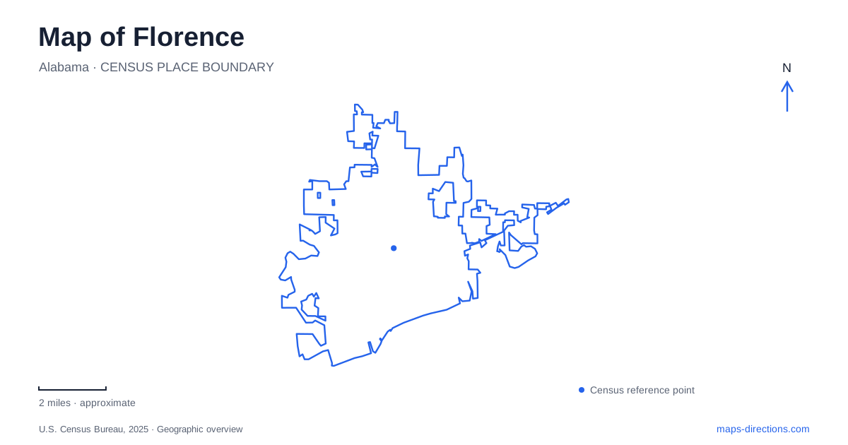
Street tiles load from OpenStreetMap when opened. The blue line shows the 2025 Census boundary.
- State
- Alabama
- Population · July 2025
- 42,581
- Land area
- 27.1 sq mi
- Water area
- 0.2 sq mi
Florence has a riverfront whose history is easier to understand as several connected landscapes: a harbor near Cypress Creek, the remains of a canal and wagon works, a major dam, and residential architecture above the water. Downtown contributes a different scale, with cultural buildings around Wilson Park. A map that holds these places together reveals how transportation, industry and civic life developed beside the Tennessee River, while leaving distinct traces on its banks.
Downtown around Wilson Park
Wilson Park, listed by the city at 351 North Wood Avenue, provides a useful reference for the downtown cultural district. The Kennedy-Douglass Center for the Arts occupies historic homes north of the park. Pope's Tavern brings an older layer into the same downtown area: the former tavern served as a makeshift hospital during the Civil War. The Shoals Theatre adds a performance venue to this collection of buildings.
For a first look at Florence, these places explain why downtown deserves more than a single restaurant or shopping marker. The arts center uses domestic buildings, the tavern preserves an earlier roadside institution, and the theater represents public entertainment. Their different building types make the district legible as a neighborhood that changed over time, rather than a set of attractions assembled around one era. North Wood Avenue and Wilson Park form a practical starting framework for comparing their locations.
The harbor near Cypress Creek
McFarland Park occupies the space between downtown and the Tennessee River near the mouth of Cypress Creek. Its address is 200 James M. Spain Drive. The city lists a boat ramp, fishing pier, campground and harbor walking path among its facilities. Those features explain the varied shapes visible on a detailed map: the harbor edge supports walking, the river supports boating, and the campground requires a broader land area than a simple waterfront lawn.
The creek mouth is the important natural reference here. It ties the park to a tributary as well as the main river, giving this part of the waterfront a different setting from the canal trail farther along the river landscape. A Florence riverfront outing can therefore be organized around contrasting environments, with McFarland providing the harbor-and-creek portion. The city's parks office is on Darby Drive; that administrative address should not replace the park's James M. Spain Drive location when planning this stop.
A canal, a factory and a newer trail
River Heritage Park is at 15 Hightower Place. Its interpretive subjects include the canal, Wilson Dam and Lock, natural history, and the Wagon Works. The River Heritage Trail, completed in spring 2024, follows the river canal for 1.3 miles to Patton Island Overlook. The canal supplies a historical line through a landscape that might otherwise appear to be simply wooded waterfront.
The Wagon Works began in 1889 under A. D. Bellamy. Later changes in transportation helped push the business toward furniture manufacturing, and it closed in 1941. Ruins and a wooden railroad trestle preserve evidence of this industrial landscape. Reading that history alongside the trail changes the meaning of the open space: factory activity, rail movement and river navigation once overlapped here. The park's interpretation makes those connections more useful than treating every remnant as an isolated scenic object.
Why the dam changes the regional map
Wilson Dam connects the local shoreline story to the Tennessee Valley. Construction began in 1918 and finished in 1925; TVA acquired the facility in 1933. TVA explains that Wilson, Wheeler and Pickwick reservoirs cover the Muscle Shoals that once obstructed river navigation. The broad water surfaces on a present-day regional map therefore conceal a substantially different earlier river environment.
Around Florence, this is an important distinction between the city's modern waterfront and the waterway that earlier travelers encountered. The dam is simultaneously part of an electricity system, a navigation system and a recreational landscape. Nearby walking areas include Old First Quarters Small Wild Area, named for housing used by engineers during construction. Even that woodland name records the infrastructure project rather than merely describing the vegetation.
A house shaped around everyday life
The Rosenbaum House at 601 Riverview Drive offers a more intimate counterpoint. Frank Lloyd Wright designed the home for Stanley and Mildred Rosenbaum in 1939, with an addition in 1948. Its L-shaped plan, cypress, brick, glass and cantilevered roofs illustrate the Usonian approach. Built-in furniture and heating within the concrete floor made the design extend into ordinary household routines.
The house became a public museum after city restoration. Placing it alongside the downtown cultural buildings and the river landscapes gives a map of Florence unusual range: domestic experimentation, civic institutions, industrial remnants and large public works all contribute to the same urban geography. The most revealing itinerary follows those relationships, allowing each place to explain a different use of the river-facing city.
Map and statistics: U.S. Census Bureau, 2025 Gazetteer, January 2025 generalized place boundaries and Vintage 2025 population estimates. Local references: Florence-Lauderdale Tourism; City of Florence; Tennessee Valley Authority; Frank Lloyd Wright Foundation. Article prepared by Maps & Directions.