Map of Fishers
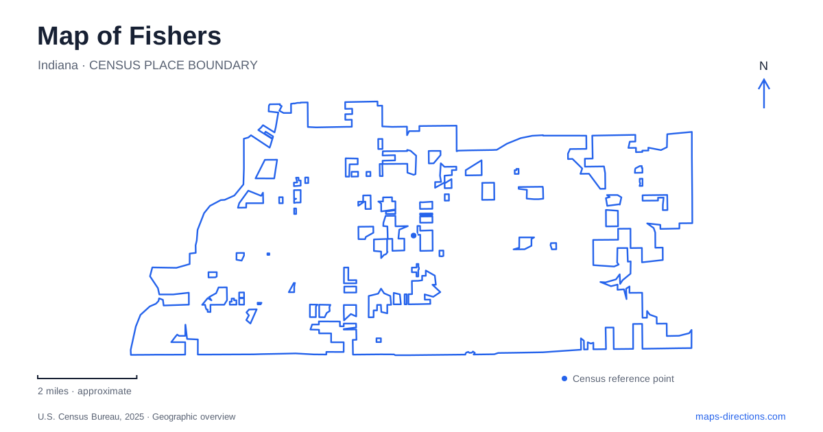
Street tiles load from OpenStreetMap when opened. The blue line shows the 2025 Census boundary.
- State
- Indiana
- Population · July 2025
- 104,812
- Land area
- 36.6 sq mi
- Water area
- 2.2 sq mi
Fishers can be understood through three different lines on a map: the former Nickel Plate railway, Allisonville Road, and the shoreline of Geist Reservoir. The railway corridor now carries a walking and cycling trail through the civic center. Allisonville connects with historic properties and the museum landscape at Conner Prairie. Farther east, Olio Road provides access to a newer waterfront park. These places belong to the same city, but each developed around a different kind of movement and land use.
The trail through the civic center
The Nickel Plate Trail follows the former railroad corridor between 96th and 146th streets. In the central district, it passes beneath 116th Street through a pedestrian and bicycle tunnel. North Street and South Street identify the approaches to this downtown section, where the trail becomes part of a larger public-space network.
The Nickel Plate District includes the municipal complex and its amphitheater, with shops and restaurants nearby. Its relationship to the trail is especially important: the former transport corridor now brings people into a civic and commercial gathering area at a walking or cycling pace.
For Fishers, the tunnel provides a memorable orientation point. The east–west street and north–south trail cross at different levels, allowing the trail to continue through the center without using the road intersection. That arrangement helps explain why downtown maps show both a street network and a separate, continuous pedestrian route.
A regional crossing at 96th Street
The pedestrian bridge over 96th Street opened in February 2026 with the southern trail extension. This completed the local connection toward Indianapolis, where the corridor joins a wider regional trail system. At the northern end, the route continues into Noblesville beyond 146th Street.
The bridge and the 116th Street tunnel solve similar crossing problems in different ways: one carries the trail above a roadway, while the other carries it below. They are useful landmarks for understanding both the local route and its relationship to neighboring communities.
A Fishers trail map should therefore distinguish the central district from the whole corridor. A short walk near the municipal complex occupies only one portion of a route that reaches municipal boundaries and regional connections. The numbered streets supply a consistent sequence, helping users understand where they are along the former railway alignment.
Allisonville Road and a museum landscape
Conner Prairie uses 13400 Allisonville Road. Its outdoor historical settings include 1836 Prairietown, a fictional village whose stories and material culture are based on historical research. That distinction is worth retaining: the village is an interpretive environment, not an intact town preserved exactly where all its buildings originally stood.
Several structures were moved from other places. The schoolhouse came from Bentonville, while a house interpreted within the village was moved from Cicero. The Campbell House originated in the Allisonville area. Their assembly creates a landscape for understanding nineteenth-century life through buildings with different individual histories.
This gives Fishers a heritage destination whose internal geography differs from the surrounding road map. Allisonville Road leads to the museum campus; within it, named settings organize the visitor experience. The museum has also reported closure of its separate Trails after flooding, so those nature routes should not be assumed available simply because other parts of the institution operate.
The Ambassador House's change of address
The Ambassador House at Heritage Park is another example of a historic building moved to a new setting. Its original property was near 96th Street and Allisonville Road. The house was relocated in 1996 to the park at 106th Street and Eller Road, then restored for public and event use.
Its name recalls Addison Harris, who served as ambassador to Austria-Hungary from 1899 to 1901. The property began with a nineteenth-century cabin and later developed into the house associated with the Harris family. The present gardens and park setting continue that story while occupying a different parcel.
Comparing the original and current locations makes the preservation history tangible. Allisonville belongs to the earlier estate geography; Eller Road identifies the surviving house today. The move prevented demolition but changed the relationship between building and surrounding land.
Public access to Geist Reservoir
Geist Waterfront Park opened in 2023 at 10811 Olio Road, near 111th Street on the road's east side. Its 70 acres include trails, a playground, beach access, and a nonmotorized boat launch for kayaks, canoes, and paddleboards.
This eastern destination adds a reservoir setting to Fishers' better-known trail and heritage corridors. The park grounds support walking and play beyond the summer swimming season, while beach operations follow a seasonal schedule. Olio Road, the shoreline, and the named park facilities provide a clear final set of references: a public waterfront landscape that complements the former railway downtown and the historic properties along Allisonville.
Map and statistics: U.S. Census Bureau, 2025 Gazetteer, January 2025 generalized place boundaries and Vintage 2025 population estimates. Local references: Fishers Parks; City of Fishers; Indiana Department of Natural Resources; Conner Prairie. Article prepared by Maps & Directions.