Map of Federal Way
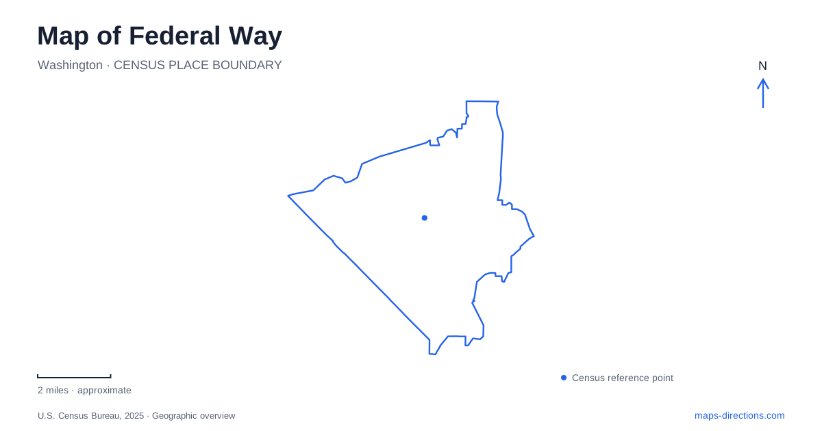
Street tiles load from OpenStreetMap when opened. The blue line shows the 2025 Census boundary.
- State
- Washington
- Population · July 2025
- 99,729
- Land area
- 22.3 sq mi
- Water area
- 1.4 sq mi
Federal Way sits between a regional transportation corridor and the Puget Sound shoreline, with civic parks, wooded destinations, and gardens distributed across the city. Its map is not simply a collection of exits along Interstate 5. The downtown rail hub, Dash Point Road, the Dumas Bay shore, and the Weyerhaeuser campus area each organize a different kind of trip. Keeping those districts separate explains how an urban transit journey can end in a setting quite different from a beach or garden visit.
The downtown station changes the regional map
Federal Way Downtown Station serves Link's 1 Line and a group of connecting bus services. The extension opened in December 2025, adding this station along with Star Lake and Kent Des Moines. Older transit maps that end farther north therefore omit a major part of the current regional connection.
The station brings King County Metro, Sound Transit express buses, and Pierce Transit into the same interchange. Its numbered bus bays matter when transferring: the facility is more than the rail platform, and the different operators do not all depart from one curb. A station diagram is the appropriate final layer after a regional route map has established which train or bus to use.
For someone arriving from elsewhere in the Puget Sound region, the rail hub is a practical central reference. It does not mean that every local attraction is within the immediate station area. The bonsai museum, for example, describes a further journey from the station, while the saltwater parks lie in another part of the city. That relationship makes local streets and connecting services important even after the longer train journey is complete.
Two Dumas Bay destinations
Dumas Bay Centre and Park is at 3200 Southwest Dash Point Road. The site includes the Knutzen Family Theatre, a retreat and meeting center, and grounds with views toward Puget Sound and Maury Island. Dumas Bay Sanctuary has a different address, 30844 44th Avenue Southwest, with a sandy beach and interpretation of the nearby heron rookery.
These names describe related shoreline geography but different facilities. A theatre visit belongs at the centre; a shoreline nature visit belongs at the sanctuary. On a map of Federal Way, retaining both full names prevents the bay label from obscuring that distinction.
Dash Point's forest and saltwater beach
Dash Point State Park is at 5700 Southwest Dash Point Road. Its forested trails and camping areas sit beside a sandy Puget Sound beach, making it a larger outdoor destination than a small neighborhood waterfront access point. The state identifies both hiking and biking opportunities as well as a substantial saltwater shoreline.
The beach is associated with skimboarding, while small craft such as kayaks and canoes can use the water without a developed watercraft launch. This is a useful distinction for a boating map: a beach where a small craft can be carried to the water is not automatically a trailer-boat ramp.
A state-park map also separates the campground from day-use facilities. Those areas serve different visits even when they share the same park name and road approach. A brief beach outing, a forest walk, and an overnight stay consequently require different internal destinations rather than one generic park marker.
The garden campus east of the freeway
Pacific Bonsai Museum is at 2515 South 336th Street. The operator's driving directions use South 320th Street, Weyerhaeuser Way, and Weyerhaeuser Road to approach the east gate. It specifically warns that the west gate can be closed while the museum is open, making the alternative entry a meaningful part of the route.
This Federal Way museum is outdoors, with fine-gravel paths and a compact exhibition loop. General parking is across the road, connected by a trail, while passenger drop-off and accessible spaces are at the museum entrance. It shares a courtyard and restrooms with the neighboring Rhododendron Species Botanical Garden. The two institutions therefore form a useful paired destination, although their collections and visitor arrangements remain distinct.
Inland parks complete the picture
Steel Lake Park, at 2410 South 312th Street, offers a freshwater beach setting. Celebration Park, at 1095 South 324th Street, concentrates on sports fields and paths connecting with the BPA Trail. West Hylebos Wetlands, at 411 South 348th Street, provides interpretive trails and observation areas within a wetland landscape.
Together these places show why Federal Way benefits from a map organized by landscape and purpose. The freshwater lake, athletic grounds, wetlands, saltwater beach, garden campus, and rail interchange are all local destinations, but each belongs to a different pattern of streets, paths, and access.
Map and statistics: U.S. Census Bureau, 2025 Gazetteer, January 2025 generalized place boundaries and Vintage 2025 population estimates. Local references: Sound Transit; Washington State DOT; City of Federal Way; Washington State Parks; Pacific Bonsai Museum. Article prepared by Maps & Directions.